Unorganized Centre Parry Sound District

Last updated

Unorganized Centre Parry Sound District
Parry Sound, Unorganized, Centre Part
Britt ON.jpg
Britt and Byng Inlet
Unorg Centre Parry Sound.png
Coordinates: 45°55′N80°00′W / 45.917°N 80.000°W / 45.917; -80.000
CountryCanada
Province Ontario
District Parry Sound
Government
  Federal riding Parry Sound-Muskoka
  Prov. riding Parry Sound—Muskoka
Area
[1]
  Land2,587.29 km2 (998.96 sq mi)
Population
 (2021) [2]
  Total2,495
  Density1.0/km2 (3/sq mi)
Time zone UTC−05:00 (EST)
  Summer (DST) UTC−04:00 (EDT)
Postal Code
P0G, P0H
Area code 705
Loring Loring ON.JPG
Loring
Port Loring Port Loring ON 1.JPG
Port Loring

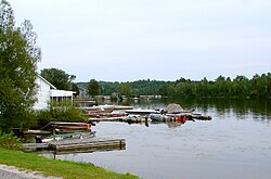
Unorganized Centre Parry Sound District is an unorganized area in central Ontario, Canada, between Georgian Bay and Lake Nipissing in the District of Parry Sound. It is made up of geographic townships which have no governing bodies and which are not incorporated as municipalities. The territory consists of two non-contiguous areas, with the main part located directly south of the French River and Lake Nipissing, and east of Georgian Bay. Shawanaga Township is a small exclave south of it along Highway 69.

Contents

Local services boards

Townships

List of townships with its communities:

In addition, the division also includes two geographic townships which are entirely unpopulated:

Demographics

Canada census – Parry Sound, Unorganized, Centre Part community profile
2016 2011
Population2143 (-5.6% from 2011)2199 (-9.3% from 2006)
Land area2,698.17 km2 (1,041.77 sq mi)2,697.64 km2 (1,041.56 sq mi)
Population density0.8/km2 (2.1/sq mi)0.8/km2 (2.1/sq mi)
Median age61.0 (M: 60.8, F: 61.2)
Private dwellings2630 (total) 2637 (total) 
Median household income
References: 2016 [3] 2011 [4] earlier [5] [6]

Mother tongue: [7]

Population trend: [8]

See also

Related Research Articles

<span class="mw-page-title-main">Timiskaming District</span> District in Ontario, Canada

Timiskaming is a district and census division in Northeastern Ontario in the Canadian province of Ontario. The district was created in 1912 from parts of Algoma, Nipissing, and Sudbury districts. In 1921, Cochrane District was created from parts of this district and parts of Thunder Bay District.

<span class="mw-page-title-main">Sudbury District</span> District in Ontario, Canada

The Sudbury District is a district in Northeastern Ontario in the Canadian province of Ontario. It was created in 1894 from townships of eastern Algoma District and west Nipissing District.

<span class="mw-page-title-main">Unorganized South Nipissing District</span> Unorganized area in Ontario, Canada

Unorganized South Nipissing District is an unorganized area in north-central Ontario, in the District of Nipissing. It is almost entirely within and includes most of Algonquin Provincial Park.

<span class="mw-page-title-main">Parry Sound District</span> District in Ontario, Canada

Parry Sound District is a census division of the Canadian province of Ontario. Its boundaries are District of Muskoka to the south, the Sudbury District to the north-northwest, the French River and Lake Nipissing in the north, Nipissing District and North Bay in the north and east and parts of Algonquin Park in the northeast.

<span class="mw-page-title-main">The Archipelago</span> Township in Ontario, Canada

The Archipelago is a township in central Ontario, Canada, along the Georgian Bay in the Parry Sound District.

<span class="mw-page-title-main">Restoule</span> Designated place with Local Services Board in Ontario, Canada

Restoule is a community and designated place in geographic Patterson Township in the Centre Unorganized Part of Parry Sound District in Central Ontario, Canada. It is situated on the Restoule River between Commanda Lake, and Restoule Lake and is part of the Almaguin Highlands region.

<span class="mw-page-title-main">Nipissing District</span> District in Ontario, Canada

Nipissing District is a district in Northeastern Ontario in the Canadian province of Ontario. It was created in 1858. The district seat is North Bay.

<span class="mw-page-title-main">Nipissing, Ontario</span> Township in Ontario, Canada

Nipissing is an incorporated (political) township in Parry Sound District in Central Ontario, Canada. It is on Lake Nipissing and is part of the Almaguin Highlands region. Nipissing was surveyed between 1874 and 1881, and was incorporated in 1888. Among the first settlers in the area were the Chapman and Beatty families. Nipissing Township annexed Gurd Township in 1970. The township also contains a community named Nipissing, which is located on the South River near Chapman's Landing, on the South Bay of Lake Nipissing. The township administrative offices are located in Nipissing.

<span class="mw-page-title-main">Unorganized North Nipissing District</span> Unorganized area in Ontario, Canada

Unorganized North Nipissing District is an unorganized area in northeastern Ontario, Canada. It includes the unincorporated areas in northern Nipissing District north of the Mattawa River.

Kearney is a town and municipality in the Almaguin Highlands region of Parry Sound District of Ontario, Canada. With a landmass of 528 square kilometres and a year-round population of 974 in the Canada 2021 Census, Kearney claims to be the "Biggest Little Town in Ontario."

<span class="mw-page-title-main">Britt, Ontario</span>

Britt is a community in the Canadian province of Ontario, located in the unincorporated township of Wallbridge in the Parry Sound District.

<span class="mw-page-title-main">Whitestone, Ontario</span> Municipality in Ontario, Canada

Whitestone is a municipality in the Canadian province of Ontario, as well as the name of a community within the municipality.

<span class="mw-page-title-main">Unorganized Rainy River District</span> Unorganized area in Ontario, Canada

Unorganized Rainy River District is an unorganized area in the Rainy River District of Ontario, Canada, comprising all communities in the district which are not part of incorporated municipalities. Quetico Provincial Park is located entirely within this area.

Dokis 9 is a First Nations reserve and community in the Canadian province of Ontario, assigned to the Dokis First Nation. The reserve is located approximately 16 kilometers southwest of central southern Lake Nipissing along the French River. It is divided into two large parts consisting of a north island, Okikendawt, and a large southern peninsula. The two land masses, which are nestled within the flows of the French river, covers 154.36 square kilometers. The French River watershed in Northern Ontario was created more than ten thousand years ago when the last ice-age receded and left a maze of rivers and small lakes. The main settlement is found on Okikendawt island which can be accessed by a gravel road which connects with Highway 64. The Land is occupied by the Dokis and its cousin tribe, the Restoule‘s. The land is well known for its hunting, fishing, fur trades, and timber.

<span class="mw-page-title-main">Unorganized West Timiskaming District</span> Unorganized area in Ontario, Canada

Unorganized West Timiskaming District is an unorganized area in the Canadian province of Ontario, comprising almost all portions of the Timiskaming District which are not organized into incorporated municipalities.

<span class="mw-page-title-main">Almaguin Highlands</span> Inter-region in Ontario, Canada

The Almaguin Highlands Region in Ontario, Canada, covers approximately 5,200 km2 (2,000 sq mi) comprising the eastern half of Parry Sound District. It is bounded by Muskoka in the south, and by Lake Nipissing and Nipissing District in the north. The eastern edge abuts the western boundary of Algonquin Provincial Park, whereas the western boundary of the Almaguin Highlands is generally regarded to be the mid east-west point of Parry Sound District. Originally derived from the words Algonquin, Magnetawan, and Seguin. the name Almaguin is now used to describe the marketing region of East Parry Sound.

Shawanaga is an unincorporated geographic township in the Unorganized Centre Part of Parry Sound District in central Ontario, Canada.

Pringle is an unorganized geographic township in Parry Sound District, Ontario, Canada. It is topographically part of the Almaguin Highlands region, and is part of the census subdivision of Unorganized Centre Parry Sound District. The township includes the communities of Bear Valley, Carr, Farleys Corners and Golden Valley. Although not an incorporated municipality, the township is served by two local services boards: Bear Valley and Golden Valley are served by the LSB of Loring, Port Loring and District, while Carr and Farleys Corners are served by the LSB of Restoule.

Wallbridge is an unorganized geographic township in Parry Sound District, Ontario, Canada. Part of the census subdivision of Unorganized Centre Parry Sound District, the township includes the communities of Britt, Byng Inlet and Harris Lake and the rail sidings of Drocourt and North Magnetawan. Although not an incorporated municipality, Britt and Byng Inlet are jointly served by a local services board.

Henvey is an unorganized geographic township in the Canadian province of Ontario, located within the Parry Sound District. Part of the census subdivision of Unorganized Centre Parry Sound District, the township includes the communities of Britt Station and Still River. It formerly had larger boundaries, also including the ghost town of Key Harbour, although the more northerly section was transferred to the municipality of Killarney in the 1990s. Britt Station is part of the local services board of Britt and Byng Inlet.

References

  1. "Parry Sound, Unorganized, Centre Part census profile". 2011 Census of Population . Statistics Canada. Retrieved 2012-02-10.
  2. "Focus on Geography Series, 2021 Census - Parry Sound, Unorganized, Centre Part (Census subdivision)". 9 February 2022.
  3. "2016 Community Profiles". 2016 Canadian Census . Statistics Canada. August 12, 2021. Retrieved 2018-02-18.
  4. "2011 Community Profiles". 2011 Canadian Census . Statistics Canada. March 21, 2019. Retrieved 2012-02-10.
  5. "2006 Community Profiles". 2006 Canadian Census . Statistics Canada. August 20, 2019.
  6. "2001 Community Profiles". 2001 Canadian Census . Statistics Canada. July 18, 2021.
  7. Statistics Canada 2006 Census - Parry Sound, Unorganized, Centre Part community profile
  8. Statistics Canada: 1996, 2001, 2006 census