Callander, Ontario

Last updated

Callander
Municipality of Callander
Callander, Ontario.jpg
Main Street in Callander
Motto: 
Four Seasons of Reasons
Canada Southern Ontario location map 2.png
Red pog.svg
Callander
Location of Callander in Ontario
Coordinates: 46°13′N79°22′W / 46.217°N 79.367°W / 46.217; -79.367
CountryCanada
Province Ontario
District Parry Sound
Established1891
Government
  TypeTownship
  Mayor Robb Noon [1]
  MP Anthony Rota
  MPP Vic Fedeli
Area
[2]
  Land102.98 km2 (39.76 sq mi)
  Metro
788.48 km2 (304.43 sq mi)
Population
 (2021) [3]
   Municipality (single-tier)3,964
  Density38.5/km2 (100/sq mi)
Time zone UTC−5 (EST)
  Summer (DST) UTC−4 (EDT)
Area code 705
Website www.mycallander.ca
Marina on Callander Bay Callander ON.jpg
Marina on Callander Bay

The Municipality of Callander (formerly the Township of North Himsworth) is a township in central Ontario, Canada, located at the southeast end of Lake Nipissing in the Almaguin Highlands region of the District of Parry Sound. The municipality is located on Callander Bay, just south of North Bay.

Contents

The municipality renamed itself from North Himsworth to Callander in 2003, adopting the name of its major community because, in the words of then-mayor Bill Brazeau, "Nobody knew where North Himsworth was." [4]

Communities

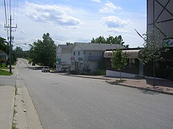
The main community of Callander is located in the northeast corner of the municipality, along the eastern shore of Callander Bay.

The south shore of Callander Bay and Lake Nipissing (southwest of the town) represents the rural population of Callander, which primarily runs along Highway 654 West. This area includes the communities of Wisawasa and Lighthouse Beach.

History

Callander Bay is an eroded Proterozoic volcanic pipe formed by the violent, supersonic eruption of a deep-origin volcano, approximately 500 million years ago. It is one of eight known volcanic sites in Ontario, including the Manitou Islands in North Bay.

The first people in the Callander area were of Ojibwa and Algonquin descent who have lived around Lake Nipissing for about 9,400 years. Though in history known by many names, they are currently known as Nipissing First Nation. They are generally considered part of the Anishinaabe peoples, a grouping which includes the Odaawaa, Ojibwe and Algonquins.

In 1610, French explorer Samuel de Champlain sent a young apprentice, Étienne Brûlé, to live with the Huron natives at Georgian Bay. While en route, Brûlé discovered Lake Nipissing via the La Vase River Portage (approximately 3 km north of Callander) and established a major fur trading route linking the Ottawa River with the upper Great Lakes. Other explorers who used the La Vase Portage were Samuel de Champlain in 1615, Pierre Gaultier de Varennes, sieur de La Vérendrye in 1731, Alexander Henry the elder in 1761 and Sir Alexander MacKenzie in 1802.

In 1880, George Morrison, a bookkeeper from Oxford County in Southern Ontario travelled by ox-cart from Muskoka to Lake Nipissing. There he built a raft and floated his family and possessions across the lake to the south-east bay. Logging companies had taken interest in the abundant Eastern White Pine that grew in the area. He was one of its first pioneers and his wife was the first white woman. On June 1, 1881, he opened a Post Office in his general store and named it after his parents' Scottish birthplace of Callander.

Lumber companies that established mills in Callander included:

Notable people

Prominent people who have lived in Callander include:

Demographics

In the 2021 Census of Population conducted by Statistics Canada, Callander had a population of 3,964 living in 1,636 of its 1,758 total private dwellings, a change of

See also

Related Research Articles

<span class="mw-page-title-main">North Bay, Ontario</span> City in Ontario, Canada

North Bay is a city in Northeastern Ontario, Canada. It is the seat of Nipissing District, and takes its name from its position on the shore of Lake Nipissing. North Bay developed as a railroad centre, and its airport was an important military location during the Cold War. The city is located 300 kilometres (190 mi) from both Ottawa and Toronto.

<span class="mw-page-title-main">District Municipality of Muskoka</span> Regional municipality in Ontario, Canada

The District Municipality of Muskoka, more generally referred to as the District of Muskoka or Muskoka, is a regional municipality in Central Ontario, Canada. Muskoka extends from Georgian Bay in the west, to the northern tip of Lake Couchiching in the south, to the western border of Algonquin Provincial Park in the east. A two-hour drive north of Toronto, Muskoka spans 6,475 km2 (2,500 sq mi). Muskoka has some 1,600 lakes, making it a popular cottaging destination.

<span class="mw-page-title-main">Lake of Bays</span> Township municipality in Ontario, Canada

Lake of Bays is a township municipality within the District Municipality of Muskoka, Ontario, Canada. The township, situated 193 kilometres (120 mi) north of Toronto, is named after the Lake of Bays. During the 2016 census, the township had a population of 3,167 and encompassed 677.91 square kilometres (261.74 sq mi) of land.

<span class="mw-page-title-main">Parry Sound District</span> District in Ontario, Canada

Parry Sound District is a census division of the Canadian province of Ontario. Its boundaries are District of Muskoka to the south, the Sudbury District to the north-northwest, the French River and Lake Nipissing in the north, Nipissing District and North Bay in the north and east and parts of Algonquin Park in the northeast.

<span class="mw-page-title-main">Central Ontario</span> Secondary region in Ontario, Canada

Central Ontario is a secondary region of Southern Ontario in the Canadian province of Ontario that lies between Georgian Bay and the eastern end of Lake Ontario.

<span class="mw-page-title-main">Burk's Falls</span> Village in Ontario, Canada

Burk's Falls is an incorporated village in the Almaguin Highlands region of Parry Sound District, Ontario, Canada, located 265 kilometres (165 mi) north of Toronto and 90 kilometres (56 mi) south of North Bay, Ontario. The village, and the waterfall on the site, were named by David Francis Burk of Oshawa, after he selected the land surrounding the waterfall in the Free Land Grant Act. Burk's Falls is part of the Magnetawan River waterway.

<span class="mw-page-title-main">Parry Sound—Muskoka</span> Federal electoral district in Ontario, Canada

Parry Sound—Muskoka is a federal electoral district in Ontario, Canada, that has been represented in the House of Commons of Canada since 1949.

<span class="mw-page-title-main">Mattawa, Ontario</span> Town in Ontario, Canada

Mattawa is a town in northeastern Ontario, Canada on Algonquin Nation land at the confluence of the Mattawa and Ottawa Rivers in Nipissing District. Mattawa means "Meeting of the Waters" in the Algonquin language. The first Europeans to pass through this area were Étienne Brûlé and Samuel de Champlain.

<span class="mw-page-title-main">Bonfield, Ontario</span> Township in Ontario, Canada

Bonfield is a township in northeastern Ontario, Canada, on the Mattawa River in Nipissing District.

<span class="mw-page-title-main">East Ferris</span> Township in Ontario, Canada

East Ferris is a township in northeastern Ontario, Canada located between Trout Lake and Lake Nosbonsing in the District of Nipissing. West Ferris has long been annexed into the city of North Bay.

<span class="mw-page-title-main">Nipissing, Ontario</span> Township in Ontario, Canada

Nipissing is an incorporated (political) township in Parry Sound District in Central Ontario, Canada. It is on Lake Nipissing and is part of the Almaguin Highlands region. Nipissing was surveyed between 1874 and 1881, and was incorporated in 1888. Among the first settlers in the area were the Chapman and Beatty families. Nipissing Township annexed Gurd Township in 1970. The township also contains a community named Nipissing, which is located on the South River near Chapman's Landing, on the South Bay of Lake Nipissing. The township administrative offices are located in Nipissing.

<span class="mw-page-title-main">Parry Sound—Muskoka (provincial electoral district)</span> Provincial electoral district in Ontario, Canada

Parry Sound—Muskoka is a provincial electoral district in the Canadian province of Ontario.

Kearney is a town and municipality in the Almaguin Highlands region of Parry Sound District of Ontario, Canada. With a landmass of 528 square kilometres and a year-round population of 974 in the Canada 2021 Census, Kearney claims to be the "Biggest Little Town in Ontario."

<span class="mw-page-title-main">Powassan</span> Municipality in Ontario, Canada

Powassan is a municipality in the Canadian province of Ontario, located near North Bay. Powassan is located in the Almaguin Highlands region of Parry Sound District, at its easternmost boundary with the Nipissing District.

<span class="mw-page-title-main">South Algonquin</span> Township municipality in Ontario, Canada

South Algonquin is a township municipality in Nipissing District, Ontario, Canada. Located south of Algonquin Provincial Park, it is the sole populated portion of the district that lies south of the traditional dividing line between Northern Ontario and Southern Ontario and is closer connected to Renfrew County as opposed to the core portions of Nipissing District.

<span class="mw-page-title-main">Neighbourhoods in North Bay, Ontario</span>

The Canadian city of North Bay, Ontario, is divided into numerous neighbourhoods.

<span class="mw-page-title-main">Almaguin Highlands</span> Inter-region in Ontario, Canada

The Almaguin Highlands Region in Ontario, Canada, covers approximately 5,200 km2 (2,000 sq mi) comprising the eastern half of Parry Sound District. It is bounded by Muskoka in the south, and by Lake Nipissing and Nipissing District in the north. The eastern edge abuts the western boundary of Algonquin Provincial Park, whereas the western boundary of the Almaguin Highlands is generally regarded to be the mid east-west point of Parry Sound District. Originally derived from the words Algonquin, Magnetawan, and Seguin. the name Almaguin is now used to describe the marketing region of East Parry Sound.

The South is a river in the Almaguin Highlands region of Parry Sound District, Ontario, beginning in the Western Uplands of Algonquin Provincial Park and emptying into Lake Nipissing. The river takes its name from an arm of Lake Nipissing into which it flows, South Bay.

References

  1. Long-serving northern mayor Hector Lavigne dies suddenly
  2. "2021 Census Profile".
  3. 1 2 "Population and dwelling counts: Canada, provinces and territories, census divisions and census subdivisions (municipalities), Ontario". Statistics Canada. February 9, 2022. Retrieved March 31, 2022.
  4. "Callander grows selectively". Northern Ontario Business , January 2005.
  5. "Michael J. Fox". Mycallander.ca.