
Nobel is a village on the shores of Parry Sound, Ontario, Canada. It is in the Municipality of McDougall in the District of Parry Sound. The community is named after Alfred Nobel, the inventor of dynamite.
Cochrane District is a district and census division in Northeastern Ontario in the Canadian province of Ontario. It was created in 1921 from parts of Timiskaming and Thunder Bay districts.
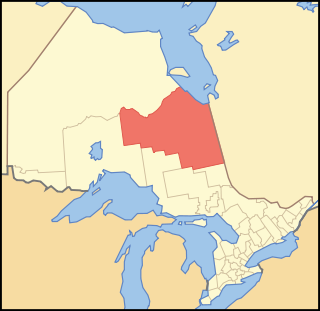
Parry Sound District is a census division of the Canadian province of Ontario. Its boundaries are District of Muskoka to the south, the Sudbury District to the north-northwest, the French River and Lake Nipissing in the north, Nipissing District and North Bay in the north and east and parts of Algonquin Park in the northeast.
Unorganized Centre Parry Sound District is an unorganized area in central Ontario, Canada, between Georgian Bay and Lake Nipissing in the District of Parry Sound. It is made up of geographic townships which have no governing bodies and which are not incorporated as municipalities. The territory consists of two non-contiguous areas, with the main part located directly south of the French River and Lake Nipissing, and east of Georgian Bay. Shawanaga Township is a small exclave south of it along Highway 69.

The Chippewas of Georgina Island First Nation are an Ojibwa people located on Georgina Island in Lake Simcoe, Ontario, Canada. In 2008, of the First Nation's registered population of 666 people, 181 lived on, and 485 lived outside, their reserve. As of 2020, the band has a total population of 923 members. They are one of a handful of First Nations in the Toronto Census Metropolitan Area.
First Nations in Ontario constitute many nations. Common First Nations ethnicities in the province include the Anishinaabe, Haudenosaunee, and the Cree. In southern portions of this province, there are reserves of the Mohawk, Cayuga, Onondaga, Oneida, Seneca and Tuscarora.

The Algonquins of Pikwàkanagàn First Nation, formerly known as the Golden Lake First Nation, are an Algonquin First Nation in Ontario, Canada. Their territory is located in the former township of South Algona in the Ottawa Valley on Golden Lake.

The Enoch Cree Nation #440 is a First Nations band government in Alberta, Canada. Members of the Nation are of Cree ancestry and speak the Plains Cree dialect of the Cree language group. The band is a signatory of Treaty 6 and is a member of the Confederacy of Treaty Six First Nations. The chief of the Enoch Cree Nation is Cody Thomas.

R v Pamajewon, [1996] 2 S.C.R. 821, is a leading Supreme Court of Canada decision on Aboriginal self-government under section 35(1) of the Constitution Act, 1982. The Court held that the right to self-government, if it exists, is subject to reasonable limitations and excluded the right to control high-stakes gambling.

Whitestone is a municipality in the Canadian province of Ontario, as well as the name of a community within the municipality.

Kebaowek or Eagle Village First Nation - Kipawa Indian Reserve, is a First Nations reserve in Abitibi-Témiscamingue, Quebec. It is under the governance of the Kebaowek First Nation.

Maskwacis, renamed in 2014 from Hobbema, is an unincorporated community in central Alberta, Canada at intersection of Highway 2A and Highway 611, approximately 70 kilometres (43 mi) south of the City of Edmonton. The community consists of two Cree First Nations communities – one on the Ermineskin 138 reserve to the north and the other on the Samson 137 reserve to the south. It also consists of an adjacent hamlet within Ponoka County. The community also serves three more nearby First Nations reserves including Samson 137A to the south, Louis Bull 138B to the northwest, and Montana 139 to the south.

Ahtahkakoop First Nation is a Cree First Nation band government in Shell Lake, Saskatchewan, Canada. The Ahtahkakoop First Nation government and community is located on Ahtahkakoop 104, 72 kilometers northwest of Prince Albert and is 17,347 hectares in size. The community was formerly known as the "Sandy Lake Indian Band", a name which is still used interchangeably when referring to the reserve.

Black Lake is a Denesuline First Nations band government in the boreal forest of northern Saskatchewan, Canada. It is located on the northwest shore of Black Lake where the Fond du Lac River leaves the lake to flow to Lake Athabasca.

Secondary Highway 529, commonly referred to as Highway 529, is a provincially maintained secondary highway in the Canadian province of Ontario. Located within Parry Sound District, the highway follows a 25.7-kilometre (16.0 mi) route, from its southern terminus at Highway 69 near Pointe au Baril to its northern terminus at the Highway 69 crossing of the Magnetawan River near Byng Inlet. Two spur routes, Highway 529A and Highway 645, branch off the highway to serve the communities of Bayfield Inlet and Byng Inlet, respectively. The route was established along the present alignment of Highway 529A in 1956. It was relocated in 1961 along the former routing of Highway 69 when a bypass opened through the area, with the former alignment being renumbered as Highway 529A.
Wallbridge is an unorganized geographic township in Parry Sound District, Ontario, Canada. Part of the census subdivision of Unorganized Centre Parry Sound District, the township includes the communities of Britt, Byng Inlet and Harris Lake and the rail sidings of Drocourt and North Magnetawan. Although not an incorporated municipality, Britt and Byng Inlet are jointly served by a local services board.
Shawanaga First Nation is an Anishinaabe First Nation band government in central Ontario near Nobel. Its reserves include:
Shawanaga 17B is a First Nations reserve on Georgian Bay in Parry Sound District, Ontario. It is one of the reserves of the Shawanaga First Nation.


