Strong | |
|---|---|
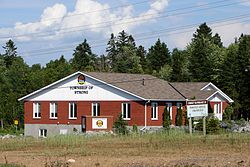
| Township of Strong | |
 Lake Bernard in Strong Township | |
| Motto: Together for a strong tomorrow | |
 Strong | |
| Coordinates: 45°45′N79°24′W / 45.750°N 79.400°W | |
| Country | Canada |
| Province | Ontario |
| District | Parry Sound |
| Settled | 1876 |
| Incorporated | 1877 |
| Government | |
| • Type | Township |
| • Mayor | Tim Bryson |
| • Fed. riding | Parry Sound-Muskoka |
| • Prov. riding | Parry Sound—Muskoka |
| Area | |
| • Land | 158.88 km2 (61.34 sq mi) |
| Population (2021) [1] | |
• Total | 1,566 |
| • Density | 9.9/km2 (26/sq mi) |
| Time zone | UTC-5 (EST) |
| • Summer (DST) | UTC-4 (EDT) |
| Postal Code | P0A |
| Area codes | 705, 249 |
| Website | www |
Strong is a township in the Canadian province of Ontario, as well as the name of a community within the township. Located in the Almaguin Highlands region of Parry Sound District, the township surrounds but does not include the village of Sundridge.
Contents
The township includes the communities of Hartfell, Kennedys, Lake Bernard, Pevensey, Stirling Falls, and Strong. It is home to Lake Bernard.
Strong Township is accessible via Highway 11 and Highway 124. It is bisected by the CN railway. [2]