
Saginaw County, officially the County of Saginaw, is a county located in the U.S. state of Michigan. As of the 2020 Census, the population was 190,124. The county seat is Saginaw. The county was created by September 10, 1822, and was fully organized on February 9, 1835. The etymology of the county's name is uncertain. It may be derived from Sace-nong or Sak-e-nong, as the Sauk tribe is believed by some to have once lived there. A more likely possibility is that it comes from Ojibwe words meaning "place of the outlet" –sag and ong. See List of Michigan county name etymologies.

Tawas City is a city in and county seat of Iosco County in the U.S. state of Michigan. The population was 1,834 at the 2020 census. The city is mostly surrounded by Tawas Township, but the two areas are administered autonomously.

Saginaw is a city in and the seat of Saginaw County, Michigan, United States. The city proper had a population of 44,202 at the 2020 census. Located along the Saginaw River, Saginaw is adjacent to Saginaw Charter Township and considered part of Greater Tri-Cities region of Central Michigan. The Saginaw metropolitan area had a population of 190,124 in 2020. The city is also the largest municipality in the Greater Tri-Cities, with a combined population of 377,474 in the combined statistical area in 2020.
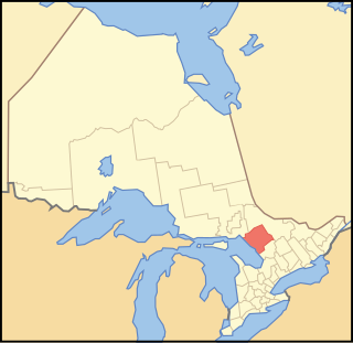
Parry Sound District is a census division of the Canadian province of Ontario. Its boundaries are District of Muskoka to the south, the Sudbury District to the north-northwest, the French River and Lake Nipissing in the north, Nipissing District and North Bay in the north and east and parts of Algonquin Park in the northeast.
Unorganized Centre Parry Sound District is an unorganized area in central Ontario, Canada, between Georgian Bay and Lake Nipissing in the District of Parry Sound. It is made up of geographic townships which have no governing bodies and which are not incorporated as municipalities. The territory consists of two non-contiguous areas, with the main part located directly south of the French River and Lake Nipissing, and east of Georgian Bay. Shawanaga Township is a small exclave south of it along Highway 69.

Nickel Centre was a town in Ontario, Canada, which existed from 1973 to 2000.

The Magnetawan River is a long river in Parry Sound District, Ontario, Canada. The river flows 175 km from its source of Magnetawan Lake inside Algonquin Provincial Park to empty into Georgian Bay at the community of Britt on Byng Inlet.
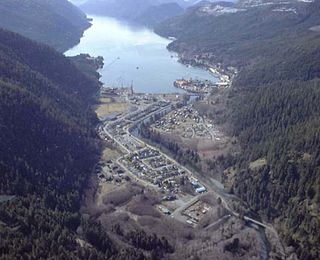
Tahsis is a village municipality on the west coast of Vancouver Island, British Columbia, Canada, about 300 km (186 mi) northwest of the provincial capital Victoria at 49°55′33″N126°37′16″W. As of 2011, the Canadian census listed 316 residents, a decline from the 2006 Census count of 366 residents. The Village of Tahsis economy used to be dependent on forestry, but after the closure of the local sawmill in 2001, the economy became heavily dependent on sport fishing for salmon and halibut, outdoor recreation and tourism.
Lost Channel is a ghost town in Parry Sound District, Ontario.
Kearney is a town and municipality in the Almaguin Highlands region of Parry Sound District of Ontario, Canada. With a landmass of 528 square kilometres and a year-round population of 974 in the Canada 2021 Census, Kearney claims to be the "Biggest Little Town in Ontario."
Nairn and Hyman is a township in the Canadian province of Ontario. The township, located in the Sudbury District, borders on the southwestern city limits of Greater Sudbury west of the city's Walden district. The township had a population of 342 in the Canada 2016 Census.
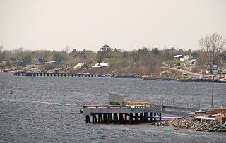
Britt is a community in the Canadian province of Ontario, located in the unincorporated township of Wallbridge in the Parry Sound District.

Magnetawan is a township in the Almaguin Highlands region of the Parry Sound District in the Canadian province of Ontario, as well as the name of the primary population centre in the township.
Byng Inlet is a body of water on the eastern shore of Georgian Bay, between Parry Sound and the mouth of the French River. It is a widening of the Magnetawan River, near its mouth. The name of the river "Magnetawan", meaning "long open channel" in the Ojibwe language, refers to this section of the river.
James Playfair was noted for his entrepreneurship in the Great Lakes shipping, lumbering, grain handling, and industrial manufacturing businesses. He was a central figure in the establishment of Midland, Ontario, Canada. The son of John Speirs Playfair and Georgina Hall of Montreal, in 1889 Playfair married Sarah Charlotte Ogilvie (1858-1945), youngest daughter of Senator A.W. Ogilvie of Montreal, former president of Ogilvie Flour Mills.

Clarke's Beach is a town on Conception Bay in the Canadian province of Newfoundland and Labrador. In the 2021 census the town had a population of 1,400. It is the home of a number of well-known Newfoundland artists, and is a favourite place for retirement.

Hampden is a town in the Canadian province of Newfoundland and Labrador. The town has a population of 429. Two islands can be seen from the shore of Hampden, Granby Island and Millers Island. The latter is much closer to the town and is the host of a tuberculosis grave-site.

The Metamora was a wooden tug commissioned in 1864 and used predominantly for ferrying passengers and goods in the Georgian Bay area of Ontario. It ran onto a shallow shoal near Turning Island in Georgian Bay on July 30, 1907, caught fire and sank in six feet of water.
Wallbridge is an unorganized geographic township in Parry Sound District, Ontario, Canada. Part of the census subdivision of Unorganized Centre Parry Sound District, the township includes the communities of Britt, Byng Inlet and Harris Lake and the rail sidings of Drocourt and North Magnetawan. Although not an incorporated municipality, Britt and Byng Inlet are jointly served by a local services board.

