Related Research Articles
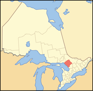
Parry Sound District is a census division of the Canadian province of Ontario. Its boundaries are District of Muskoka to the south, the Sudbury District to the north-northwest, the French River and Lake Nipissing in the north, Nipissing District and North Bay in the north and east and parts of Algonquin Park in the northeast.
Unorganized Centre Parry Sound District is an unorganized area in central Ontario, Canada, between Georgian Bay and Lake Nipissing in the District of Parry Sound. It is made up of geographic townships which have no governing bodies and which are not incorporated as municipalities. The territory consists of two non-contiguous areas, with the main part located directly south of the French River and Lake Nipissing, and east of Georgian Bay. Shawanaga Township is a small exclave south of it along Highway 69.
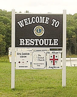
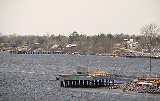
Restoule is a community and designated place in geographic Patterson Township in the Centre Unorganized Part of Parry Sound District in Central Ontario, Canada. It is situated on the Restoule River between Commanda Lake, and Restoule Lake and is part of the Almaguin Highlands region.

The Restoule River is a river in Parry Sound District in Central Ontario, Canada. It rises at Commanda Lake in geographic Patterson Township at the community of Restoule. It then flows north into Restoule Lake then north into Stormy Lake at Restoule Provincial Park, at the end of Ontario Highway 534. It then heads west into geographic Hardy Township to its mouth at the French River.
Secondary Highway 534, commonly referred to as Highway 534, is a provincially maintained secondary highway in the Canadian province of Ontario. The route begins at the entrance to Restoule Provincial Park and ends near Highway 11 in Powassan. The route provides access to several communities which lay south of Lake Nipissing. Between those communities, the highway travels mostly through thick boreal forest. It was assumed in 1956, following its present course and remaining unchanged since. It is a lightly travelled route accommodating, on an average day, no more than 850 vehicles.

Restoule Provincial Park is a provincial park in Parry Sound District in Central Ontario, Canada. It is located between Restoule Lake and Stormy Lake and extends along the banks of the Restoule River to its mouth at the French River in geographic Patterson Township and geographic Hardy Township. The park is located at the western terminus of Highway 534 northwest of Restoule, Ontario. The park offers three hiking trails and is home to coyotes, wolves, bears, otters, pine martens, moose and one of Ontario's largest white-tailed deer herd. It is also home to over 90 species of birds including the peregrine falcon, and the heron. The camping sites include Bells Point, Putts Point and Kettle Point. Many hike the well-marked trail to the 100-foot (30 m) fire tower overlooking Stormy Lake. It is one of two provincial parks found in the Almaguin Highlands.

Nipissing is an incorporated (political) township in Parry Sound District in Central Ontario, Canada. It is on Lake Nipissing and is part of the Almaguin Highlands region. Nipissing was surveyed between 1874 and 1881, and was incorporated in 1888. Among the first settlers in the area were the Chapman and Beatty families. Nipissing Township annexed Gurd Township in 1970. The township also contains a community named Nipissing, which is located on the South River near Chapman's Landing, on the South Bay of Lake Nipissing. The township administrative offices are located in Nipissing.

Commanda Lake is a lake in central Ontario, Canada. Located on the border between Patterson Township and Pringle Township, in the Almaguin Highlands region of the District of Parry Sound, it is fed by Gee Creek, Commanda Creek and Beaudry Creek and is drained by the Restoule River. The Lake is shaped like the number "3", its middle spur is called Deep Bay. The lake is home to one permanent island, located off a point in its east. This is a mud bottom lake and its water is "tea coloured." On the north shore of the lake is the community of Restoule, but cottages line many of the shore lines. Lots of crown land also surrounds the lake shore making it a very peaceful lake for people of all ages to enjoy. This lake has one public boat launch towards the southern end of the lake accessible on Commanda Lake Road. The lake is located at an altitude of 222 m (729 ft) above sea level. The lake is home to the Northern pike, Walleye, Smallmouth bass and Largemouth bass species of fish. Ice gets thick in the winter making this lake an all year round fishing lake.

Patterson Township is a geographic township in central Ontario, Canada. As it is unincorporated, it is located in the Central Unorganized portion of Parry Sound District. The township is located where the French River flows from Lake Nipissing, and then stretches south until it meets Pringle Township in the south. It is bordered by Nipissing Township on the east, and by Hardy Township on the west. Patterson only has one community, that of Restoule. Most of its settlement is found in the southern region where Restoule is, and along the two lakes of the south, Restoule Lake and Commanda Lake. It is part of the Almaguin Highlands region.
Gurd Township is an historical geographic township in central Ontario, Canada, in the Almaguin Highlands region of Parry Sound District. It was first surveyed in 1875 and was named after Robert Sinclair Gurd, a businessman and one-time mayor of Sarnia. In 1970, Gurd was annexed by the incorporated Nipissing Township.
Secondary Highway 522, commonly referred to as Highway 522, is a provincially maintained highway in the Canadian province of Ontario. The highway is 109.6 kilometres (68.1 mi) in length, connecting Highway 69 near Cranberry with Highway 11 at the community of Trout Creek. Highway 522 serves as the only link between these two routes south of Highway 17 and north of Highway 124. It is often used to access Grundy Lake Provincial Park, a popular camping area for northbound travellers.

Unorganized North East Parry Sound District is an unorganized area in Parry Sound District in Central Ontario, Canada. It is served by the local services board of Laurier and is part of the Almaguin Highlands region. The region had a population of 187 in the Canada 2016 Census, and a land area of 183.27 square kilometres.
Loring, Port Loring and District is a local services board in the Canadian province of Ontario, located in Parry Sound District, and by extension, the Almaguin Highlands region.

The Almaguin Highlands Region in Ontario, Canada, covers approximately 5,200 km2 (2,000 sq mi) comprising the eastern half of Parry Sound District. It is bounded by Muskoka in the south, and by Lake Nipissing and Nipissing District in the north. The eastern edge abuts the western boundary of Algonquin Provincial Park, whereas the western boundary of the Almaguin Highlands is generally regarded to be the mid east-west point of Parry Sound District. Originally derived from the words, Algonquin, Magnetawan, and Seguin. Almaguin is now used to describe the marketing region of East Parry Sound.
Shawanaga is an unorganized geographic township in the Canadian province of Ontario, located within the Parry Sound District. Part of the census subdivision of Unorganized Centre Parry Sound District, the township includes the community of Madigans and part of Round Lake Provincial Park. The township historically had larger boundaries, also including the community of Skerryvore, but most of it has been incorporated into the municipal township of The Archipelago; only a small portion in the southeast corner of the former township still exists as Shawanaga Township.

Bob's Lake is a lake in geographic Patterson Township in the Unorganized Centre Part of Parry Sound District in Central Ontario, Canada. It is in the Great Lakes Basin, and the nearest community is Restoule, 6 kilometres (4 mi) to the east. It is located in the Almaguin Highlands.
Wallbridge is an unorganized geographic township in Parry Sound District, Ontario, Canada. Part of the census subdivision of Unorganized Centre Parry Sound District, the township includes the communities of Britt, Byng Inlet and Harris Lake and the rail sidings of Drocourt and North Magnetawan. Although not an incorporated municipality, Britt and Byng Inlet are jointly served by a local services board.
Henvey is an unorganized geographic township in the Canadian province of Ontario, located within the Parry Sound District. Part of the census subdivision of Unorganized Centre Parry Sound District, the township includes the communities of Britt Station and Still River. It formerly had larger boundaries, also including the ghost town of Key Harbour, although the more northerly section was transferred to the municipality of Killarney in the 1990s. Britt Station is part of the local services board of Britt and Byng Inlet.
The Pickerel River is a river in the Canadian province of Ontario. Essentially a secondary arm of the larger French River system, the river extends from its headwaters in the Loring and Restoule area of the Almaguin Highlands in the northern part of Parry Sound District to Georgian Bay. Smaller channels near Wanikewin and Hartley Bay also connect the river directly to the main watercourse of the French River.
The Wolf River is a river in Parry Sound District in Central Ontario, Canada. It is in the Great Lakes Basin and is a right tributary of the Pickerel River.
References
- ↑ "Pringle". Geographical Names Data Base. Natural Resources Canada . Retrieved 2017-11-10.
- ↑ Rayburn, Alan (1997). Place Names of Ontario. Toronto: University of Toronto Press. p. 282. ISBN 0-8020-7207-0.
Places adjacent to Pringle Township | |
|---|---|
Coordinates: 45°56′22″N79°42′39″W / 45.93944°N 79.71083°W
| This Ontario location article is a stub. You can help Wikipedia by expanding it. |