Unorganized Centre Parry Sound District is an unorganized area in central Ontario, Canada, between Georgian Bay and Lake Nipissing in the District of Parry Sound. It is made up of geographic townships which have no governing bodies and which are not incorporated as municipalities. The territory consists of two non-contiguous areas, with the main part located directly south of the French River and Lake Nipissing, and east of Georgian Bay. Shawanaga Township is a small exclave south of it along Highway 69.
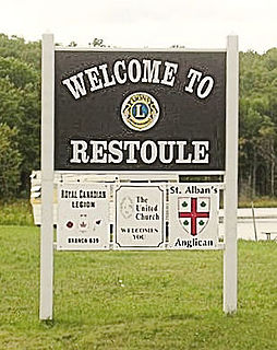
Restoule is a community and designated place in geographic Patterson Township in the Centre Unorganized Part of Parry Sound District in Central Ontario, Canada. It is situated on the Restoule River between Commanda Lake, and Restoule Lake and is part of the Almaguin Highlands region.
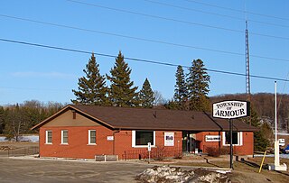
Armour is a township municipality in the Canadian province of Ontario.

South Algonquin is a township municipality in Nipissing District, Ontario, Canada. Located south of Algonquin Provincial Park, it is the sole populated portion of the district that lies south of the traditional dividing line between Northern Ontario and Southern Ontario and is closer connected to Renfrew County as opposed to the core portions of Nipissing District.

Upper Madawaska River Provincial Park is a waterway-class provincial park on the Madawaska River in the Municipality of South Algonquin in Nipissing District, Ontario, Canada. The park consists of a strip of land along both shores of the Madawaska River from the communities of Whitney to Madawaska. It is upstream and north of the Lower Madawaska River Provincial Park.

Dunchurch is a compact rural community in the Canadian province of Ontario, located in the municipality of Whitestone in Parry Sound District.

Kitigan is a dispersed rural community in the Unorganized North Part of Cochrane District in Northeastern Ontario, Canada. It is located in geographic O'Brien Township along Ontario Highway 11 between the incorporated municipalities of Moonbeam to the east and Kapuskasing to the west.

Departure Lake is a dispersed rural community and unincorporated place in geographic Haggart Township, Cochrane District in Northeastern Ontario, Canada. It is located on Ontario Highway 11 between the communities of Strickland to the west and Smooth Rock Falls to the east.

Unorganized North East Parry Sound District is an unorganized area in Parry Sound District in Central Ontario, Canada. It is served by the local services board of Laurier and is part of the Almaguin Highlands region. The region had a population of 187 in the Canada 2016 Census, and a land area of 183.27 square kilometres.

Canoe Lake is a lake in geographic Syine Township in the Unorganized Part of Thunder Bay District, Ontario, Canada, about 12.5 kilometres (7.8 mi) northeast of the municipality of Terrace Bay.
Bob's Lake is a lake in geographic Patterson Township in the Unorganized Centre Part of Parry Sound District in Central Ontario, Canada. It is in the Great Lakes Basin, and the nearest community is Restoule, 6 kilometres (4 mi) to the east. It is located in the Almaguin Highlands.
Mowat is an unorganized geographic township in the Canadian province of Ontario, located within the Parry Sound District. Part of the census subdivision of Unorganized Centre Parry Sound District, the township includes the communities of Bon Air, Cranberry and Key River, the ghost towns of Ludgate and Pakesley and the rail sidings of Mowat and Wanikewin.
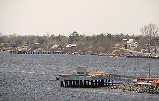
Wallbridge is an unorganized geographic township in Parry Sound District, Ontario, Canada. Part of the census subdivision of Unorganized Centre Parry Sound District, the township includes the communities of Britt, Byng Inlet and Harris Lake and the rail sidings of Drocourt and North Magnetawan. Although not an incorporated municipality, Britt and Byng Inlet are jointly served by a local services board.
The Dunrankin River is a river in Algoma District and Sudbury District in northeastern Ontario, Canada. It is in the James Bay drainage basin, begins at Upper Dunrankin Lake and is a left tributary of the Kapuskasing River.
René Brunelle Provincial Park is a provincial park in both the municipality of Moonbeam and geographic Gurney Township in Unorganized North Cochrane District, Cochrane District, in Northeastern Ontario, Canada. Established in 1957 and named after 1981 for René Brunelle, it is operated by Ontario Parks and has camping, hiking, swimming and other facilities on or near Remi Lake.
The Remi River is a river in the Unorganized North Part of Cochrane District in Northeastern Ontario, Canada. It is in the James Bay drainage basin and is a right tributary of the Kapuskasing River.
Mameigwess Lake is a lake in the south of the Unorganized Part of Kenora District in northwestern Ontario, Canada. The lake is in the Hudson Bay drainage basin.
Frith Lake is lake in geographic Churchill Township the Unorganized North Part of Sudbury District in northeastern Ontario, Canada. The lake is in the Saint Lawrence River drainage basin.

Potter Creek is a stream in the Unorganized South Part of Nipissing District in Northeastern Ontario, Canada. It is a tributary of Canoe Lake, is in the Lake Huron drainage basin, and lies within Algonquin Provincial Park.
Peters Lake is a lake in Peters Township, a geographic township, in the Unorganized North Part of Sudbury District in northeastern Ontario, Canada. It is in the Lake Superior drainage basin.
