Cambridge Township, Ontario

Last updated

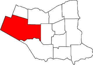
Cambridge Township was a township in Ontario, Canada. Along with Clarence Township, Russell Township and Cumberland Township, Cambridge Township was one of the four townships of Russell County. [1]

The term township generally means the district or area associated with a town. However, in some systems, no town needs to be involved. The specific use of the term to describe political subdivisions has varied by country, usually to describe a local rural or semi-rural government within the country itself.

Ontario Province of Canada

Ontario is one of the 13 provinces and territories of Canada and is located in east-central Canada. It is Canada's most populous province accounting for 38.3 percent of the country's population, and is the second-largest province in total area. Ontario is fourth-largest jurisdiction in total area when the territories of the Northwest Territories and Nunavut are included. It is home to the nation's capital city, Ottawa, and the nation's most populous city, Toronto, which is also Ontario's provincial capital.

Canada Country in North America

Canada is a country in the northern part of North America. Its ten provinces and three territories extend from the Atlantic to the Pacific and northward into the Arctic Ocean, covering 9.98 million square kilometres, making it the world's second-largest country by total area. Canada's southern border with the United States is the world's longest bi-national land border. Its capital is Ottawa, and its three largest metropolitan areas are Toronto, Montreal, and Vancouver. As a whole, Canada is sparsely populated, the majority of its land area being dominated by forest and tundra. Consequently, its population is highly urbanized, with over 80 percent of its inhabitants concentrated in large and medium-sized cities, many near the southern border. Canada's climate varies widely across its vast area, ranging from arctic weather in the north, to hot summers in the southern regions, with four distinct seasons.

It was created in 1800. It existed for 198 years before becoming part of The Nation Municipality in 1998, during the Eastern Ontario municipal fusions.

The Nation, Ontario Municipality in Ontario, Canada

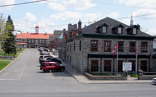
The Nation is a municipality in eastern Ontario, located within Canada's National Capital Region, in the United Counties of Prescott and Russell. The municipality consists of the former geographic townships of Caledonia, Cambridge and South Plantagenet.

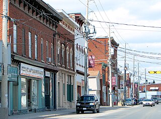
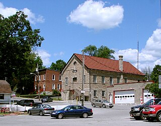
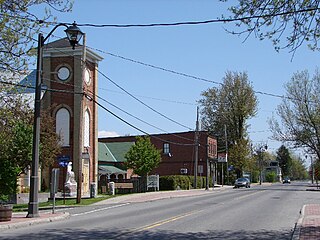
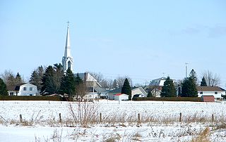
Major communities in what was Cambridge Township are Limoges and St. Albert. Other communities include Benoit, Gagnon, Longtinville, Martels Corners and Mayerville.

Limoges, Ontario Unincorporated place / Community in Ontario, Canada

Limoges, Ontario is a small community in The United Counties of Prescott and Russell approximately 35 kilometres east of Ottawa. The east and north sides of the community are located in the township of The Nation, while the west side of the community is located in the township of Russell.

St. Albert, Ontario human settlement in Canada

St. Albert is a small town in The Nation Township in Eastern Ontario, Canada. It is located on the South Nation River, 10 km southwest of Casselman and 17 km southeast of Embrun.

According to the Canada 2001 Census: [2]

See also

Related Research Articles

West Lincoln, Ontario Township in Ontario, Canada

West Lincoln is a township in the Niagara Region of Ontario, Canada. Main urban areas are located along the former provincial Highway 20. The administrative centre of West Lincoln is the community of Smithville, situated halfway between Hamilton and Pelham.

Casselman, Ontario Village in Ontario, Canada

Casselman is a village in eastern Ontario, Canada, in the United Counties of Prescott and Russell on the South Nation River.

Tweed, Ontario Municipality in Ontario, Canada

Tweed is a municipality and a village located in central-eastern Ontario, Canada, in Hastings County.

Marmora and Lake Municipality in Ontario, Canada

The Municipality of Marmora and Lake is nestled along the banks of Crowe River and Beaver Creek. A picturesque municipality, home to more than 4,000 full time and seasonal residents many of whom enjoy outdoor recreation and relaxation on Crowe Lake. Midway between Toronto and Ottawa on provincial highway 7 in beautiful Hastings County in Central Ontario, Canada.

United Counties of Prescott and Russell United counties in Ontario, Canada

The United Counties of Prescott and Russell are consolidated counties located in the Canadian province of Ontario. Its county seat is L'Orignal. It was created as a result of a merger between Russell County and Prescott County in 1820. It is located in Eastern Ontario, in the wedge-shaped area between the Ottawa River and St. Lawrence River, approximately 55 km east of the City of Ottawa.

Cumberland, Ontario

Cumberland was a township in eastern Ontario, Canada, that existed from 1800 to 1999, when it was incorporated as the City of Cumberland. It ceased to be a separate municipality in 2001, when it was amalgamated into the city of Ottawa.

Division No. 6, Alberta Census division in Alberta in Canada

Division No. 6 is a census division in Alberta, Canada. Surrounding the City of Calgary, the majority of the division comprises Alberta's Calgary Region, while the northern portion of the division is located within central Alberta. The division also forms the southern segment of the Calgary–Edmonton Corridor. Division No. 6 is the largest census division in Alberta according to population and also has the highest population density.

The Regional Municipality of Ottawa–Carleton was a regional government area and census division in Ontario, Canada, which existed from 1969 until 2001. It was created in 1969 from the former Carleton County plus Cumberland Township, previously part of Russell County.

Stormont County area 248,608 acres (1,006 km2) is a county in the Canadian province of Ontario.

Russell County is a historic county in the Canadian province of Ontario.

Division No. 11, Alberta Census division in Alberta in Canada

Division No. 11 is a census division in Alberta, Canada. Surrounding the City of Edmonton, the majority of the division comprises Alberta's Capital Region, while the western and southern portions of the division are located within central Alberta. The division also forms the northern segment of the Calgary–Edmonton Corridor.

Osgoode, Ontario Community in Ontario, Canada

Osgoode is a population centre in Osgoode Ward in the rural south end of Ottawa, Ontario, Canada. It is located just 2 km east of the Rideau River. Until amalgamation in 2001, it was located in Osgoode Township. According to the Canada 2011 Census Osgoode had a population of 2,453.

Alnwick/Haldimand Township in Ontario, Canada

The Township of Alnwick/Haldimand is a township in central Ontario, Canada, in Northumberland County, situated between Lake Ontario and Rice Lake. It was formed in 2001 by the merger of Alnwick Township in the north and Haldimand Township in the south. Alderville First Nation is an autonomously governed First Nation contained within the township boundaries, in two non-contiguous sections along County Roads 45 and 18.

Cockburn Island (Ontario) Township in Ontario, Canada

Cockburn Island is an island and municipality in the Canadian province of Ontario, located in the Manitoulin District. It is separated from the westernmost point of Manitoulin Island by the Mississagi Strait, and from Michigan's Drummond Island by the False Detour Channel.

Marionville is a dispersed rural community in Russell Township, Ontario, located on the border with the City of Ottawa and North Dundas. The community is located about 750m northwest of the East Castor River.

Kenmore, Ontario Community in Ontario, Canada

Kenmore is a rural community in Osgoode Ward in the southeastern corner of the City of Ottawa, Ontario, Canada. Prior to amalgamation in 2001, it was located in Osgoode Township. It consists of two small residential neighbourhoods and farmland. Notable features include Kenmore Bicentennial Park, Kenmore Community Centre, and the Castor River, a tributary of the South Nation River. According to the Canada 2011 Census, the population of the surrounding blocks was 501.

The Stormont, Dundas and Glengarry County Library, Ontario, Canada, was established in 1971, the SD&G County Library grew from the merger of seven existing libraries located in a number of small rural communities of Eastern Ontario, Canada: Lancaster, Ingleside, Newington, Morrisburg, Chesterville, Winchester and South Mountain. Added in the same year were branches in Maxville and Alexandria, followed by Long Sault (1972); Crysler (1973); Moose Creek, Avonmore, St. Andrews, Williamstown (1975); Brinston (1976–1998); Finch and Dalkeith (1978); Williamsburg (1979); Morewood (1986); Glen Robertson (1988–1998); Lancaster Township (1992–2001); and Iroquois (1998).

Gordon/Barrie Island Municipality in Ontario, Canada

The Municipality of Gordon/Barrie Island is a township in Manitoulin District in north central Ontario, Canada. It was formed on January 1, 2009, upon the amalgamation of the townships of Gordon and Barrie Island.

LOrignal, Ontario village in Champlain, Ontario

L'Orignal is a village and former municipality, now part of Champlain Township in eastern Ontario, Canada. It likely took its name from its location on the Ottawa River once known as Pointe à l'Orignal, where moose crossed the river.

References

  1. "Township of Cambridge". The Canadian County Atlas Digital Project. McGill University . Retrieved 2010-08-08.
  2. "Cambridge". Community Highlights 2001. Statistics Canada . Retrieved 2010-08-08.

Coordinates: 45°30′N75°10′W / 45.500°N 75.167°W / 45.500; -75.167

Geographic coordinate system Coordinate system

A geographic coordinate system is a coordinate system that enables every location on Earth to be specified by a set of numbers, letters or symbols. The coordinates are often chosen such that one of the numbers represents a vertical position and two or three of the numbers represent a horizontal position; alternatively, a geographic position may be expressed in a combined three-dimensional Cartesian vector. A common choice of coordinates is latitude, longitude and elevation. To specify a location on a plane requires a map projection.