Lake of the Woods, Ontario

Last updated

Lake of the Woods
Township of Lake of the Woods
Dawson-Lake-Woods Twp.JPG
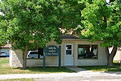
Township office in Rainy River
Canada Ontario location map 2.svg
Red pog.svg
Lake of the Woods
Coordinates: 49°00′N94°23′W / 49.000°N 94.383°W / 49.000; -94.383
CountryCanada
Province Ontario
District Rainy River
FormedJanuary 1, 1998
Government
  MayorColleen Fadden
  Federal riding Thunder Bay—Rainy River
  Prov. riding Kenora—Rainy River
Area
[1]
  Land751.31 km2 (290.08 sq mi)
Population
 (2011) [1]
  Total230
  Density0.3/km2 (0.8/sq mi)
Time zone UTC-6 (CST)
  Summer (DST) UTC-5 (CDT)
Postal Code FSA
P0W
Area code 807
Website www.lakeofthewoods.ca

Lake of the Woods is a township in the Canadian province of Ontario, located within the Rainy River District. The township is located on the eponymous Lake of the Woods, consisting of mainland in the south-east part of the lake, the southern shores of Aulneau Peninsula, along with several islands in the lake, including Big Island and Bigsby Island. It fully surrounds the Anishnaabeg of Naongashiing, Big Grassy River 35G, Big Island Mainland 93, and Saug-a-Gaw-Sing 1 First Nation reserves.

Contents

The township was formed on January 1, 1998, when the former incorporated townships of Morson and McCrosson/Tovell were amalgamated. The following year portions of Unorganized Kenora District were annexed. [2]

The primary communities within the township are Bergland, Minahico and Morson.

Demographics

In the 2021 Census of Population conducted by Statistics Canada, Lake of the Woods had a population of 308 living in 140 of its 454 total private dwellings, a change of 33.9% from its 2016 population of 230. With a land area of 746.24 km2 (288.12 sq mi), it had a population density of 0.4/km2 (1.1/sq mi) in 2021. [3]

Canada census – Lake of the Woods community profile
2021 2016 2011
Population308 (+33.9% from 2016)230 (-22.3% from 2011)296 (-8.4% from 2006)
Land area746.24 km2 (288.12 sq mi)751.31 km2 (290.08 sq mi)751.95 km2 (290.33 sq mi)
Population density0.4/km2 (1.0/sq mi)0.3/km2 (0.78/sq mi)0.4/km2 (1.0/sq mi)
Median age59.2 (M: 59.2, F: 58.8)59.6 (M: 61.1, F: 58.6)
Private dwellings454 (total)  140 (occupied)521 (total) 555 (total) 
Median household income$75,000$55,936
References: 2021 [4] 2016 [5] 2011 [6] earlier [7] [8]
Lake of the Woods Township
historical populations
YearPop.±%
1996 432    
2001 330−23.6%
2006 323−2.1%
2011 296−8.4%
2016 230−22.3%
[9] [10] [1]

Notable people

See also

Related Research Articles

<span class="mw-page-title-main">Georgian Bluffs</span> Township in Ontario, Canada

Georgian Bluffs is a township in southwestern Ontario, Canada, in Grey County located between Colpoy's Bay and Owen Sound on Georgian Bay.

<span class="mw-page-title-main">Georgian Bay, Ontario</span> Township in Ontario, Canada

The Township of Georgian Bay is an area municipality of the District Municipality of Muskoka, in south-central Ontario, Canada. It is located on the Severn River, where it empties into the eponymous Georgian Bay. The municipal offices are at Port Severn.

<span class="mw-page-title-main">Carling, Ontario</span> Township in Ontario, Canada

Carling is a township in Ontario, Canada, located in the District of Parry Sound on Georgian Bay. Killbear Provincial Park is located in the municipality.

<span class="mw-page-title-main">Manitoulin District</span> District in Ontario, Canada

Manitoulin District is a district in Northeastern Ontario within the Canadian province of Ontario. It was created in 1888 from part of the Algoma District. The district seat is in Gore Bay.

<span class="mw-page-title-main">The Archipelago</span> Township in Ontario, Canada

The Archipelago is a township in central Ontario, Canada, along the Georgian Bay in the Parry Sound District.

<span class="mw-page-title-main">Seguin, Ontario</span> Township in Ontario, Canada

Seguin is a township in central Ontario, Canada, in the District of Parry Sound.

<span class="mw-page-title-main">Nipissing District</span> District in Ontario, Canada

Nipissing District is a district in Northeastern Ontario in the Canadian province of Ontario. It was created in 1858. The district seat is North Bay.

<span class="mw-page-title-main">Rainy River District</span> District in Ontario, Canada

Rainy River District is a district and census division in Northwestern Ontario in the Canadian province of Ontario. It was created in 1885. It is the only division in Ontario that lies completely in the Central Time Zone, except for the township of Atikokan observing Eastern Standard Time year-round. Its seat is Fort Frances. It is known for its fishing and its location on the US border opposite International Falls, Minnesota, and Baudette, Minnesota.

<span class="mw-page-title-main">Thunder Bay District</span> District in Ontario, Canada

Thunder Bay District is a district and census division in Northwestern Ontario in the Canadian province of Ontario. The district seat is Thunder Bay.

<span class="mw-page-title-main">Thames Centre</span> Municipality in Ontario, Canada

Thames Centre is a municipality in Middlesex County, Ontario, Canada, directly east of the City of London. It was formed on January 1, 2001, when the townships of West Nissouri and North Dorchester were amalgamated. It is part of the London census metropolitan area.

<span class="mw-page-title-main">Prince, Ontario</span> Township in Ontario, Canada

Prince is a township in the Canadian province of Ontario, located within the Algoma District northwest of Sault Ste. Marie. Although the township is not part of the city of Sault Ste. Marie, some municipal services are contracted to the city.

<span class="mw-page-title-main">Shuniah</span> Municipality in Ontario, Canada

Shuniah is a municipal township bordering the city of Thunder Bay, Ontario, Canada on the east. Shuniah was incorporated by an act of the Ontario legislature in 1873, and at that time included much of present-day Thunder Bay and its predecessor and surrounding municipalities. It gradually shrunk in size until by 1936 it included only three wards, the geographic townships of McIntyre, McGregor, and McTavish. That year it had the Ontario Legislative Assembly remove a number of islands in Lake Superior that had formed the Island Ward since 1873. In 1970 McIntyre Township was amalgamated into the city of Thunder Bay. Shuniah, named after the Ojibwa word "zhooniyaa" for "money" or "silver", was settled largely due to silver mining potential identified in the mid-19th century.

<span class="mw-page-title-main">Central Manitoulin</span> Township in Ontario, Canada

Central Manitoulin is a township in the Canadian province of Ontario. It is located on Manitoulin Island and in Manitoulin District.

<span class="mw-page-title-main">Cramahe, Ontario</span> Township in Ontario, Canada

Cramahe is a rural township located in Northumberland County in southern Ontario, Canada. It is situated just off Ontario Highway 401 approximately 140 km East of Toronto. It was named for Hector Theophilus de Cramahé, who was Lieutenant-Governor of the Province of Quebec. The township's seat and largest town is Colborne.

<span class="mw-page-title-main">Assiginack</span> Township in Ontario, Canada

Assiginack is a township in the Canadian province of Ontario, located on Manitoulin Island. An Ontario Historical Plaque was built on the grounds of the Assiginack Museum by the province to commemorate the Manitoulin Treaties' role in Ontario's heritage.

<span class="mw-page-title-main">Strong, Ontario</span> Township in Ontario, Canada

Strong is a township in the Canadian province of Ontario, as well as the name of a community within the township. Located in the Almaguin Highlands region of Parry Sound District, the township surrounds but does not include the village of Sundridge.

<span class="mw-page-title-main">Macdonald, Meredith and Aberdeen Additional</span> Township in Ontario, Canada

Macdonald, Meredith and Aberdeen Additional is a township in Algoma District, Ontario, Canada. Originally surveyed as separate geographical townships, Macdonald and Meredith were incorporated as a single, municipal township in 1892. The geographical township of Aberdeen Additional was added to Macdonald and Meredith township in 1899 to create the municipal township of Macdonald, Meredith and Aberdeen Additional.

<span class="mw-page-title-main">Dawson, Ontario</span> Township in Ontario, Canada

Dawson is a township located in Rainy River District in Northwestern Ontario, Canada. The township is located at the mouth of the Rainy River where it flows into Lake of the Woods.

<span class="mw-page-title-main">The North Shore, Ontario</span> Township in Ontario, Canada

The North Shore is a township in the Canadian province of Ontario, located in the Algoma District. The township had a population of 497 in the Canada 2016 Census. It is along the north shore of the North Channel of Lake Huron, with its main communities all along Highway 17.

<span class="mw-page-title-main">Gordon/Barrie Island</span> Municipality in Ontario, Canada

The Municipality of Gordon/Barrie Island is a township in Manitoulin District in north central Ontario, Canada. It was formed on January 1, 2009, upon the amalgamation of the townships of Gordon and Barrie Island.

References

  1. 1 2 3 "Census Profile, 2016 Census: Lake of the Woods, Township". Statistics Canada. Retrieved July 2, 2019.
  2. "History". Lake of the Woods Township. Archived from the original on 2011-08-27. Retrieved 2011-05-06.
  3. "Population and dwelling counts: Canada, provinces and territories, census divisions and census subdivisions (municipalities), Ontario". Statistics Canada. February 9, 2022. Retrieved April 2, 2022.
  4. "2021 Community Profiles". 2021 Canadian Census . Statistics Canada. February 4, 2022. Retrieved 2023-10-19.
  5. "2016 Community Profiles". 2016 Canadian Census . Statistics Canada. August 12, 2021. Retrieved 2019-07-02.
  6. "2011 Community Profiles". 2011 Canadian Census . Statistics Canada. March 21, 2019. Retrieved 2012-03-30.
  7. "2006 Community Profiles". 2006 Canadian Census . Statistics Canada. August 20, 2019.
  8. "2001 Community Profiles". 2001 Canadian Census . Statistics Canada. July 18, 2021.
  9. Statistics Canada: 2001, 2006, 2011 census
  10. "Lake of the Woods census profile". 2011 Census of Population . Statistics Canada. Retrieved 2012-03-30.