
Bruce County is a county in Southwestern Ontario, Canada. It has eight lower-tier municipalities with a total 2016 population of 66,491. It is named for James Bruce, 8th Earl of Elgin and 12th Earl of Kincardine, the sixth Governor General of the Province of Canada. The Bruce name is also linked to the Bruce Trail and the Bruce Peninsula.
Cochrane District is a district and census division in Northeastern Ontario in the Canadian province of Ontario. It was created in 1921 from parts of Timiskaming and Thunder Bay districts.

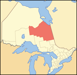
Thunder Bay District is a district and census division in Northwestern Ontario in the Canadian province of Ontario. The district seat is Thunder Bay.
Munsee-Delaware Nation is a Lenape First Nations band government located 24 kilometres (15 mi) west of St. Thomas, in southwest Ontario, Canada.
Neskantaga First Nation is a remote Oji-Cree First Nation band government in the northern reaches of the Canadian province of Ontario, situated along the shore of Attawapiskat Lake in the District of Kenora.

The Township of Alnwick/Haldimand is a township in central Ontario, Canada, in Northumberland County, situated between Lake Ontario and Rice Lake. It was formed in 2001 by the merger of Alnwick Township in the north and Haldimand Township in the south. Alderville First Nation is an autonomously governed First Nation contained within the township boundaries, in two non-contiguous sections along County Roads 45 and 18.
Cat Lake First Nation is an Ojibway First Nation reserve approximately 180 kilometres northwest of Sioux Lookout in northwestern Ontario, Canada, located on the central north shore of Cat Lake. As of 2021, their total registered population was 651 people.
Webequie First Nation is located on the northern peninsula of Eastwood Island on Winisk Lake, 540 km (336 mi) north of Thunder Bay in Ontario, Canada. Webequie is a fly-in community with no summer road access. The primary way into the community is by air to Webequie Airport or winter road, which connects to the Northern Ontario Resource Trail. The First Nation have the 34,279 ha Webequie Indian reserve. The Webequie or Webiqui Indian Settlement also have reserve status. Webequie First Nation is a member of the Matawa First Nations, a Regional Chiefs' Council and a member of the Nishnawbe Aski Nation.
Marten Falls First Nation is an Anishinaabe First Nation reserve located in northern Ontario. The First Nation occupies communities on both sides of the Albany River in Northern Ontario, including Ogoki Post in the Cochrane District and Marten Falls in the Kenora District. As of December 2013, the First Nation had a total registered population of 728 people, of which their on-reserve population was 328 people.

Apitipi Anicinapek Nation, formerly known as Wahgoshig First Nation, is an Algonquin Anicinape community, located near Matheson in Cochrane District in northeastern Ontario, Canada. In January 2008, the First Nation had 270 people registered with the nation, of which their on-reserve population was 121.
Buffalo Point First Nation is an Ojibwa or Saulteaux First Nations located in the southeastern corner of Manitoba, along the shores of Lake of the Woods. It is bordered largely by the unorganized portion of Division No. 1, Manitoba, and also has smaller borders with the Rural Municipality of Piney, as well as the northeast corner of Roseau County, Minnesota.
Wabigoon Lake Ojibway Nation, commonly known as Wabigoon First Nation, is a Saulteaux First Nation band government who inhabit the Kenora District in northwestern Ontario, Canada. It is approximately 19 km southeast of Dryden, Ontario. As of January 2008, the First Nation had a registered population of 533 people, of which their on-Reserve population was 175.
Lac La Croix First Nation is a Saulteaux First Nation band government who reside in the Rainy River District of northwestern Ontario, Canada, along the Ontario-Minnesota border. It is approximately 200 km northwest of Thunder Bay, Ontario. As of January 2008, the First Nation had a registered population of 398 people, of which their on-Reserve population was 273.

Long Lake 58 First Nation is an Anishinaabe (Ojibway) First Nation band government located in Northern Ontario, located approximately 40 km east of Geraldton, Ontario, Canada, on the northern shore of Long Lake, immediately north of Ginoogaming First Nation and west of the community of Longlac, Ontario. As of January, 2008, their total registered population was 1,248 people, of which their on-Reserve population was 427.
Dokis 9 is a First Nations reserve and community in the Canadian province of Ontario, assigned to the Dokis First Nation. The reserve is located approximately 16 kilometers southwest of central southern Lake Nipissing along the French River. It is divided into two large parts consisting of a north island, Okikendawt, and a large southern peninsula. The two land masses, which are nestled within the flows of the French river, covers 154.36 square kilometers. The French River watershed in Northern Ontario was created more than ten thousand years ago when the last ice-age receded and left a maze of rivers and small lakes. The main settlement is found on Okikendawt island which can be accessed by a gravel road which connects with Highway 64. The Land is occupied by the Dokis and its cousin tribe, the Restoule‘s. The land is well known for its hunting, fishing, fur trades, and timber.
Beausoleil First Nation is an Ojibwe First Nation band government located in Simcoe County, Ontario, Canada. The main settlement of the Beausoleil First Nation is on Christian Island, Ontario, Canada in southern Georgian Bay. As of 2018, the total number of status Native Americans registered with the First Nation is 2,587. The on-reserve population is 614.

The Biinjitiwaabik Zaaging Anishinaabek is an Ojibway First Nation band government in Northwestern Ontario, Canada. Their territory is located on the Rocky Bay 1 reserve in Greenstone, Ontario, bordering on the community of Macdiarmid. In October 2008, they had a total registered population of 678 people, of which 327 people lived on their own Indian reserve. The Nation is led by Chief Gladys Thompson. The council is a member of Nokiiwin Tribal Council, a Regional Chiefs' Council, and is member of Union of Ontario Indians, a Tribal Political Organization. The First Nation is also a member of Waaskiinaysay Ziibi Inc., an economic development corporation made up of five Lake Nipigon First Nations.
The Leq'á:mel First Nation, formerly known as Lakahahmen First Nation, is a First Nations band government whose community and offices are located in the area near Deroche, British Columbia in the Fraser Valley region in Canada, about 12 kilometres east of the District of Mission. They are a member government of the Sto:lo Nation Chiefs Council, which is one of two tribal councils of the Sto:lo.
Rainy Lake 26A is a First Nations reserve on Rainy Lake in Rainy River District, Ontario, Canada. It is the main reserve of the Nigigoonsiminikaaning First Nation. The population was 158 in the 2021 census. Languages spoken are given as English and Ojibway in the census.

Sturgeon Falls 23 is a First Nations reserve in Rainy River District, Ontario, Canada. It is one of the reserves of the Seine River First Nation.

