Dawson, Ontario

Last updated

Dawson
Township of Dawson
Dawson-Lake-Woods Twp.JPG
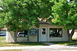
Township office of Dawson in Rainy River
Canada Ontario location map 2.svg
Red pog.svg
Dawson
Coordinates: 48°45′N94°29′W / 48.750°N 94.483°W / 48.750; -94.483
CountryCanada
Province Ontario
District Rainy River
Formed1 January 1997
Government
  MayorDouglas Hartnell
  Federal riding Thunder Bay—Rainy River
  Prov. riding Kenora—Rainy River
Area
[1]
  Land339.5 km2 (131.1 sq mi)
Elevation
[2]
335 m (1,099 ft)
Population
 (2016) [1]
  Total468
  Density1.4/km2 (4/sq mi)
Time zone UTC-6 (CST)
  Summer (DST) UTC-5 (CDT)
Postal Code FSA
P0W 1L0
Area code 807

Dawson is a township located in Rainy River District in Northwestern Ontario, Canada. The township is located at the mouth of the Rainy River where it flows into Lake of the Woods.

Contents

The township was formed on 1 January 1997, when the former incorporated townships of Atwood, Blue, Dilke, and Worthington were amalgamated.

Communities

The primary communities in the township are Blue, McGinnis Creek, Pinewood and Sleeman.

Demographics

In the 2021 Census of Population conducted by Statistics Canada, Dawson had a population of 399 living in 190 of its 274 total private dwellings, a change of -14.7% from its 2016 population of 468. With a land area of 343.42 km2 (132.60 sq mi), it had a population density of 1.2/km2 (3.0/sq mi) in 2021. [3]

Canada census – Dawson community profile
2021 2016 2011
Population399 (-14.7% from 2016)468 (-16.9% from 2011)563 (-9.2% from 2006)
Land area343.42 km2 (132.60 sq mi)339.5 km2 (131.1 sq mi)338.35 km2 (130.64 sq mi)
Population density1.2/km2 (3.1/sq mi)1.4/km2 (3.6/sq mi)1.7/km2 (4.4/sq mi)
Median age56.4 (M: 57.6, F: 53.6)54.5 (M: 54.9, F: 53.5)47.8 (M: 49.1, F: 46.2)
Private dwellings274 (total)  190 (occupied)292 (total) 307 (total) 
Median household income$75,000$61,312
References: 2021 [4] 2016 [5] 2011 [6] earlier [7] [8]
Dawson, Ontario
historical populations
YearPop.±%
1996 631    
2001 613−2.9%
2006 620+1.1%
2011 563−9.2%
2016 468−16.9%
[9] [1]

Climate

Climate data for Sleeman
MonthJanFebMarAprMayJunJulAugSepOctNovDecYear
Record high °C (°F)7
(45)
11
(52)
16.5
(61.7)
31.5
(88.7)
32.5
(90.5)
33.5
(92.3)
35
(95)
34.5
(94.1)
34.4
(93.9)
26.7
(80.1)
22.2
(72.0)
9
(48)
35
(95)
Average high °C (°F)−11.4
(11.5)
−7
(19)
0.3
(32.5)
10.5
(50.9)
18.8
(65.8)
22.3
(72.1)
25
(77)
23.4
(74.1)
17.3
(63.1)
10.5
(50.9)
−0.2
(31.6)
−8.9
(16.0)
8.4
(47.1)
Daily mean °C (°F)−17.2
(1.0)
−13.2
(8.2)
−5.6
(21.9)
4.1
(39.4)
11.8
(53.2)
16.2
(61.2)
19
(66)
17.4
(63.3)
11.8
(53.2)
5.7
(42.3)
−4.1
(24.6)
−14
(7)
2.7
(36.9)
Average low °C (°F)−22.9
(−9.2)
−19.3
(−2.7)
−11.4
(11.5)
−2.2
(28.0)
4.8
(40.6)
9.9
(49.8)
12.9
(55.2)
11.4
(52.5)
6.3
(43.3)
0.8
(33.4)
−8
(18)
−19.1
(−2.4)
−3.1
(26.4)
Record low °C (°F)−44
(−47)
−41
(−42)
−37.5
(−35.5)
−27.8
(−18.0)
−8
(18)
−2
(28)
1.1
(34.0)
−1.7
(28.9)
−6
(21)
−17
(1)
−39
(−38)
−43
(−45)
−44
(−47)
Average precipitation mm (inches)27.9
(1.10)
21.6
(0.85)
30.1
(1.19)
37.9
(1.49)
60.4
(2.38)
107.5
(4.23)
86.4
(3.40)
90.5
(3.56)
69.3
(2.73)
57.7
(2.27)
37.2
(1.46)
23.5
(0.93)
650
(25.6)
Source: Environment Canada [2]

See also

Related Research Articles

<span class="mw-page-title-main">Montague, Ontario</span> Township in Ontario, Canada

Montague is a township in eastern Ontario, Canada, in Lanark County on the Rideau River. The township administrative offices are located on Roger Stevens Drive east of Smiths Falls.

<span class="mw-page-title-main">Alfred and Plantagenet</span> Township in Ontario, Canada

Alfred and Plantagenet is a Franco-Ontarian township in eastern Ontario, Canada, in the United Counties of Prescott and Russell. Located approximately 70 km (43 mi) from downtown Ottawa at the confluence of the Ottawa River and the South Nation River.

<span class="mw-page-title-main">Champlain, Ontario</span> Township in Ontario, Canada

Champlain is a township in eastern Ontario, Canada, in the United Counties of Prescott and Russell on the Ottawa River. It was formed on January 1, 1998, through the amalgamation of West Hawkesbury Township, Longueuil Township, Town of Vankleek Hill, and the Village of L'Orignal.

<span class="mw-page-title-main">Georgian Bluffs</span> Township in Ontario, Canada

Georgian Bluffs is a township in southwestern Ontario, Canada, in Grey County located between Colpoy's Bay and Owen Sound on Georgian Bay.

<span class="mw-page-title-main">East Hawkesbury</span> Township in Ontario, Canada

East Hawkesbury is a township in eastern Ontario, Canada, in the United Counties of Prescott and Russell. Situated on the Ottawa River, its eastern boundary is the border with the province of Quebec.

<span class="mw-page-title-main">Nipissing District</span> District in Ontario, Canada

Nipissing District is a district in Northeastern Ontario in the Canadian province of Ontario. It was created in 1858. The district seat is North Bay.

<span class="mw-page-title-main">Rainy River District</span> District in Ontario, Canada

Rainy River District is a district and census division in Northwestern Ontario in the Canadian province of Ontario. It was created in 1885. It is the only division in Ontario that lies completely in the Central Time Zone, except for the township of Atikokan observing Eastern Standard Time year-round. Its seat is Fort Frances. It is known for its fishing and its location on the US border opposite International Falls, Minnesota, and Baudette, Minnesota.

<span class="mw-page-title-main">Thunder Bay District</span> District in Ontario, Canada

Thunder Bay District is a district and census division in Northwestern Ontario in the Canadian province of Ontario. The district seat is Thunder Bay.

<span class="mw-page-title-main">Laird, Ontario</span> Township in Ontario, Canada

Laird is a township and village in the Algoma District in Northern Ontario, Canada. The township had a population of 1,047 in the Canada 2016 Census, down from 1,057 in the 2011 census.

<span class="mw-page-title-main">Central Huron</span> Municipality in Ontario, Canada

Central Huron is a township in western Ontario, Canada, in Huron County. It is situated on Lake Huron between the Maitland River and the Bayfield River.

Malahide is a municipal township in Elgin County in southwestern Ontario, Canada.

<span class="mw-page-title-main">Chapple, Ontario</span> Township municipality in Ontario, Canada

Chapple is a township municipality in Rainy River District in Northwestern Ontario, Canada.

<span class="mw-page-title-main">Dubreuilville</span> Township in Ontario, Canada

Dubreuilville is a township in the Canadian province of Ontario, located in the Algoma District. Established as a company town in 1961 by the Dubreuil Brothers lumber company, Dubreuilville was incorporated as a municipality in 1977.

<span class="mw-page-title-main">Machin, Ontario</span> Township in Ontario, Canada

Machin is a township in the Canadian province of Ontario, located in the Kenora District west of Dryden.

<span class="mw-page-title-main">Hilton, Ontario</span> Township in Ontario, Canada

Hilton is a township in the Canadian province of Ontario, comprising the southeast quadrant of St. Joseph Island in the Algoma District. It surrounds, but does not include, the independent village of Hilton Beach.

<span class="mw-page-title-main">La Vallee, Ontario</span> Township in Ontario, Canada

La Vallee is a township in the Canadian province of Ontario, located within the Rainy River District. It stretches for 6 miles (9.7 km) along the north side of the Rainy River, with a depth of 15 miles (24 km), and consists of the geographic townships of Devlin, Burriss and Woodyatt. The township had a population of 938 in the Canada 2016 Census, down 5.1% from 2011.

<span class="mw-page-title-main">Lake of the Woods, Ontario</span> Township in Ontario, Canada

Lake of the Woods is a township in the Canadian province of Ontario, located within the Rainy River District. The township is located on the eponymous Lake of the Woods, consisting of mainland in the south-east part of the lake, the southern shores of Aulneau Peninsula, along with several islands in the lake, including Big Island and Bigsby Island. It fully surrounds the Anishnaabeg of Naongashiing, Big Grassy River 35G, Big Island Mainland 93, and Saug-a-Gaw-Sing 1 First Nation reserves.

<span class="mw-page-title-main">Morley, Ontario</span> Township in Ontario, Canada

Morley is a township in the Canadian province of Ontario, located within the Rainy River District. The township had a population of 481 in the Canada 2016 Census. Named after John Morley, it was formed in 1903 when the townships of Morley and Pattullo, as well as the village of Stratton, were amalgamated.

<span class="mw-page-title-main">Dorion, Ontario</span> Township in Ontario, Canada

Dorion is a township in the Canadian province of Ontario, located within the Thunder Bay District. The township had a population of 316 in the Canada 2016 Census. Ouimet Canyon and the Dorion Bible Camp are located in the community.

<span class="mw-page-title-main">Gillies, Ontario</span> Township in Ontario, Canada

Gillies is a township in the Canadian province of Ontario, located within the Thunder Bay District.

References

  1. 1 2 3 "Census Profile, 2016 Census: Dawson, Township". Statistics Canada. 8 February 2017. Retrieved 2 July 2019.
  2. 1 2 Environment Canada – Canadian Climate Normals 1971–2000, accessed 2011-05-05
  3. "Population and dwelling counts: Canada, provinces and territories, census divisions and census subdivisions (municipalities), Ontario". Statistics Canada. 9 February 2022. Retrieved 2 April 2022.
  4. "2021 Community Profiles". 2021 Canadian Census . Statistics Canada. 4 February 2022. Retrieved 19 October 2023.
  5. "2016 Community Profiles". 2016 Canadian Census . Statistics Canada. 12 August 2021. Retrieved 2 July 2019.
  6. "2011 Community Profiles". 2011 Canadian Census . Statistics Canada. 21 March 2019. Retrieved 30 March 2012.
  7. "2006 Community Profiles". 2006 Canadian Census . Statistics Canada. 20 August 2019.
  8. "2001 Community Profiles". 2001 Canadian Census . Statistics Canada. 18 July 2021.
  9. Statistics Canada: 2001, 2006, 2011 census