Related Research Articles

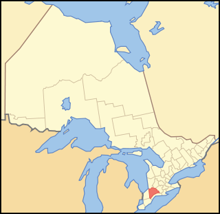
Middlesex County is a primarily rural county in Southwestern Ontario, Canada. Landlocked, the county is bordered by Huron and Perth counties on the north, Oxford County on the east, Elgin County on the south, and Chatham-Kent and Lambton County on the west.

Greater Napanee is a town in southeastern Ontario, Canada, approximately 45 kilometres (28 mi) west of Kingston and the county seat of Lennox and Addington County. It is located on the eastern end of the Bay of Quinte. Greater Napanee municipality was created by amalgamating the old Town of Napanee with the townships of Adolphustown, North and South Fredericksburg, and Richmond in 1999. Greater Napanee is co-extensive with the original Lennox County.

Hastings County is located in the province of Ontario, Canada. Geographically, it is located on the border of Eastern Ontario and Central Ontario. Hastings County is the second-largest county in Ontario, after Renfrew County, and its county seat is Belleville, which is independent of Hastings County. Hastings County has trademarked the moniker "Cheese Capital of Canada".

Renfrew County is a county in the Canadian province of Ontario. It stands on the west bank of the Ottawa River. There are 17 municipalities in the county.

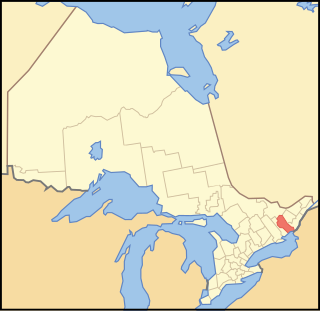
Frontenac County is a county and census division of the Canadian province of Ontario. It is located in the eastern portion of Southern Ontario. The city of Kingston is in the Frontenac census division, but is separated from the County of Frontenac.

Huron County is a county of the province of Ontario, Canada. It is located on the southeast shore of its namesake, Lake Huron, in the southwest part of the province. The county seat is Goderich, also the county's largest community.

Lennox and Addington County is a county and census division of the Canadian province of Ontario. The county seat is Greater Napanee. It is located in the subregion of Southern Ontario named Eastern Ontario.
Addington County was a historic county in the Canadian province of Ontario which now forms part of Lennox and Addington County. It was named after Henry Addington, 1st Viscount Sidmouth.

Grenville County is a former county in the Canadian province of Ontario. It fronted on the north shore of the Saint Lawrence River, between the towns of Kingston and Cornwall. The county was created in 1792, and named in honour of William Grenville, 1st Baron Grenville, who was the British Secretary of State responsible for the colonies in 1790. It consisted of five townships, which were settled primarily by United Empire Loyalists in the late 1700s after the Revolutionary War. Prior to being settled by Europeans, the area was home to many generations of native cultures. Grenville County merged with Leeds County in 1850 to create Leeds and Grenville County. The county covered an area of 272,261 acres (110,180 ha).
Leeds County is a historic county in the Canadian province of Ontario. The county was first surveyed in 1792 as one of the nineteen counties created by Sir John Graves Simcoe in preparation for the United Empire Loyalists to settle here. The county took its name from Francis Osborne, 5th Duke of Leeds; the "Leeds" of the Dukedom referred to Leeds in West Yorkshire, England and not for Leeds, Kent, England. In 1850, Leeds County merged with Grenville County to create the United Counties of Leeds and Grenville. This county was home to several townships as well as the city of Brockville.
Frontenac—Addington was a federal electoral district represented in the House of Commons of Canada from 1925 to 1953. It was located in the province of Ontario. This riding was created in 1924 from parts of Frontenac and Lennox and Addington ridings.
Frontenac—Lennox and Addington was a federal electoral district represented in the House of Commons of Canada from 1968 to 1979. It was located in the province of Ontario. This riding was created in 1966 from parts of Hastings—Frontenac, Kingston, Lanark, Prince Edward—Lennox, Renfrew North and Renfrew South ridings.

The Home District was one of four districts of the Province of Quebec created in 1788 in the western reaches of the Montreal District and detached in 1791 to create the new colony of Upper Canada. It was abolished with the adoption of the county system in 1849.

Western District was one of four districts of the Province of Quebec created in 1788 in the western reaches of the Montreal District which were later detached in 1791 to create the new colony of Upper Canada. Known as Hesse District until 1792, it was abolished in 1849.

Midland District was one of four districts of the Province of Quebec created in 1788 in the western reaches of the Montreal District and partitioned in 1791 to create the new colony of Upper Canada.

The Bathurst District was a historic district in Upper Canada. It was created in 1822 from the Johnstown District. Containing Carleton County, it existed until 1849. The district town was Perth.
Durham was an electoral district of the Legislative Assembly of the Parliament of the Province of Canada, in Canada West, on the north shore of Lake Ontario. It was created in 1841, upon the establishment of the Province of Canada by the union of Upper Canada and Lower Canada. Durham was represented by one member in the Legislative Assembly. It was abolished in 1867, upon the creation of Canada and the province of Ontario.
Frontenac was an electoral district of the Legislative Assembly of the Parliament of the Province of Canada, in Canada West, based on Frontenac County. It was created in 1841, upon the establishment of the Province of Canada by the union of Upper Canada and Lower Canada. Frontenac was represented by one member in the Legislative Assembly. It was abolished in 1867, upon the creation of Canada and the province of Ontario.
Hastings was an electoral district of the Legislative Assembly of the Parliament of the Province of Canada, in Canada West. Based on Hastings County, it fronted on the Bay of Quinte on Lake Ontario and extended north. It was created in 1841, upon the establishment of the Province of Canada by the union of Upper Canada and Lower Canada.
Lennox and Addington was an electoral district of the Legislative Assembly of the Parliament of the Province of Canada, in Canada West. Based on the combined counties of Lennox and Addington, it was created in 1841, upon the establishment of the Province of Canada by the union of Upper Canada and Lower Canada.
References
- ↑ Proclamation of July 16, 1792
- ↑ An act for building a gaol and court house in every district within this province, and for altering the names of the said districts , S.U.C. 1792, c. 8, s. 3
- ↑ An act for the better division of this province , S.U.C. 1798, c. 5, s. 15
- ↑ An Act for better defining the limits of the Counties and Districts in Upper Canada, for erecting certain new Townships, for detaching Townships from some Counties and attaching them to others, and for other purposes relative to the division of Upper Canada into Townships, Counties and Districts , S.Prov.C. 1845, c. 7, Sch. B
- ↑ An Act for abolishing the Territorial Division of Upper-Canada into Districts, and for providing temporary Unions of Counties for Judicial and other purposes, and for the future dissolutions of such Unions, as the increase of wealth and population may require , S.Prov.C. 1849, c. 78, Sch. A, B
- ↑ An Act to amend "An Act respecting the Territorial Division of Upper Canada" , S.Prov.C. 1860, c. 39, s. 1
- ↑ North and South Fredericksburgh – Embrace the history of this charming area. Naturally L & A. Accessed 21 May 2023.