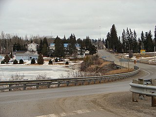
Bompas Township is a geographic township in the Unorganized West Part of Timiskaming District in northeastern Ontario, Canada. The township is uninhabited, and has no communities. However, there is a small camp in the southwestern corner.

Sarsfield Creek is a creek in Timiskaming District in northeastern Ontario, Canada. It is in the James Bay drainage basin and is a right tributary of Woollings Creek.

The Blanche River is a river in the Saint Lawrence River drainage basin in Timiskaming District in northeastern Ontario, Canada. The river is a tributary of Lake Timiskaming and its name is from the French for the colour "white".
Terry Township is an unincorporated geographic township in the Unorganized West part of Timiskaming District in Northeastern Ontario, Canada. The township lies on the northern edge of Timaskaming District on the border with Cochrane District.
Marter Township is an unincorporated geographic township in the Unorganized West part of Timiskaming District in Northeastern Ontario, Canada. The township is named for George Frederick Marter.

The Misema River is a river in Timiskaming District and Cochrane District in Northeastern Ontario, Canada. It is in the Saint Lawrence River drainage basin and is a left tributary of the Blanche River.

Sullivan Lake is a lake in geographic Ben Nevis Township, Cochrane District, with a small tip in geographic Katrine Township, Timiskaming District, in Northeastern Ontario, Canada. It is in the Saint Lawrence River drainage basin and is the source of the Misema River. The lake is also located in the Pushkin Hills, part of the Blake River Megacaldera Complex.
Ben Nevis Township is an unincorporated geographic township in the Unorganized North part of Cochrane District in Northeastern Ontario, Canada. The township is named for Ben Nevis, the highest mountain in the British Isles.

The Little Misema River is a river in Timiskaming District and Cochrane District in Northeastern Ontario, Canada. It is in the Saint Lawrence River drainage basin and is a left tributary of the Misema River.

Little Misema Lake is a lake in geographic Ben Nevis Township, Cochrane District in Northeastern Ontario, Canada. It is in the Saint Lawrence River drainage basin and is the source of the Little Misema River. The lake is also located in the Pushkin Hills, part of the Blake River Megacaldera Complex.

Misema Lake is a lake in geographic Katrine and geographic Arnold Township, Timiskaming District in Northeastern Ontario, Canada. It is in the Saint Lawrence River drainage basin and is in the Misema Caldera.
Arnold Township is an unincorporated geographic township in the Unorganized East part of Timiskaming District in Northeastern Ontario, Canada.

Fallduck Lakes is a lake in geographic Terry Township, Timiskaming District in Northeastern Ontario, Canada. It is in the Saint Lawrence River drainage basin and is the source of the Englehart River.

The Black River is a river in Cochrane District and Timiskaming District in Northeastern Ontario, Canada. It is part of the James Bay drainage basin, and is a right tributary of the Abitibi River. The municipality of Black River-Matheson is named after the river.
Lee Township is a geographic township in the Unorganized West Part of Timiskaming District in northeastern Ontario, Canada. The township is uninhabited, and has no communities.

Tomwool Creek is a creek in Timiskaming District and Cochrane District in northeastern Ontario, Canada. It is in the James Bay drainage basin and is a left tributary of Sarsfield Creek.

Meyers Lake is a lake in Cochrane District and Timiskaming District, in northeastern Ontario, Canada. The lake is in the James Bay drainage basin and the nearest community is Bourkes, 4.6 kilometres (2.9 mi) to the northeast.

Woollings Creek is a creek in Timiskaming District and Cochrane District in northeastern Ontario, Canada. It is in the James Bay drainage basin and is a tributary of the Whiteclay River.

The Whiteclay River is a river in Cochrane District and Timiskaming District in northeastern Ontario, Canada. It is in the James Bay drainage basin and is a left tributary of the Black River.

Sucker Lake is a lake in geographic La Salle Township and geographic Osborne Township in the Unorganized North Part of Nipissing District in Northeastern Ontario, Canada, about 5.5 kilometres (3.4 mi) east of the railway point of Diver on the Ontario Northland Railway. It is in the Saint Lawrence River drainage basin and is the source of Sucker Creek.


