
Dryden, originally known as New Prospect, is the second-largest city in the Kenora District of Northwestern Ontario, Canada, located on Wabigoon Lake. It is the least populous community in Ontario incorporated as a city. The City of Dryden had a population of 7,749 and its population centre had a population of 5,586 in 2016.

Kenora, previously named Rat Portage, is a city situated on the Lake of the Woods in Ontario, Canada, close to the Manitoba boundary, and about 210 km (130 mi) east of Winnipeg by road. It is the seat of Kenora District.

Crowsnest Pass is a low mountain pass across the Continental Divide of the Canadian Rockies on the Alberta–British Columbia border.

King's Highway 17, more commonly known as Highway 17, is a provincially maintained highway and the primary route of the Trans-Canada Highway through the Canadian province of Ontario. It begins at the Manitoba boundary, 50 km (31 mi) west of Kenora, and the main section ends where Highway 417 begins just west of Arnprior. A small disconnected signed section of the highway still remains within the Ottawa Region between County Road 29 and Grants Side Road. This makes it Ontario's longest highway.

The Wabigoon River is a river in Kenora District in northwestern Ontario, Canada. It flows from Raleigh Lake past Dryden, Ontario on Wabigoon Lake to join the English River. The name "Wabigoon" comes from the Ojibwe waabigon, "marigold", or waabi-miigwan, "white feather".

Bonfield is a township in northeastern Ontario, Canada, on the Mattawa River in Nipissing District.

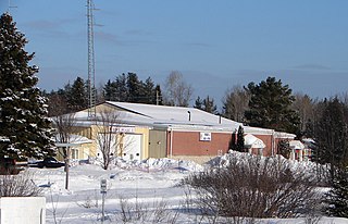
Ignace is a township in the Kenora District of Northwestern Ontario, Canada, located at Highway 17 and Secondary Highway 599, and on the Canadian Pacific Railway between Thunder Bay and Kenora. It is on the shore of Agimak Lake, and as of 2016, the population of Ignace was 1,202.

Minaki is an unincorporated area and community in Unorganized Kenora District in northwestern Ontario, Canada. It is located at the point where the Canadian National Railways transcontinental main line crosses the Winnipeg River, between Wade to the west and Ena Lake at the east, and was accessible only by rail until about 1960. It was a fuelling and watering point in the days of steam locomotives; now few trains stop in Minaki, though the thrice-weekly Via Rail transcontinental Canadian passenger trains will stop on request at the Minaki railway station.
Nairn and Hyman is a township in the Canadian province of Ontario. The township, located in the Sudbury District, borders on the southwestern city limits of Greater Sudbury west of the city's Walden district. The township had a population of 342 in the Canada 2016 Census.

The Huron Central Railway is a railway operating in northern Ontario, Canada. It is operated by Genesee & Wyoming Canada, the Canadian subsidiary of Genesee & Wyoming.
CKQV-FM is a radio station in Vermilion Bay, Ontario. Owned by Golden West Broadcasting, it broadcasts a classic hits format serving the Kenora District of Northwestern Ontario. The station's main studio and transmitter are located in Vermilion Bay, with repeaters in Kenora, Dryden and Sioux Lookout from which it derives its branding.

Ear Falls is a township located in Northwestern Ontario, Canada, on the banks of the English River, Lac Seul, Pakwash Lake and Wenesaga Lake. It is located along Highway 105, 100 kilometres (62 mi) north of Highway 17 and Vermilion Bay, about halfway between Highway 17 and Red Lake, or about 480 kilometres (300 mi) northwest of Thunder Bay.
King's Highway 105, commonly referred to as Highway 105, is a provincially maintained highway in the Canadian province of Ontario. Located in the Kenora District of northern Ontario, the highway extends for 173.5 kilometres (107.8 mi) from an intersection with Highway 17 between Kenora and Dryden with the Red Lake mining area to the north. The route also passes through the town of Ear Falls near its midpoint. Highway 105 was built to provide access to the large gold deposits at Red Lake, which were only accessible by boat or plane between their discovery in 1926 and the opening of the highway in 1946. Highway 105 passes through long stretches of isolated forest and lakeland, with no services available between the distanced communities along the route.
Machin is a township in the Canadian province of Ontario, located in the Kenora District west of Dryden.

Eagle Lake is a lake in Kenora District, Ontario, Canada, west of the City of Dryden. The communities of Vermilion Bay and Eagle Lake First Nation are located on the lake's north shore.
McIntosh is an unincorporated place on Canyon Lake on the Canyon River in Unorganized Kenora District in northwestern Ontario, Canada. It lies on the Canadian National Railway transcontinental main line, between Canyon to the west and Quibell to the east, and is passed but not served by Via Rail transcontinental Canadian trains. The community can be accessed by road using the continuation of Ontario Highway 647 that arrives from the southeast from the community of Vermilion Bay, on Ontario Highway 17, via Blue Lake Provincial Park.
Red Lake Road is an unincorporated place and community in Unorganized Kenora District in northwestern Ontario, Canada. It is named for the road, today's Ontario Highway 105, that runs from the community of Vermilion Bay in the south to the town of Red Lake in the north. Red Lake Road is at the junction of Highway 105 with the eastern terminus of Ontario Highway 609, which runs west to the community of Quibell and onward to its northern terminus at Clay Lake.
Naden Boats is a line of aluminum fishing boats manufactured in Canada by Temagami Boat Manufacturing Inc. Six models are offered, ranging from 11’11" to 16’ in overall length. They are noted for their expanded polystyrene flotation, rigid construction, and semi-V planing hull with five keels.

Kenora station is a heritage Canadian Pacific Railway station in Kenora, Ontario.


