Related Research Articles

Deloraine is an unincorporated urban community in the Municipality of Deloraine – Winchester within the Canadian province of Manitoba that held town status prior to January 1, 2015. It is situated near the Turtle Mountains in the southwestern corner of the province. Located in the Westman Region, the community is 100 km (62 mi) south of Brandon. Deloraine originally incorporated as a village in 1904 and then as a town in 1907. Its town status was relinquished in 2015 when it amalgamated with the Rural Municipality of Winchester.
The Rural Municipality of Albert is a former rural municipality (RM) in the Canadian province of Manitoba. It was originally incorporated as a rural municipality on December 1, 1905. It ceased on January 1, 2015 as a result of its provincially mandated amalgamation with the RM of Arthur and the RM of Edward to form the Municipality of Two Borders.
The Rural Municipality of Cameron is a former rural municipality (RM) in the Canadian province of Manitoba. It was originally incorporated as a rural municipality on November 16, 1896. It ceased on January 1, 2015, as a result of its provincially mandated amalgamation with the RM of Whitewater and the Town of Hartney to form the Municipality of Grassland.
The Rural Municipality of Glenwood is a former rural municipality (RM) in the Canadian province of Manitoba. It was originally incorporated as a rural municipality on December 22, 1883. It ceased on January 1, 2015 as a result of its provincially mandated amalgamation with the Town of Souris to form the Municipality of Souris – Glenwood.

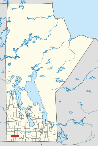
Division No. 5 is a census division located within the Westman Region in the south west area of the province of Manitoba, Canada. Unlike in some other provinces, census divisions do not reflect the organization of local government in Manitoba. These areas exist solely for the purposes of statistical analysis and presentation; they have no government of their own.
The Rural Municipality of Arthur is a former rural municipality (RM) in the Canadian province of Manitoba. It was originally incorporated as a rural municipality on December 22, 1883. It ceased on January 1, 2015 as a result of its provincially mandated amalgamation with the RM of Albert and the RM of Edward to form the Municipality of Two Borders.
The Rural Municipality of Brenda is a former rural municipality (RM) in the Canadian province of Manitoba. It was originally incorporated as a rural municipality on December 22, 1883. It ceased on January 1, 2015 as a result of its provincially mandated amalgamation with the Village of Waskada to form the Municipality of Brenda – Waskada.
The Rural Municipality of Edward is a former rural municipality (RM) in the Canadian province of Manitoba. It was originally incorporated as a rural municipality on December 1, 1905. It ceased on January 1, 2015 as a result of its provincially mandated amalgamation with the RM of Albert and the RM of Arthur to form the Municipality of Two Borders.
The Rural Municipality of Louise is a former rural municipality (RM) in the Canadian province of Manitoba. It was originally incorporated as a rural municipality on February 14, 1880. It ceased on January 1, 2015 as a result of its provincially mandated amalgamation with the Town of Pilot Mound and the Village of Crystal City to form the Municipality of Louise.
The Rural Municipality of Pembina is a former rural municipality (RM) in the Canadian province of Manitoba.
The Rural Municipality of Rhineland is a former rural municipality (RM) in the Canadian province of Manitoba. Since 1876, the area made up part of the Mennonite West Reserve. The R.M. of Rhineland was originally incorporated as a rural municipality on February 14, 1880 and later absorbed the neighbouring RM of Douglas in January 1891. It ceased on January 1, 2015 as a result of its provincially mandated amalgamation with the towns of Gretna and Plum Coulee to form the Municipality of Rhineland.
The Rural Municipality of Whitewater is a former rural municipality (RM) in the Canadian province of Manitoba. It was originally incorporated as a rural municipality on December 22, 1883. It ceased on January 1, 2015 as a result of its provincially mandated amalgamation with the RM of Cameron and the Town of Hartney to form the Municipality of Grassland.
The Rural Municipality of Winchester is a former rural municipality (RM) in the Canadian province of Manitoba. It was originally incorporated as a rural municipality on November 1, 1890. It ceased on January 1, 2015 as a result of its provincially mandated amalgamation with the Town of Deloraine to form the Municipality of Deloraine – Winchester.
The Rural Municipality of Woodworth is a former rural municipality (RM) in the Canadian province of Manitoba. It was originally incorporated as a rural municipality on December 22, 1883. It ceased on January 1, 2015 as a result of its provincially mandated amalgamation with the RM of Wallace and the Village of Elkhorn to form the Rural Municipality of Wallace – Woodworth.
The Rural Municipality of Roblin is a former rural municipality (RM) in the Canadian province of Manitoba. It was originally incorporated as a rural municipality on November 15, 1902. It ceased on January 1, 2015 as a result of its provincially mandated amalgamation with the Village of Cartwright to form the Cartwright – Roblin Municipality.
The Rural Municipality of Franklin is a former rural municipality (RM) in the Canadian province of Manitoba. It was incorporated on December 22, 1883. It ceased on January 1, 2015 as a result of a provincially mandated amalgamation with the Town of Emerson to form the Municipality of Emerson – Franklin.

The Municipality of Boissevain-Morton is a rural municipality (RM) in the Westman Region of the Canadian province of Manitoba.

Cartwright–Roblin Municipality is a rural municipality in the Canadian province of Manitoba.

The Municipality of Deloraine – Winchester is a rural municipality (RM) in the Canadian province of Manitoba.
The Municipality of Grassland is a rural municipality (RM) in the Canadian province of Manitoba.
References
- ↑ "Manitoba's Municipal History: Rural Municipalities and Local Government Districts". The Manitoba Historical Society. September 21, 2014. Retrieved January 2, 2015.
- ↑ "Manitoba's Municipal History: Municipal Amalgamations (2015)". The Manitoba Historical Society. December 1, 2014. Retrieved January 2, 2015.
