Minto, Manitoba

Last updated

Welcome sign for Minto, Manitoba Minto, Manitoba.JPG
Welcome sign for Minto, Manitoba

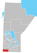
Minto is an unincorporated community recognized as a local urban district [1] located in the Municipality of Grassland, Manitoba, Canada.

Contents

A railway point for the Canadian National railway and post office was located in Minto. It was named in 1899 for Sir Gilbert Elliot-Murray-Kynynmound, 4th Earl of Minto. He was the Governor General of Canada at the time.
Transportation

Minto is located 48 kilometres (30 mi) south of Brandon at the southern end of the concurrence of Manitoba Highways 10 and 23. These routes connect it to several other communities in the region, as well as the North Dakota border at the International Peace Garden and the Pembina Valley region of the province.

Minto was featured during season 4 of the CBC program Still Standing . [2]

The episode originally aired on December 4, 2018.

Related Research Articles

<span class="mw-page-title-main">Gilbert Plains</span> Place in Manitoba, Canada

Gilbert Plains is an unincorporated urban community in the Gilbert Plains Municipality, Manitoba, Canada, that was classified as a town prior to January 1, 2015.

<span class="mw-page-title-main">Westman Region</span> Region in Manitoba, Canada

The Westman Region is an informal geographic region of the Canadian province of Manitoba located in the southwestern corner of the province.

<span class="mw-page-title-main">Hamiota, Manitoba</span> Town in Canada

Hamiota is an unincorporated urban community in the Hamiota Municipality within the Canadian province of Manitoba that held town status prior to January 1, 2015. It is located on Provincial Trunk Highway 21 midway between the Trans-Canada Highway and the Yellowhead Highway. It is located in Western Manitoba, 84 kilometers northwest of Brandon. The trading area radius of 20 kilometres has approximately 10,000 people. First known as Hamilton, for Thomas Hamilton, one of the first settlers, the town name was changed to avoid confusion with Hamilton, Ontario. The new name contracted Hamilton with the Sioux word ota, "much".

<span class="mw-page-title-main">Northern Manitoba</span> Region of Manitoba, Canada

Northern Manitoba is a geographic and cultural region of the Canadian province of Manitoba. Originally encompassing a small square around the Red River Colony, the province was extended north to the 60th parallel in 1912. The region's specific boundaries vary, as "northern" communities are considered to share certain social and geographic characteristics, regardless of latitude.

Austin is an unincorporated community recognized as a local urban district in western Manitoba on the Trans-Canada Highway about 110 km (68 mi) west of Winnipeg. It is part of the Municipality of North Norfolk. It sits at the western edge of the table-flat Portage Plains, but to the south and west is surrounded by miles of low wooded hills known as the Carberry sandhills. The biggest attraction is the annual rodeo and Threshermen's Reunion held at the Manitoba Agricultural Museum the last four business days of July.

Ashern is a local urban district located in the Municipality of West Interlake in Manitoba's Interlake Region.

Cypress River is an unincorporated community recognized as a local urban district in the Rural Municipality of Victoria in the Canadian province of Manitoba. Originally, the community was known as "Littleton". On Neil Young's 2005 album Prairie Wind, he makes references to Cypress River in the title track.

Kenton is an unincorporated community recognized as a local urban district in Manitoba, Canada. It is located in the Rural Municipality of Woodworth, about an hour's drive west of Brandon. The first permanent settlement of the area began in 1881, following the westward expansion of the borders of the province of Manitoba. The settlement was named for its first postmaster, A.W. Kent. Kenton became an unincorporated village district in 1947. In 1986, the community had a population of 158. Water supply for the community is from the nearby half-mile long Kenton Reservoir on Bars Creek, a tributary of the Oak River. The 600 acre foot reservoir was constructed in 1969 by the Prairie Farm Rehabilitation Administration and also provides an opportunity for sport fishing. Kenton is the location of the municipal council chamber for the RM of Woodworth.

Oakville, Manitoba is an unincorporated community recognized as a local urban district in Manitoba. It is located in the Rural Municipality of Portage la Prairie. Oakville is 56 km (35 mi) west of Winnipeg at the intersection of PTH 13 and PR 331.

Reston is an unincorporated community recognized as a local urban district in southwestern Manitoba, located near the border of Saskatchewan on the west and North Dakota on the south. It is the largest community in the Rural Municipality of Pipestone, which also includes Sinclair, Cromer and Pipestone.

St. Malo is a local urban district located in the Rural Municipality of De Salaberry, approximately 70 km south of The Forks, Winnipeg, Manitoba. Most of the community's residents are bilingual francophone of Métis or Québécois heritage.

La Rivière is an unincorporated community recognized as a local urban district in Manitoba, Canada. It is located 11 km west of the town of Manitou on Highway 3. It is located in the Municipality of Pembina. La Riviere was founded 1886 by Metis Franco-Manitobans, however it is predominantly English speaking. It has a post office, credit union, a five-lift ski hill, a construction company, and a seasonal drive-in restaurant. It has a full service campground at the edge of the community that backs onto the Pembina River. La Riviere was previously home to Hamm-tone Guitars and Mandolins and the Pembina Valley Guitar Building Course.

<span class="mw-page-title-main">Gainsborough, Saskatchewan</span> Village in Saskatchewan, Canada

Gainsborough is a village in the Canadian province of Saskatchewan within the Rural Municipality of Argyle No. 1 and Census Division No. 1. A farming community, the village is located on Highway 18 in the southeastern corner of Saskatchewan. Gainsborough is approximately 6 km (3.7 mi) from the Manitoba border, and 19 km (12 mi) from the North Dakota, United States border. The first post office was established on April 1, 1884 as the community of Antler. On September 1, 1885, the name of the community changed to Gainsborough, after Gainsborough, Lincolnshire in England, which was the former home of J. J. Sadler, an early settler.

<span class="mw-page-title-main">Mather, Manitoba</span> Place in Manitoba, Canada

Mather is an unincorporated community recognized as a local urban district in southwest Manitoba, Canada, and part of Cartwright – Roblin Municipality. The Mather area is known as Crocus Country.

<span class="mw-page-title-main">St. Leon, Manitoba</span>

St. Leon is an unincorporated community recognized as a local urban district in Manitoba, Canada. It is located in the Municipality of Lorne to the southwest of Winnipeg, near the United States border. The community is best known as the site of the St. Leon Wind Farm project.

Richer is a local urban district in southeast Manitoba, almost 60 kilometres (37 mi) east south-east of Winnipeg. It is located in the Rural Municipality of Ste. Anne, at the junction of the Trans-Canada Highway and Provincial Road 302.

<span class="mw-page-title-main">Division No. 15, Manitoba</span> Census division in Manitoba, Canada

Census Division No. 15 is a census division located within the Westman Region of the province of Manitoba, Canada. Unlike in some other provinces, census divisions do not reflect the organization of local government in Manitoba. These areas exist solely for the purposes of statistical analysis and presentation; they have no government of their own.

<span class="mw-page-title-main">Ninette, Manitoba</span> Local urban district in Manitoba, Canada

Ninette is an unincorporated community recognized as a local urban district located in Manitoba, Canada at the north end of Pelican Lake. It is located in the Rural Municipality of Prairie Lakes. Ninette has many small businesses, and is known locally for its wide range of sports facilities. In the summer, activities such as boating, fishing, and hunting are offered, while snowmobiling and ice fishing are offered during the wintertime.

Miniota, Manitoba is an unincorporated community recognized as a local urban district in Prairie View Municipality, Manitoba, Canada. It is located northwest of Virden near the intersection of PTH 83 and PTH 24. The post office opened in 1885 on 36-13-27W. It was originally named Parkisimo and changed to its present name in 1900. It had two railways in its history: the Canadian Pacific Railway and the Grand Trunk Railway. Both had rail points about one mile apart, and there was a Miniota Station on the latter.

References

  1. "Local Urban Districts Regulation". Government of Manitoba. April 23, 2016. Retrieved April 24, 2016.
  2. "Still Standing, Season 4, Episode 12: Minto, Manitoba". Canadian Broadcasting Corporation. Retrieved May 19, 2021.

49°24′27″N100°01′16″W / 49.40750°N 100.02111°W / 49.40750; -100.02111