Easterville, Manitoba

Last updated

Easterville
Unincorporated community
736 Easterville, Manitoba.svg
Community boundaries
Canada Manitoba location map 2.svg
Red pog.svg
Easterville
Location in Manitoba
Coordinates: 53°06′27″N99°48′46″W / 53.10750°N 99.81278°W / 53.10750; -99.81278
Country Canada
Province Manitoba
Established1962;61 years ago (1962)
Government
  Type Mayor–council
  ChiefClarence Easter
  Councillors
  • Quentin Mink
  • Auggie Ledoux
  • Sheldon Bourassa
  • Conway Munroe
  • Franklin Turner
Area
  Land3.31 km2 (1.28 sq mi)
Population
 (2016)
  Total44
  Density13.3/km2 (34/sq mi)
  Summer (DST) UTC-4

Easterville is an unincorporated community, designated as a northern community, in the Canadian province of Manitoba. [1]

Contents

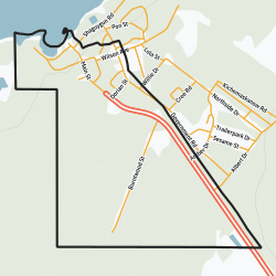
It is situated 200 kilometres southeast of The Pas and 100 kilometres (40 km by air) west of Grand Rapids, on the south shore of Cedar Lake. Its elevation above sea level is 265 metres (869 ft). The Chemawawin Cree Nation community is adjacent to the community on Cedar Lake.

The current community of Easterville was established in 1962, when nearby native populations were being displaced by the building of the Grand Rapids Dam, which flooded their prior ~80-year-old community of Chemawawin. [2]

History

The community of Easterville as it exists today was established in 1962, when it, along with nearby Indigenous populations, were relocated to the south shore of Cedar Lake. The relocation happened as result of displacement by Manitoba Hydro, who flooded the original location within Chemawawin on the lake as a part of a hydroelectric development project for the construction of the Grand Rapids Dam. [2] [3] [4] [5] Roughly 200,000 hectares were flooded in total. The new area lacked arable land, unlike the old one, being composed mostly of rock. The terrain also resulted in buildings having to be built on cement foundations without basements.

Demographics

In the 2021 Census of Population conducted by Statistics Canada, Easterville had a population of 20 living in 9 of its 14 total private dwellings, a change of

Economy

The main sources of economic base, or natural resources of Easterville, are fishing and trapping. The community offers recreational facilities such as the Skating Rink and community centre, public services including a fire hall and school, and local businesses like Easterville Fisherman's Association, a coffee shop, Griffin's Lucky Dollar Foods, and the U&S Department Store.

Notable people

Infrastructure

Easterville is located at the northern terminus of Manitoba Provincial Road 327. It is approximately 20 km north of Provincial Highway 60, the major roadway in the area which connects Highway 6 (to Thompson) and Highway 10 (to Flin Flon). The community is also serviced by Easterville Airport, located just to the east of the town.

Media

Related Research Articles

<span class="mw-page-title-main">Cedar Lake (Manitoba)</span>

Cedar Lake is a lake just north of Lake Winnipegosis in Manitoba, Canada. Cedar Lake's water level is controlled by the Grand Rapids dam. The town of Grand Rapids and the First Nations town of Easterville are nearby.

<span class="mw-page-title-main">Petawawa River</span> River in Ontario, Canada

The Petawawa River is a river in the Saint Lawrence River drainage basin in Nipissing District and Renfrew County in eastern and northeastern Ontario, Canada. The river flows from Algonquin Provincial Park to the Ottawa River at the town of Petawawa, and is only one of two major tributaries of the Ottawa River to flow completely free. The river's name comes from the Algonquian for "where one hears a noise like this", which refers to its many rapids.

<span class="mw-page-title-main">Gillam, Manitoba</span> Town in Manitoba, Canada

Gillam is a town on the Nelson River in northern Manitoba, Canada. It is situated between Thompson and Churchill on the Hudson Bay Railway line.

<span class="mw-page-title-main">Lockport, Manitoba</span> Place in Manitoba, Canada

Lockport is a small unincorporated community in Manitoba, Canada. It is located 28 kilometres (17 mi) north of the city of Winnipeg along the Red River. The community is split between the Rural Municipalities of St. Andrews and St. Clements.

<span class="mw-page-title-main">Slave Lake</span> Town in Alberta, Canada

Slave Lake is a town in northern Alberta, Canada that is surrounded by the Municipal District of Lesser Slave River No. 124. It is approximately 255 km (158 mi) northwest of Edmonton. It is located on the southeast shore of Lesser Slave Lake at the junction of Highway 2 and Highway 88.

<span class="mw-page-title-main">Grand Rapids, Manitoba</span> Town in Manitoba, Canada

Grand Rapids is a town in Manitoba, Canada, on the northwestern shore of Lake Winnipeg where the Saskatchewan River enters the lake. As the name implies, the river had a significant drop at this point. In modern days, a large hydroelectric plant has been built there. Cedar Lake, a short distance upriver, provides a natural water source for the plant. Provincial Trunk Highway 6, the region's primary roadway, crosses the Saskatchewan River at the Grand Rapids Bridge.

<span class="mw-page-title-main">Misipawistik Cree Nation</span> Place in Manitoba, Canada

Misipawistik Cree Nation is a Cree community in northern Manitoba. Misipawistik in the local Cree language means 'Rushing Rapids', which was once a historical Canadian landmark before the construction of the Manitoba Hydro-electric Dam in the late 1950s.

<span class="mw-page-title-main">Nelson River Hydroelectric Project</span>

The Nelson River Hydroelectric Project refers to the construction of a series of dams and hydroelectric power plants on the Nelson River in Northern Manitoba, Canada. The project began to take shape in the late 1950s, with the planning and construction of the Kelsey dam and hydroelectric power station, and later was expanded to include the diversion of the upper Churchill River into the Nelson River and the transformation of Lake Winnipeg, the world's 11th largest freshwater lake, into a hydroelectric reservoir. The project is owned and operated by Manitoba Hydro, the electrical utility in the province.

South Indian Lake is an Indian settlement located on the southeast shore of Southern Indian Lake in northern Manitoba, Canada, about 130 km (81 mi) north of the city of Thompson by air. It had a population of 981 in 2016, and is the main settlement of the O-Pipon-Na-Piwin Cree Nation, a First Nations band government.

<span class="mw-page-title-main">Division No. 19, Manitoba</span> Census division in Manitoba, Canada

Division No. 19, also informally known as North East Manitoba, is a census division within the Province of Manitoba, Canada. Unlike in some other provinces, census divisions do not reflect the organization of local government in Manitoba. These areas exist solely for the purposes of statistical analysis and presentation; they have no government of their own.

<span class="mw-page-title-main">Division No. 21, Manitoba</span> Census division in Manitoba, Canada

Division No. 21, also informally known as Flin Flon-Northwest, is a census division within the Province of Manitoba, Canada. Unlike in some other provinces, census divisions do not reflect the organization of local government in Manitoba. These areas exist solely for the purposes of statistical analysis and presentation; they have no government of their own.

Lac Seul First Nation is an Ojibwe First Nation band government located on the southeastern shores of Lac Seul, 56 kilometres (35 mi) northeast of the city of Dryden, Ontario. Though Lac Seul First Nation is a treaty signatory to Treaty 3, the First Nation is a member of the Independent First Nations Alliance, a regional tribal council and a member of the Nishnawbe Aski Nation.

<span class="mw-page-title-main">Berens River, Manitoba</span> Unincorporated community in Manitoba, Canada

Berens River is a community in Manitoba, Canada, along the eastern shore of Lake Winnipeg, at the mouth of the Berens River, which flows west from the Ontario headwaters. Together with the adjacent Berens River 13 reserve, it forms one a population centre collectively called Berens River. Both are served by the Berens River Airport.

Hydroelectric development in Easterville, Chemawawin began in 1962. By the early 1960s a new era began to emerge in Northern Manitoba with the development of hydroelectric projects. In 1962 the government of Manitoba contacted the Chemawawin Cree Nation asking them to surrender their lands so that the Grand Rapids Dam could be constructed. Subsequent flooding of the land that belonged to the Chemawawin people meant relocating them to Easterville, Manitoba. The Grand Rapids Forebay Administration Committee, or Forebay Committee for short, sent what is known as the "Letter of intent" or "Forebay Agreement" to the Chemawawin community stipulating a number of promises to them should they decide to relocate. Ultimately the Chemawawin people relocated to Easterville and continue to live there today. The agreements made between the government of Manitoba and the Chemawawin Indian Band are highly disputed in terms of whether the agreements were fulfilled.

<span class="mw-page-title-main">Sapotaweyak Cree Nation</span>

The Sapotaweyak Cree Nation is a First Nations band government whose reserves are located in northern Manitoba, north-east of Swan River, approximately 400 kilometres northwest of Winnipeg.

The Chemawawin Cree Nation is a First Nations community located in the lower region of northern Manitoba, Canada, next to the community of Easterville.

<span class="mw-page-title-main">Southern Indian Lake</span>

Southern Indian Lake is a large lake in northern Manitoba, Canada. It has an area of 2,247 km2 (868 sq mi) with a surface elevation of 258 m (846 ft).

<span class="mw-page-title-main">Moose Lake (Manitoba)</span>

Moose Lake is a lake located near the Saskatchewan River delta in Manitoba, Canada. It is separated into two irregularly shaped lobes, North Moose Lake and South Moose Lake, by the Moose Lake Narrows Control Structure, which was built in 1964. South Moose Lake drains south into Cedar Lake via Moose Creek; these two lakes form the reservoir of the Grand Rapids Generating Station, and the sluice gates at Moose Lake Narrows helps regulate their water levels. The lake as a whole lies at an elevation of 255 metres (837 ft) and covers 1,367 square kilometres (528 sq mi). The community of Moose Lake is located on the south shore of the lake.

Shelly Lynne Chartier is an indigenous Canadian woman of the Chemawawin Cree Nation. Chartier became infamous for her online involvement in a catfishing scandal involving NBA basketball player Chris Andersen and a teenage aspiring model, Paris Dunn, among others.

References

  1. Government of Canada, Statistics Canada (2017-02-08). "Population and Dwelling Count Highlight Tables, 2016 Census". www12.statcan.gc.ca. Retrieved 2021-08-13.
  2. 1 2 (31 July 2010). Paradise Lost, Winnipeg Free Press
  3. Miller, David L. et al. (eds.) The First ones: Readings in Indian/Native studies (1992) ("The new community of Easterville to which the people were relocated, described as a "pre-planned" community by Manitoba Hydro, was built some 40 miles from Chemawawin along the shore of Cedar Lake.")
  4. Waldrum, James B. As long as the rivers run: hydroelectric development and native communities in Western Canada, p.81-105 (1988)
  5. https://www.gov.mb.ca/inr/publications/community_profiles/pubs/easterville-2016.pdf [ bare URL PDF ]
  6. "Population and dwelling counts: Canada and designated places". Statistics Canada. February 9, 2022. Retrieved Sep 3, 2022.
  7. "How this woman catfished an NBA star and an aspiring model". ABC News. 17 April 2017. Retrieved 1 February 2019.
  8. October 26, CBC Radio ·. "The untold story of Shelly Chartier: the rural Manitoba woman who catfished the stars | CBC Radio". CBC. Retrieved 1 February 2019.