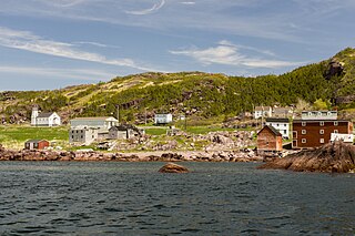
Glovertown is a town in northeastern Newfoundland, Newfoundland and Labrador, Canada. It is in Division No. 7 on Alexander Bay.
Piccadilly Slant-Abraham's Cove is a local service district and designated place in the Canadian province of Newfoundland and Labrador. It is located on the island of Newfoundland, along St. George's Bay, on the Port au Port Peninsula. The DPL consists of the fishing villages of Abraham's Cove and Piccadilly.

Open Hall-Red Cliffe is a local service district and designated place in the Canadian province of Newfoundland and Labrador.

Sandy Cove is a town located on the Eastport Peninsula in Newfoundland and Labrador, Canada. It is located on Newman Sound, which is part of Bonavista Bay. It had a population of 120 in the 2021 census.
Upper Amherst Cove, is a local service district and designated place in the Canadian province of Newfoundland and Labrador.

Reefs Harbour-Shoal Cove West-New Ferolle is a local service district and designated place in the Canadian province of Newfoundland and Labrador. It is southwest of Anchor Point.

Small Point-Adam's Cove-Blackhead-Broad Cove is a town in the Canadian province of Newfoundland and Labrador, located in the Trinity-Conception Bay District north of Carbonear.
Admirals Beach is a rural community located in Newfoundland and Labrador, Canada.
Sheaves Cove is a local service district and designated place in the Canadian province of Newfoundland and Labrador. It is on the Port au Port Peninsula along the shore of St. George's Bay. There is a small tourist alcove just off the highway where views of the waterfalls and the ocean are visited often.
Ship Cove-Lower Cove-Jerry's Nose is a local service district and designated place in the Canadian province of Newfoundland and Labrador.

Spaniard's Bay is a town in the Canadian province of Newfoundland and Labrador. It is located on the northwest side of Conception Bay and consists of Vokey's Shore, Northern Cove, Mint Cove, Green Head, and Goddenville. The name Spaniard's Bay came from the Basque and Portuguese fishermen who frequented the port in the 16th century and 17th century, and were referred to by the English as ‘Spaniards’.
Chance Cove is a town in the Canadian province of Newfoundland and Labrador. The town had a population of 213 in the Canada 2021 Census.
Trinity Bay North is a town in the Canadian province of Newfoundland and Labrador. It is located at the northern tip of Trinity Bay. The town had a population of 1,649 in the Canada 2021 Census.
O'Donnells is a local service district and designated place in the Canadian province of Newfoundland and Labrador. It is southeast of Placentia. The first postmistress was Mrs. Theresa M. Hanlon on July 16, 1951. By 1956 there was a population of 244.
Dunfield is a local service district and designated place in the Canadian province of Newfoundland and Labrador. It is southwest of Catalina. It had a population of 222 in 1940, 193 in 1951 and 210 in 1956. Renamed in 1913, the present day Dunfield was once the community of Cuckold's Cove.
Newman's Cove is a local service district and designated place in the Canadian province of Newfoundland and Labrador.
Lower Lance Cove is a local service district and designated place in the Canadian province of Newfoundland and Labrador.
Canning's Cove is a local service district and designated place in the Canadian province of Newfoundland and Labrador. It is on Bonavista Bay.

Birchy Cove is a local service district and designated place in the Canadian province of Newfoundland and Labrador.
Division No. 7, Newfoundland and Labrador is a census division in the Canadian province of Newfoundland and Labrador, primarily comprising the Bonavista Bay region. Like all census divisions in Newfoundland and Labrador, but unlike the census divisions of some other provinces, the division exists only as a statistical division for census data, and is not a political entity.


