Port Blandford

Last updated

Port Blandford
Town
Portblandford.JPG
Canada Newfoundland location map.svg
Red pog.svg
Port Blandford
Location of Port Blandford in Newfoundland
Coordinates: 48°21′N54°10′W / 48.350°N 54.167°W / 48.350; -54.167 Coordinates: 48°21′N54°10′W / 48.350°N 54.167°W / 48.350; -54.167
Country Flag of Canada (Pantone).svg  Canada
Province Flag of Newfoundland and Labrador.svg  Newfoundland and Labrador
Census division 7
Area
  Total50.56 km2 (19.52 sq mi)
Elevation
39.5 m (129.6 ft)
Population
 (2021) [1]
  Total513
  Density11.9/km2 (31/sq mi)
  [2]
Time zone UTC-3:30 (Newfoundland Time)
  Summer (DST) UTC-2:30 (Newfoundland Daylight)
Postal code span
A0C
Area code 709
Highways NL TCH sign.svgNL Route 233.svg Route 1 (TCH)  / Route 233
Website www.portblandford.com

Port Blandford is a town in eastern Newfoundland, Newfoundland and Labrador, Canada. It is in Division No. 7 on Clode Sound. The population in 1940 was 539, and increased to 631 by 1956.

Contents

Climate

Port Blandford has a humid continental climate typical of the island of Newfoundland. It is wet, snowy, highly seasonal and retains warm summers and cold winter nights coupled with relatively mild winter days.

Climate data for Port Blandford
MonthJanFebMarAprMayJunJulAugSepOctNovDecYear
Record high °C (°F)15.0
(59.0)
15.5
(59.9)
19.0
(66.2)
24.0
(75.2)
29.5
(85.1)
32.0
(89.6)
33.0
(91.4)
33.0
(91.4)
32.5
(90.5)
24.0
(75.2)
17.5
(63.5)
14.0
(57.2)
33.0
(91.4)
Average high °C (°F)−1.8
(28.8)
−1.1
(30.0)
2.5
(36.5)
7.7
(45.9)
13.9
(57.0)
18.9
(66.0)
23.2
(73.8)
23.2
(73.8)
18.5
(65.3)
12.3
(54.1)
6.6
(43.9)
1.2
(34.2)
10.4
(50.8)
Daily mean °C (°F)−7.0
(19.4)
−6.5
(20.3)
−2.8
(27.0)
2.9
(37.2)
7.8
(46.0)
12.3
(54.1)
17.0
(62.6)
17.1
(62.8)
12.7
(54.9)
7.4
(45.3)
2.3
(36.1)
−3.1
(26.4)
5.0
(41.0)
Average low °C (°F)−12.1
(10.2)
−11.9
(10.6)
−8.0
(17.6)
−1.9
(28.6)
1.8
(35.2)
5.7
(42.3)
10.8
(51.4)
10.8
(51.4)
6.9
(44.4)
2.5
(36.5)
−2.0
(28.4)
−7.5
(18.5)
−0.4
(31.3)
Record low °C (°F)−30.0
(−22.0)
−30.0
(−22.0)
−28.0
(−18.4)
−21.5
(−6.7)
−8.5
(16.7)
−4.0
(24.8)
−1.0
(30.2)
−2.0
(28.4)
−4.0
(24.8)
−8.0
(17.6)
−17.0
(1.4)
−25.0
(−13.0)
−30.0
(−22.0)
Average precipitation mm (inches)92.1
(3.63)
87.2
(3.43)
77.9
(3.07)
76.6
(3.02)
70.8
(2.79)
81.7
(3.22)
73.2
(2.88)
78.1
(3.07)
88.8
(3.50)
93.1
(3.67)
80.9
(3.19)
87.9
(3.46)
988.3
(38.93)
Average rainfall mm (inches)35.7
(1.41)
41.9
(1.65)
40.4
(1.59)
61.4
(2.42)
69.7
(2.74)
81.7
(3.22)
73.2
(2.88)
78.1
(3.07)
88.8
(3.50)
92.3
(3.63)
66.9
(2.63)
48.5
(1.91)
778.6
(30.65)
Average snowfall cm (inches)56.4
(22.2)
45.3
(17.8)
37.5
(14.8)
15.2
(6.0)
1.1
(0.4)
0.0
(0.0)
0.0
(0.0)
0.0
(0.0)
0.0
(0.0)
0.8
(0.3)
14.0
(5.5)
39.4
(15.5)
209.7
(82.5)
Source: Environment Canada [3]

Demographics

In the 2021 Census of Population conducted by Statistics Canada, Port Blandford had a population of 513 living in 258 of its 398 total private dwellings, a change of

See also

Related Research Articles

<span class="mw-page-title-main">Bonavista, Newfoundland and Labrador</span> Town in Newfoundland and Labrador, Canada

Bonavista is a town on the Bonavista Peninsula, Newfoundland in the Canadian province of Newfoundland and Labrador. Unlike many Newfoundland coastal settlements, Bonavista was built on an open plain, not in a steep cove, and thus had room to expand to its current area of 31.5 km2 (12.2 sq mi). Bonavista is located approximately 300 km from the provincial capital of St. John's.

<span class="mw-page-title-main">Deer Lake, Newfoundland and Labrador</span> Town in Newfoundland and Labrador, Canada

Deer Lake is a town in the western part of the island of Newfoundland in the province of Newfoundland and Labrador, Canada.

<span class="mw-page-title-main">Channel-Port aux Basques</span> Town in Newfoundland and Labrador, Canada

Channel-Port aux Basques is a town at the extreme southwestern tip of Newfoundland fronting on the western end of the Cabot Strait. A Marine Atlantic ferry terminal is located in the town which is the primary entry point onto the island of Newfoundland and the western terminus of the Newfoundland and Labrador Route 1 in the province. The town was incorporated in 1945 and its population in the 2021 census was 3,547.

<span class="mw-page-title-main">Nain, Newfoundland and Labrador</span> Inuit community in Newfoundland and Labrador, Canada

Nain is the northernmost permanent settlement in the Canadian province of Newfoundland and Labrador, within the Nunatsiavut region, located about 370 km (230 mi) by air from Happy Valley-Goose Bay. The town was established as a Moravian mission in 1771 by Jens Haven and other missionaries. As of 2021, the population is 1,204 mostly Inuit and mixed Inuit-European. Nain is the administrative capital of the autonomous region of Nunatsiavut.

Port Kirwan is a small incorporated fishing community located on the southern shore of the Avalon Peninsula, Newfoundland, Canada.

<span class="mw-page-title-main">Port Saunders</span> Town in Newfoundland and Labrador, Canada

Port Saunders is a community of 674 located in Newfoundland and Labrador, Canada.

Daniel's Harbour is a community on the west coast of Newfoundland, in the province of Newfoundland and Labrador. Its population as reported by the 2021 Census was 220 people. It has a reputation as a great place for wild whale sightings.

<span class="mw-page-title-main">Burgeo</span> Town in Newfoundland and Labrador, Canada

Burgeo is a town in the Canadian province of Newfoundland and Labrador. It is located mainly on Grandy Island, on the south coast of the island of Newfoundland. It is an outport community.

<span class="mw-page-title-main">Rattling Brook, Newfoundland and Labrador</span> Local service district / designated place in Newfoundland and Labrador, Canada

Rattling Brook is a local service district and designated place in the Canadian province of Newfoundland and Labrador. It is in the north-central portion of the island of Newfoundland near Baie Verte and Springdale. Formerly a fishing village, its main residents are retirees and seasonal tourists.

<span class="mw-page-title-main">Burnt Islands, Newfoundland and Labrador</span> Town in Newfoundland and Labrador, Canada

Burnt Islands is a small coastal community found in God Bay on the southwest coast of Newfoundland, Canada.

Hawke's Bay is a town at the mouth of Torrent River southeast of Point Riche in the Canadian province of Newfoundland and Labrador.

Main Brook is a town in the Canadian province of Newfoundland and Labrador. The town had a population of 246 in the Canada 2021 Census.

<span class="mw-page-title-main">Mary's Harbour</span> Town in Newfoundland and Labrador, Canada

Mary's Harbour is a town in the Canadian province of Newfoundland and Labrador. The town had a population of 312 in the Canada 2021 Census, down from 341 in the Canada 2016 Census. It is serviced by Mary's Harbour Airport.

Port Anson is a town on Sunday Cove Island in the Canadian province of Newfoundland and Labrador. The town had a population of 42 in 2021, down from 155 in the Canada 2006 Census.

Port au Port East is a town in the Canadian province of Newfoundland and Labrador, situated on the shore of Isthmus Bay. The town had a population of 413 in the Canada 2021 Census. The town consists of the unincorporated communities of Port au Port and Romaines.

St. Shott's is the southernmost town in the Canadian province of Newfoundland and Labrador. A popular claim the town is associated with is having the most fog. In the Canada 2021 Census, the town had a population of 55.

Trinity Bay North is a town in the Canadian province of Newfoundland and Labrador. It is located at the northern tip of Trinity Bay. The town had a population of 1,649 in the Canada 2021 Census.

Winterland is a town in the Canadian province of Newfoundland and Labrador. The town is considered to be a bedroom community of Marystown.

Division No. 7, Newfoundland and Labrador is a census division in the Canadian province of Newfoundland and Labrador, primarily comprising the Bonavista Bay region. Like all census divisions in Newfoundland and Labrador, but unlike the census divisions of some other provinces, the division exists only as a statistical division for census data, and is not a political entity.

<span class="mw-page-title-main">Fogo Island, Newfoundland and Labrador</span> Town in Newfoundland and Labrador, Canada

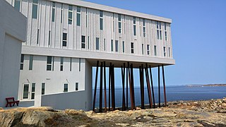
Fogo Island is a town located on Fogo Island, the largest of the offshore islands in the province of Newfoundland and Labrador, Canada.

References

  1. 1 2 "Population and dwelling counts: Canada, provinces and territories, census divisions and census subdivisions (municipalities), Newfoundland and Labrador". Statistics Canada. February 9, 2022. Retrieved March 15, 2022.
  2. "Port Blandford Census Profile". Statistics Canada. Statistics Canada. 8 February 2012. Retrieved 1 September 2015.
  3. "Port Blandford". Canadian Climate Normals 1981–2010 (in English and French). Environment Canada. 31 October 2011. Retrieved September 1, 2015.