Port Kirwan is a small incorporated fishing community located on the southern shore of the Avalon Peninsula, Newfoundland, Canada.
Gallants is located northeast of Stephenville, Newfoundland and Labrador, Canada. It was created as a Local Government Community on August 16, 1966.

Reidville is a village located north east of Deer Lake. A post office was established in 1967 and the first Postmisstress was Dorothy Barrett.
River of Ponds is a town located northeast of Daniel's Harbour, Newfoundland and Labrador. It became a Local Government Community in 1970 and had a population of 166 in 1956. The 2021 census reported a population of 173.
Parson's Pond is a community in the province of Newfoundland and Labrador in Canada.
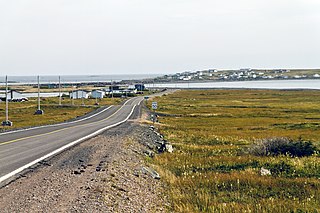
Fermeuse is a town in the Canadian province of Newfoundland and Labrador. The town had a population of 266 in the Canada 2021 Census.

Forteau is a town in the Canadian province of Newfoundland and Labrador. The town had a population of 409 as of the Canada 2016 Census.
Glenburnie-Birchy Head-Shoal Brook is a town in the Canadian province of Newfoundland and Labrador. The town had a population of 241 in the Canada 2021 Census.
Heart's Desire is a town in the Canadian province of Newfoundland and Labrador. The town had a population of 184 in the Canada 2021 Census.
Hughes Brook is a town in the Canadian province of Newfoundland and Labrador. The town had a population of 236 in the Canada 2021 Census. It is located to the northeast of Corner Brook, in the western Bay of Islands area.
Lamaline is a town in the Canadian province of Newfoundland and Labrador. The town had a population of 480 in 1940, 643 in 1956 and 218 in the Canada 2021 Census. Lamaline was a small place with 10 families in 1864. The Way Office was established in 1863 and the first Waymaster was James Pittman.
Little Bay East is a town in the Canadian province of Newfoundland and Labrador. The town had a population of 84 in the Canada 2021 Census.
Mount Moriah is a town in the Canadian province of Newfoundland and Labrador. The town had a population of 700 in the Canada 2021 Census.
Port Anson is a town on Sunday Cove Island in the Canadian province of Newfoundland and Labrador. The town had a population of 42 in 2021, down from 155 in the Canada 2006 Census.
Port au Port East is a town in the Canadian province of Newfoundland and Labrador. The town had a population of 413 in the Canada 2021 Census. The town consists of the unincorporated communities of Port au Port and Romaines.
Port Rexton is a small town in the Canadian province of Newfoundland and Labrador. It is located on the East Coast of the island of Newfoundland at the north end of Robinhood Bay, about 10 minutes east of Trinity and 3 hours north of St. John's. The town had a population of 690 in 1940, 449 in 1951, 454 in 1956, 351 in the Canada 2006 Census, 338 in the Canada 2011 Census and most recently 340 in the Canada 2016 Census. The town is part of a group of communities known as the Trinity Bight. The town is home to a few small businesses, including inns and restaurants as well as the Skerwink trail which connects Port Rexton to Trinity Harbour.
St. Pauls is a town in the Canadian province of Newfoundland and Labrador. The town had a population of 202 in the Canada 2021 Census.
Woodstock is a town in the Canadian province of Newfoundland and Labrador. The town had a population of 195 in 2021, up from 190 in the Canada 2016 Census.
Portland Creek is a local service district and designated place in the Canadian province of Newfoundland and Labrador.
Eddies Cove West is a local service district and designated place in the Canadian province of Newfoundland and Labrador.


