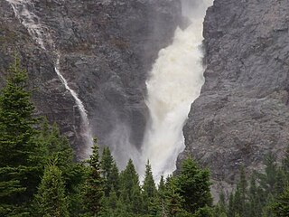
Harbour Main-Chapel's Cove-Lakeview is a town on the Avalon Peninsula in Newfoundland and Labrador, Canada. It is in Division 1, on Conception Bay. During King William's War, the village was destroyed in the Avalon Peninsula Campaign.

Gambo is a town and designated place in the Canadian province of Newfoundland and Labrador. Located in the northeastern portion of the island of Newfoundland on Freshwater Bay, it is in Division No. 7.
Musgravetown an incorporated municipality in the sheltered southwest corner of Bonavista Bay on the northeast coast of the island of Newfoundland of the Canadian province of Newfoundland and Labrador.
Steady Brook is a Canadian town in the province of Newfoundland and Labrador. Located on the west coast of the island of Newfoundland, the town is situated 8 kilometres east of the city of Corner Brook in the lower Humber Valley. The town is surrounded by the Long Range Mountains and sits astride the Humber River. Steady Brook has become a thriving community in recent years as a result of provincial investments in the Marble Mountain alpine ski resort, along with golf courses and other recreational amenities.
George's Brook is a designated place in the Canadian province of Newfoundland and Labrador that is a neighbourhood in the Town of George's Brook-Milton. It is north of Clarenville.
Gillams is a town located north west of the city of Corner Brook in the Canadian province of Newfoundland and Labrador.

Rattling Brook is a local service district and designated place in the Canadian province of Newfoundland and Labrador. It is in the north-central portion of the island of Newfoundland near Baie Verte and Springdale. Formerly a fishing village, its main residents are retirees and seasonal tourists.
Massey Drive is a town located close to the west coast of the island of Newfoundland in the province of Newfoundland and Labrador, Canada. Its name is derived from the original road through the town, named Massey Drive, which in turn is named after Vincent Massey, former Governor General of Canada (1952–59). It is an enclave surrounded by the municipality of Corner Brook, from which it seceded in 1971. It is primarily a residential area.
Cape St. George is a headland and community of the same name, located at the southwestern tip of the Port au Port Peninsula on the Canadian island of Newfoundland.

Cook's Harbour is a town in the Canadian province of Newfoundland and Labrador. The town had a population of 123 in the Canada 2016 Census. The population as of 2021 was 118 but the population has been decreasing ever since then. Cook’s Harbour is about 45 minutes away from St. Anthony NL and 6 hours from Corner Brook NL.
Glenburnie-Birchy Head-Shoal Brook is a town in the Canadian province of Newfoundland and Labrador. The town had a population of 241 in the Canada 2021 Census.

Hampden is a town in the Canadian province of Newfoundland and Labrador. The town has a population of 429. Two islands can be seen from the shore of Hampden, Granby Island and Millers Island. The latter is much closer to the town and is the host of a tuberculosis grave-site.
Hughes Brook is a town in the Canadian province of Newfoundland and Labrador. The town had a population of 236 in the Canada 2021 Census. It is located to the northeast of Corner Brook, in the western Bay of Islands area.

Irishtown-Summerside is a town in the Canadian province of Newfoundland and Labrador. It is located about 2.5 miles north of Corner Brook. The Post Office was established on March 1, 1965, and the first Postmistress was Blanch Anderson. The town had a population of 1,418 in the Canada 2016 Census. This contiguous settlement was formerly two separate villages – one of which was known originally as Petipas Cove. Two smaller settlements were formerly both separately reported in the census.

Pinware is a town in the Canadian province of Newfoundland and Labrador. The town has a population of 64, according to the Canada 2021 Census.
South Brook is a town in the Canadian province of Newfoundland and Labrador. It is located in the center region of the island of Newfoundland. The town had a population of 420 in 2021, down from 482 in the Canada 2016 Census.
Mount Carmel-Mitchells Brook-St. Catherines is a town in the Canadian province of Newfoundland and Labrador. The town had a population of 382 in the Canada 2021 Census.
Green Island Brook is a local service district and designated place in the Canadian province of Newfoundland and Labrador.
Pynns Brook is a local service district and designated place in the Canadian province of Newfoundland and Labrador.


