Glenwood, Newfoundland and Labrador

Last updated
Glenwood
Town
Glenwood, Newfoundland, Canada.jpg
Glenwood.JPG
Seal
Canada Newfoundland location map.svg
Red pog.svg
Glenwood
Location of Glenwood in Newfoundland
Coordinates: 49°00′00″N54°52′59″W / 49.000°N 54.883°W / 49.000; -54.883 Coordinates: 49°00′00″N54°52′59″W / 49.000°N 54.883°W / 49.000; -54.883
Country Flag of Canada (Pantone).svg  Canada
Province Flag of Newfoundland and Labrador.svg  Newfoundland and Labrador
Census division 6
Area
  Total6.92 km2 (2.67 sq mi)
Population
 (2016)
  Total778
  Density110/km2 (290/sq mi)
Time zone UTC-3:30 (Newfoundland Time)
  Summer (DST) UTC-2:30 (Newfoundland Daylight)
Area code(s) 709
Highways NL TCH sign.svg Route 1 (TCH)

Glenwood is a town in northeastern Newfoundland, Newfoundland and Labrador, Canada. It is in Division No. 6 on Gander Lake.

According to the 2016 Statistics Canada Census:

See also


Related Research Articles

Newfoundland and Labrador Province of Canada

Newfoundland and Labrador is the easternmost province of Canada. Situated in the country's Atlantic region, it is composed of the island of Newfoundland and the continental region of Labrador to the northwest, with a combined area of 405,212 square kilometres (156,500 sq mi). In 2018, the province's population was estimated at 525,073. About 92% of the province's population lives on the island of Newfoundland, of whom more than half live on the Avalon Peninsula.

Conception Harbour Town in Newfoundland and Labrador, Canada

Conception Harbour is a town on the Avalon Peninsula in Newfoundland and Labrador, Canada. It is in Division 1 on Conception Bay.

Come By Chance, Newfoundland and Labrador Town in Newfoundland and Labrador, Canada

Come By Chance is a town on the isthmus of the Avalon Peninsula in Newfoundland and Labrador, Canada. It is in Division 1 on Placentia Bay.

Clarenville Town in Newfoundland and Labrador, Canada

Clarenville is a town on the east coast of Newfoundland in the province of Newfoundland and Labrador, Canada. Clarenville was incorporated in 1951. It is located in the Shoal Harbour valley, fronting an arm of the Atlantic Ocean called Random Sound.

Port Blandford Town in Newfoundland and Labrador, Canada

Port Blandford is a town in eastern Newfoundland, Newfoundland and Labrador, Canada. It is in Division No. 7 on Clode Sound. The population in 1940 was 539 and 631 by 1956.

Norris Arm Town in Newfoundland and Labrador, Canada

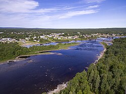
Norris Arm is a town in north-central Newfoundland, Newfoundland and Labrador, Canada. It is in Division No. 6, on the Bay of Exploits.
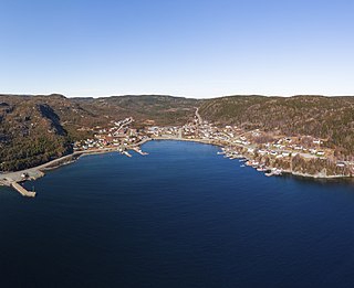
Bishops Falls Town in Newfoundland and Labrador, Canada

Bishop's Falls is a town in the north-central part of the island of Newfoundland in the Canadian province of Newfoundland and Labrador, with a population of 3, 156 at the 2016 census.

Grand Falls-Windsor Town in Newfoundland and Labrador, Canada

Grand Falls-Windsor is a town located in the central region of the island of Newfoundland in the province of Newfoundland and Labrador, Canada, with a population of 14,171 at the 2016 census. The town is the largest in the central region, the fifth largest in the province, and is home to the annual Exploits Valley Salmon Festival. Grand Falls-Windsor was incorporated in 1991, when the two former towns of Grand Falls and Windsor amalgamated.

Bonavista, Newfoundland and Labrador Town in Newfoundland and Labrador, Canada

Bonavista is a town on the Bonavista Peninsula, Newfoundland in the Canadian province of Newfoundland and Labrador. Unlike many Newfoundland coastal settlements, Bonavista was built on an open plain, not in a steep cove, and thus had room to expand to its current area of 31.5 km2 (12.2 sq mi).

Channel-Port aux Basques Town in Newfoundland and Labrador, Canada

Channel-Port aux Basques is a town at the extreme southwestern tip of Newfoundland fronting on the western end of the Cabot Strait. A Marine Atlantic ferry terminal is located in the town which is the primary entry point onto the island of Newfoundland and the western terminus of the Newfoundland and Labrador Route 1 in the province. The town was incorporated in 1945 and its population in the 2016 census was 4,067.

Conception Bay South Town in Newfoundland and Labrador, Canada

Conception Bay South is a town located on the southern shore of Conception Bay on the Avalon Peninsula of the island of Newfoundland, Province of Newfoundland and Labrador, Canada. The town is commonly called C.B.S.

Grand Bank Town in Newfoundland and Labrador, Canada

Grand Bank, Newfoundland and Labrador, Canada or 'Grand Banc' as the first French settlers pronounced it, is a small rural town with a population of 2,580. It is located on the southern tip or "toe" of the Burin Peninsula, 360 km from the province's capital of St. John's.

Port Hope Simpson Town in Newfoundland and Labrador, Canada

Port Hope Simpson, population 412 (2016) is a town located on the southeastern Labrador coast, 215 km (134 mi) from the Quebec/Labrador border in Canada. It began in the 1930s as a company town.

Brigus Town in Newfoundland and Labrador, Canada

Brigus is a small fishing community located in Conception Bay, Newfoundland and Labrador, Canada. Brigus was home to Captain Bob Bartlett and the location of his residence Hawthorne Cottage.

Garnish, Newfoundland and Labrador Town in Newfoundland and Labrador, Canada

Garnish, a town located on the west coast of the Burin Peninsula, was well known for its lumbering and now for its lobstering operations. Located on Route 213, it is 25 km along route 220 north west of Grand Bank and 18 km along Route 220 east of Marystown. The Way Office was established in 1852 and the first Waymaster was Henry Campe. Other notable people include Mayor Gregory Day and Brian Marshall. In 2016 the town had a population of 568.

Aquaforte Town in Newfoundland and Labrador, Canada

Aquaforte is a town on the south shore of Newfoundland's Avalon Peninsula in the province of Newfoundland and Labrador, Canada.

The Newfoundland T'Railway Provincial Park is a rail trail located in the Canadian province of Newfoundland and Labrador.

Mount Pearl City in Newfoundland and Labrador, Canada

Mount Pearl is the third-largest settlement and second-largest city in Newfoundland and Labrador, Canada. The city is located southwest of St. John's, on the eastern tip of the Avalon Peninsula on the island of Newfoundland. Mount Pearl is part of the St. John's metropolitan area, the 20th largest metropolitan area in Canada.

Roddickton-Bide Arm Town in Newfoundland and Labrador, Canada

Roddickton-Bide Arm is a town located in the northern portion of the island of Newfoundland within the province of Newfoundland and Labrador. It was formed on January 1, 2009 through the amalgamation of the former towns of Roddickton and Bide Arm.