Peterview

Last updated

Peterview, Newfoundland & Labrador
Peters Arm
Town
Peterviewsign.jpg
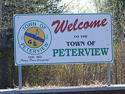
Peterview's welcome sign on the only road into the community.
Peterview NFLD seal.jpg
Canada Newfoundland location map.svg
Red pog.svg
Peterview, Newfoundland & Labrador
Location of Peterview in Newfoundland
Coordinates: 49°8′55″N55°21′02″W / 49.14861°N 55.35056°W / 49.14861; -55.35056
Country Flag of Canada (Pantone).svg  Canada
Province Flag of Newfoundland and Labrador.svg  Newfoundland and Labrador
Census division 6
Incorporated1962
Government
Area
  Total6.72 km2 (2.59 sq mi)
Elevation
12 m (39 ft)
Population
 (2021)
  Total723
  Density123.2/km2 (319/sq mi)
Time zone UTC-3:30 (Newfoundland Time)
  Summer (DST) UTC-2:30 (Newfoundland Daylight)
Postal code span
A0H
Area code 709
Highways NL Route 350.svg Route 350
Website http://www.peterview.ca/

Peterview is a town located in the Exploits Valley area of central Newfoundland and Labrador, Canada, where Peters River empties into the Bay of Exploits, just south of Botwood, off Route 350.

Contents

Originally named Peters Arm, the community was incorporated as the Town of Peterview in 1962. The mayor is Jim Samson and the deputy mayor is Pleman Brown. According to the 2001 Statistics Canada census, Peterview has a population of 807 with 266 [1] private dwellings.

Peterview has connections to Demasduit, also known as Mary March, a figure in Newfoundland history and one of the last Beothuks, as John Peyton, one of her captors, built the first house in the area. [2]

Demographics

In the 2021 Census of Population conducted by Statistics Canada, Peterview had a population of 723 living in 279 of its 288 total private dwellings, a change of

See also

Related Research Articles

<span class="mw-page-title-main">Dildo, Newfoundland and Labrador</span> Local service district / designated place in Newfoundland and Labrador, Canada

Dildo is a local service district and designated place in the Canadian province of Newfoundland and Labrador on the island of Newfoundland. It is located on the southeastern Dildo Arm of Trinity Bay about 100 kilometres (62 mi) west of St. John's. South Dildo is a community located to the south, and in 2021 had 195 residents. It is known for its unusual name.

<span class="mw-page-title-main">Port au Port West-Aguathuna-Felix Cove</span> Town in Newfoundland and Labrador, Canada

Port au Port West-Aguathuna-Felix Cove is a small town located on the Port au Port Peninsula of the Island of Newfoundland, Canada. The nearest large service area is Stephenville.

Springdale is a town in Newfoundland and Labrador, Canada, which had a population of 2,965 people in 2021, up from 2,764 in the Canada 2006 Census. The community is located on the Northwestern shores of Hall's Bay in Central Newfoundland, near the mouth of Indian River.

<span class="mw-page-title-main">Point Leamington</span> Town in Newfoundland and Labrador, Canada

Point Leamington is a town of about 590 people located north of Botwood and Grand Falls-Windsor in the Canadian province of Newfoundland and Labrador.

<span class="mw-page-title-main">Comfort Cove-Newstead</span> Town in Newfoundland and Labrador, Canada

Comfort Cove-Newstead is a small fishing community located outside Campbellton, on the east coast of Newfoundland and Labrador, Canada,.

<span class="mw-page-title-main">LaScie</span> Town in Newfoundland and Labrador, Canada

La Scie is a town in the Canadian province of Newfoundland and Labrador. The town had a population of 820 in the Canada 2021 Census, down from 872 in 2016.

<span class="mw-page-title-main">Leading Tickles</span> Town in Newfoundland and Labrador, Canada

Leading Tickles is a town in the Canadian province of Newfoundland and Labrador. In 2021, the town had a population of 296, down from 407 in the Canada 2006 Census. It is located approximately 25 km Northwest of Point Leamington on the shores of Notre Dame Bay. The town boasts spectacular scenery especially in spring and early summer when many icebergs pass just off the coast.

Miles Cove is a town on Sunday Cove Island in the Canadian province of Newfoundland and Labrador. The town had a population of 104 in 2016, down from 140 in the Canada 2006 Census.

Millertown is a town in the Canadian province of Newfoundland and Labrador on the north-east side of Beothuk Lake. The town had a population of 87 in the Canada 2021 Census.

Northern Arm is a town in the Canadian province of Newfoundland and Labrador. The town had a population of 371 in the Canada 2021 Census.

Point of Bay is a town in the Canadian province of Newfoundland and Labrador. The town had a population of 154 people in 2016, down from 163 in the Canada 2006 Census.

Port Anson is a town on Sunday Cove Island in the Canadian province of Newfoundland and Labrador. The town had a population of 42 in 2021, down from 155 in the Canada 2006 Census.

South Brook is a town in the Canadian province of Newfoundland and Labrador. It is located in the center region of the island of Newfoundland. The town had a population of 420 in 2021, down from 482 in the Canada 2016 Census.

Woodstock is a town in the Canadian province of Newfoundland and Labrador. The town had a population of 195 in 2021, up from 190 in the Canada 2016 Census.

Lushes Bight–Beaumont–Beaumont North is a town on Long Island in Notre Dame Bay in the Canadian province of Newfoundland and Labrador. The town had a population of 169 at the 2021 Census, down from 275 in the 2006 Census.

Dunfield is a local service district and designated place in the Canadian province of Newfoundland and Labrador. It is southwest of Catalina. It had a population of 222 in 1940, 193 in 1951 and 210 in 1956. Renamed in 1913, the present day Dunfield was once the community of Cuckold's Cove.

Stanhope is a local service district and designated place in the Canadian province of Newfoundland and Labrador.

St. Patricks is a local service district and designated place in the Canadian province of Newfoundland and Labrador.

Buchans Junction is a local service district and designated place in the Canadian province of Newfoundland and Labrador in the central part of the island of Newfoundland. It is on the banks of Mary March River near where the Mary March River flows into the northeast end of Beothuk Lake. The community is on a site first known as "Four Mile Siding" on the railway which was constructed in 1900 to connect the community of Millertown to the Newfoundland Railway at Millertown Junction. The site itself became a rail junction in 1927 when Asarco subsidiary, the Buchans Mining Company, completed a rail link from the newly formed mining town of Buchans. Ever since 1927, even after the Buchans Railway closed in 1977, the community has been known as "Buchans Junction".

Brown's Arm is a local service district and designated place in the Canadian province of Newfoundland and Labrador

References

  1. Population and dwelling counts
  2. "Let's cleanse the landscape of the name of a Beothuk killer | CBC News".
  3. "Population and dwelling counts: Canada, provinces and territories, census divisions and census subdivisions (municipalities), Newfoundland and Labrador". Statistics Canada. February 9, 2022. Retrieved March 15, 2022.

49°07′00″N55°21′00″W / 49.11667°N 55.35000°W / 49.11667; -55.35000