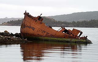
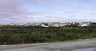
Harbour Main-Chapel's Cove-Lakeview is a town on the Avalon Peninsula in Newfoundland and Labrador, Canada. It is in Division 1, on Conception Bay. During King William's War, the village was destroyed in the Avalon Peninsula Campaign.

Conception Harbour is a town on the Avalon Peninsula in Newfoundland and Labrador, Canada. It is in Division 1 on Conception Bay and can be accessed via Newfoundland and Labrador Route 60.
Colliers is a town on the Avalon Peninsula in Newfoundland and Labrador, Canada. It is in Division 1 on Conception Bay.

Ferryland is a town in Newfoundland and Labrador on the Avalon Peninsula. According to the 2021 Statistics Canada census, its population is 371.

Division 1, Newfoundland and Labrador is a census division covering the entire Avalon Peninsula including the Isthmus of Avalon of the Canadian province of Newfoundland and Labrador. Like all census divisions in Newfoundland and Labrador, but unlike the census divisions of some other provinces, the division exists only as a statistical division for census data, and is not a political entity.

Old Perlican is a fishing village on the Avalon Peninsula, Newfoundland and Labrador in Canada. Incorporated in 1791, it is one of the oldest fishing communities in Newfoundland; it served as the major fishing station in Trinity Bay for migratory fisherman from England in the 17th century.
Port Kirwan is a small incorporated fishing community located on the southern shore of the Avalon Peninsula, Newfoundland, Canada.

Anchor Point is a town located in St. Barbe Bay, south of Flower's Cove on the west side of the Great Northern Peninsula, in Newfoundland and Labrador, Canada. It was the first English settlement on what is called the 'French Shore' of Newfoundland.
Mobile is a local service district and designated place in the Canadian province of Newfoundland and Labrador on the Avalon Peninsula.
Tors Cove is a local service district and designated place in the Canadian province of Newfoundland and Labrador. It is on the east coast of the Avalon Peninsula of the island of Newfoundland, approximately 40 kilometres south of the St. John's, the provincial capital, along Route 10. It was formerly named Toads Cove.
Renews–Cappahayden is a small fishing town on the southern shore of Newfoundland, 83 kilometres (52 mi) south of St. John's.

The Town of Cape Broyle is an incorporated community located on the Avalon Peninsula in Newfoundland and Labrador, Canada. During King William's War, the village was destroyed in the Avalon Peninsula Campaign.

Bay Bulls is a small fishing town in the province of Newfoundland and Labrador, Canada.
Admirals Beach is a rural community located in Newfoundland and Labrador, Canada.
Bauline is a small town in the Canadian province of Newfoundland and Labrador, located on the Avalon Peninsula north of St. John's. As of the 2021 census, it had a population of 412, making it the smallest incorporated community in the St. John's metropolitan area.
Portugal Cove South is a small fishing town on the southern shore of the Avalon Peninsula of Newfoundland in the province of Newfoundland and Labrador, Canada. Portugal Cove South had a population of 225 in the Canada 2006 Census, down to 86 in Canada 2021 Census.
Winterton is a town in the Canadian province of Newfoundland and Labrador. It was originally named Sille Cove or Scilly Cove. In 1912 the town was named Winterton for Sir James Spearman Winter, former Prime Minister of Newfoundland.

Witless Bay is a town on the Avalon Peninsula in the Canadian province of Newfoundland and Labrador. Located on the Irish Loop, 35 km south of the provincial capital, St. John's, Witless Bay is a small, scenic, traditional Newfoundland outport community. The town had a population of 1640 in the Canada 2021 Census. It is connected to the Witless Bay Ecological Reserve.

L'Anse-au-Loup (Town) is located on the banks of L'Anse-au-Loup Brook and the Strait of Belle Isle, in Newfoundland and Labrador province, Canada.
Cavendish is a local service district and designated place in the Canadian province of Newfoundland and Labrador.


