
Camrose is a city in central Alberta, Canada that is surrounded by Camrose County. Located along Highway 13 it had its beginnings as a railroad hub.

Spruce Grove is a city that is 11 km (6.8 mi) west of Edmonton, Alberta, in Canada. The city is adjacent to the Town of Stony Plain and is surrounded by Parkland County.

Leduc is a city in the province of Alberta, Canada. It is 33 km (21 mi) south of the provincial capital of Edmonton and is part of the Edmonton Metropolitan Region.

Wetaskiwin is a city in the province of Alberta, Canada. The city is located 70 kilometres (43 mi) south of the provincial capital of Edmonton. The city name comes from the Cree word wītaskiwinihk, meaning "the hills where peace was made".

The census geographic units of Canada are the census subdivisions defined and used by Canada's federal government statistics bureau Statistics Canada to conduct the country's quinquennial census. These areas exist solely for the purposes of statistical analysis and presentation; they have no government of their own. They exist on four levels: the top-level (first-level) divisions are Canada's provinces and territories; these are divided into second-level census divisions, which in turn are divided into third-level census subdivisions and fourth-level dissemination areas.

Division 1, Newfoundland and Labrador is a census division covering the entire Avalon Peninsula including the Isthmus of Avalon of the Canadian province of Newfoundland and Labrador. Like all census divisions in Newfoundland and Labrador, but unlike the census divisions of some other provinces, the division exists only as a statistical division for census data, and is not a political entity.

Cochrane is a town in the Calgary Metropolitan Region of Alberta, Canada. The town is located 18 km (11 mi) west of the Calgary city limits along Highway 1A. Cochrane is one of the fastest-growing communities in Canada, and with a population of 32,199 in 2021, it is one of the largest towns in Alberta. It is part of Calgary's census metropolitan area and a member community of the Calgary Metropolitan Region Board (CMRB). The town is surrounded by Rocky View County.
Airdrie is a city in Alberta, Canada, within the Calgary Region and the Calgary Metropolitan Area, It is located north of Calgary within the Calgary–Edmonton Corridor at the intersection of Queen Elizabeth II Highway and Highway 567.
Brooks is a city in southeast Alberta, Canada in the County of Newell. It is on Highway 1 and the Canadian Pacific Kansas City railway, approximately 186 km (116 mi) southeast of Calgary, and 110 km (68 mi) northwest of Medicine Hat. The city has an elevation of 760 m (2,490 ft).

Cold Lake is a city in east-central Alberta, Canada and is named after the lake nearby. Canadian Forces Base Cold Lake is situated within the city's outer limits.

The Municipality of Crowsnest Pass is a specialized municipality in southwest Alberta, Canada. Within the Rocky Mountains adjacent to the eponymous Crowsnest Pass, the municipality formed as a result of the 1979 amalgamation of five municipalities – the Village of Bellevue, the Town of Blairmore, the Town of Coleman, the Village of Frank, and Improvement District No. 5, which included the Hamlet of Hillcrest and numerous other unincorporated communities.

Strathmore is a town located in southern Alberta, Canada that is surrounded by Wheatland County. It is along the Trans-Canada Highway approximately 50 kilometres (30 mi) east of Calgary.

Lacombe is a city in central Alberta, Canada. It is located approximately 25 kilometres (16 mi) north of Red Deer, the nearest major city, and 125 kilometres (78 mi) south of Edmonton, the nearest metropolitan area. The city is set in the rolling parkland of central Alberta, between the Rocky Mountains foothills to the west and the flatter Alberta prairie to the east.
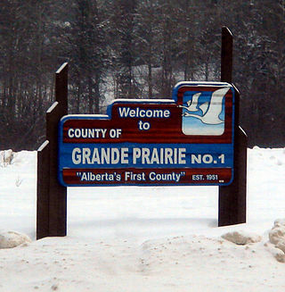
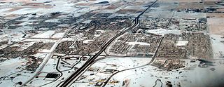
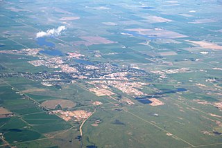
The County of Grande Prairie No. 1 is a municipal district in northwestern Alberta, Canada in Census Division No. 19.

Beaumont is a city adjacent to Leduc County within the Edmonton Metropolitan Region of Alberta, Canada. It is at the intersection of Highway 625 and Highway 814, adjacent to the City of Edmonton and 6.0 kilometres (3.7 mi) northeast of the City of Leduc. The Nisku Industrial Park and the Edmonton International Airport are 4.0 kilometres (2.5 mi) to the west and 8.0 kilometres (5.0 mi) to the southwest respectively.
High River is a town within the Calgary Metropolitan Region of Alberta, Canada. It is approximately 68 kilometres (42 mi) south of Calgary, at the junction of Alberta Highways 2 and 23. High River had a population of 14,324 in 2021.

Kinuso is a hamlet in northern Alberta, Canada within Big Lakes County, and surrounded by the Swan River First Nation reserve. It is located approximately 48 kilometres (30 mi) west of Slave Lake and 71 km east of High Prairie along Highway 2, south of the southern shore of Lesser Slave Lake.
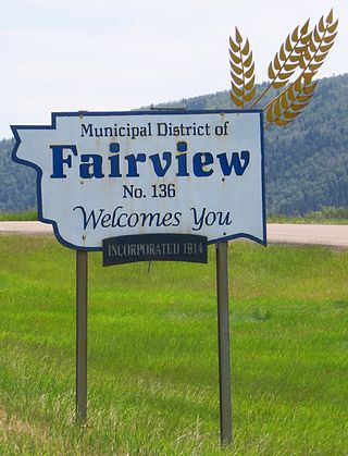
The Municipal District of Fairview No. 136 is a municipal district (MD) in northwestern Alberta, Canada. It is located in Census Division 19.

The Municipal District of Smoky River No. 130 is a municipal district (MD) in northwestern Alberta, Canada. Located in Census Division No. 19, its municipal office is located in the Town of Falher.
According to the 2021 census, the City of Edmonton had a population of 1,010,899 residents, compared to 4,262,635 for all of Alberta, Canada. The total population of the Edmonton census metropolitan area (CMA) was 1,418,118, making it the sixth-largest CMA in Canada.
