South River, Newfoundland and Labrador

Last updated

South River
Town
Coordinates: 47°31′56″N53°16′05″W / 47.53222°N 53.26806°W / 47.53222; -53.26806
Country Flag of Canada (Pantone).svg  Canada
Province Flag of Newfoundland and Labrador.svg  Newfoundland and Labrador
DistrictHarbour Main
Established ca.1620
Incorporated1966
Government
  MHA Helen Conway-Ottenheimer
  MPKen McDonald
  MayorBeverly Wells
Population
 (2021)
  Total674
Time zone UTC-3:30 (Newfoundland Time)
  Summer (DST) UTC-2:30 (Newfoundland Daylight)
Postal Code
A0A 3W0
Area code 709
Highways NL Route 60.svg Route 60
NL Route 70.svg Route 70
NL Route 71.svg Route 71
Website www.townofsouthriver.ca

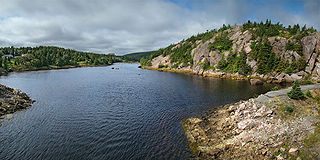
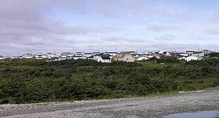
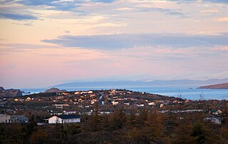
South River is an incorporated municipality in the Canadian province of Newfoundland and Labrador, located at the south-southeast side of Bay de Grave, in Conception Bay. The town had a population of 674 according to the 2021 Canadian Census. [1] South River is the site of the western terminus of Newfoundland and Labrador Route 60, also known as the Conception Bay Highway, which proceeds eastward to downtown St. John's. The river itself forms a natural boundary with neighbouring Clarke's Beach and is a scheduled salmon river. A second river, known as the Gould Brook, forms another natural boundary with the unincorporated local service district of Makinsons. South River is home to the Bay de Grave Regional Fire Department, a first step in developing successful regional cooperation amongst municipalities.

Contents

Modern-day South River comprises a number of very old, smaller settlements, namely, The Broads and Springfield. Salmon Cove Road (commonly referred to as just Salmon Cove, not to be confused with the nearby municipality of Salmon Cove) occupies the north side of a hill known as Long Harry, the south side of which is occupied by Cupids, the oldest English settlement in North America. There are three cemeteries in South River; a Roman Catholic cemetery on Hodgewater Line, and two Anglican on Salmon Cove. The earlier of the two Anglican cemeteries dates to the early-mid 19th century. In addition, there are marked graves scattered along Long Harry in areas known as The Cupids Road and Adam's Grove. These graves likely pre-date the cemeteries. There are several families in the area, particularly on Salmon Cove, which have lived there for centuries. These families names include Bussey, Wells, Batten, Noseworthy, Andrews, and more. A geological formation on the shore of Salmon Cove known as Stake Cove is reputed to be the location where a woman, Catherine Snow, murdered her husband John by hitting him with a stake maul, hence the name of the cove. Catherine was convicted of the crime and hanged at St. John's, the last known woman to have been hanged in Newfoundland.

Between South River and Cupids sits an area of provincially-protected pastureland. Used primarily by local cattle farmers, a portion of the pasture has been allocated for use by Newfoundland Ponies, Newfoundland's only designated heritage animal. The ponies are put to pasture from approximately early June to mid October. Visitors can reach the pasture from the Caplin Cove Road or Salmon Cove Road entrances.

The first mayor of South River was Mr. Harry L. Shepherd. The first female mayor was Ms. Veronica Rowe, who died while in office (2004). The council consists of seven elected residents of the town. The current mayor is Mrs. Beverly Wells.

Demographics

In the 2021 Census of Population conducted by Statistics Canada, South River had a population of 674 living in 297 of its 351 total private dwellings, a change of

See also

Related Research Articles

<span class="mw-page-title-main">Avondale, Newfoundland and Labrador</span> Town in Newfoundland and Labrador, Canada

Avondale is a town located on Newfoundland's Avalon Peninsula in the province of Newfoundland and Labrador, Canada, which was incorporated in 1974. The community is situated at the southwestern head of Conception Bay in Division 1. It is located 59 km (37 mi) southwest of St. John's and 72 km (45 mi) northeast of Placentia.

<span class="mw-page-title-main">Conception Harbour</span> Town in Newfoundland and Labrador, Canada

Conception Harbour is a town on the Avalon Peninsula in Newfoundland and Labrador, Canada. It is in Division 1 on Conception Bay and can be accessed via Newfoundland and Labrador Route 60.

Colliers is a town on the Avalon Peninsula in Newfoundland and Labrador, Canada. It is in Division 1 on Conception Bay.

<span class="mw-page-title-main">Division No. 1, Newfoundland and Labrador</span> Census division in Newfoundland and Labrador, Canada

Division 1, Newfoundland and Labrador is a census division covering the entire Avalon Peninsula including the Isthmus of Avalon of the Canadian province of Newfoundland and Labrador. Like all census divisions in Newfoundland and Labrador, but unlike the census divisions of some other provinces, the division exists only as a statistical division for census data, and is not a political entity.

<span class="mw-page-title-main">Conception Bay South</span> Town in Newfoundland and Labrador, Canada

Conception Bay South is a town in the Province of Newfoundland and Labrador, Canada. The town is commonly called CBS.

Victoria is an incorporated town in Conception Bay located approximately midway on the Bay de Verde Peninsula of Newfoundland and Labrador, Canada.

<span class="mw-page-title-main">Portugal Cove–St. Philip's</span> Town in Newfoundland and Labrador, Canada

Portugal Cove–St. Philip's is a rural seashore community located on the eastern Avalon Peninsula of Newfoundland in the province of Newfoundland and Labrador, Canada. The town is a bedroom community of the provincial capital of St. John's.

Brigus is a small fishing community located in Conception Bay, Newfoundland and Labrador, Canada. Brigus was home to Captain Bob Bartlett and the location of his residence Hawthorne Cottage.

<span class="mw-page-title-main">Anchor Point, Newfoundland and Labrador</span> Town in Newfoundland and Labrador, Canada

Anchor Point is a town located in St. Barbe Bay, south of Flower's Cove on the west side of the Great Northern Peninsula, in Newfoundland and Labrador, Canada. It was the first English settlement on what is called the 'French Shore' of Newfoundland.

<span class="mw-page-title-main">Cupids</span> Town in Newfoundland and Labrador, Canada

Cupids is a town of 699 people on Conception Bay, Newfoundland and Labrador, Canada. It has also been known as Coopers, Copers Cove, Cupers Cove, and Cuperts. It is the oldest continuously settled official British colony in Canada. Cupids is believed to be the site of the first child born of European parents in the country. The town was established by Englishman John Guy in 1610.

Roaches Line is a local service district and designated place in the Canadian province of Newfoundland and Labrador. It is on the western side of Conception Bay and south of Bay Roberts.

Bay de Verde is an incorporated town in Conception Bay on the northern tip of the Bay de Verde Peninsula of Newfoundland and Labrador, Canada. The first recorded inhabitants at Bay de Verde arrived in 1662. Bay de Verde became an incorporated town in 1950.

<span class="mw-page-title-main">Bay Roberts</span> Town in Newfoundland and Labrador, Canada

Bay Roberts is a town located on the north shore of Conception Bay on the northeastern Avalon Peninsula in the province of Newfoundland and Labrador, Canada. The growth of the local economy can be connected to the town's proximity to other major Newfoundland markets, by road and by water.

<span class="mw-page-title-main">Clarke's Beach</span> Town in Newfoundland and Labrador, Canada

Clarke's Beach is a town on Conception Bay in the Canadian province of Newfoundland and Labrador. In the 2021 census the town had a population of 1,400. It is the home of a number of well-known Newfoundland artists, and is a favourite place for retirement.

North River is a town on the Avalon Peninsula of Newfoundland in the Canadian province of Newfoundland and Labrador. It was incorporated as a municipality in 1964.

Harry's Harbour is a local service district and designated place in the Canadian province of Newfoundland and Labrador. It is southeast of Baie Verte.

<span class="mw-page-title-main">Division No. 1, Subdivision G, Newfoundland and Labrador</span> Unorganized territory in Newfoundland and Labrador, Canada

Division No. 1, Subdivision G is an unorganized subdivision on the Avalon Peninsula in Newfoundland and Labrador, Canada. It is in Division 1 and contains the unincorporated communities of Baccalieu Island, Besom Cove, Bradley's Cove, Burnt Point, Caplin Cove, Daniel's Cove, Grates Cove, Gull Island, Job's Cove, Kingston, Long Beach, Lower Island Cove, Low Point, Northern Bay, Ochre Pit Cove, Red Head Cove, Riverhead, Smooth Cove and Western Bay.

Division No. 1, Subdivision L is an unorganized subdivision on the Avalon Peninsula in Newfoundland and Labrador, Canada. It is in Division 1 and contains the unincorporated communities of Bareneed, Black Duck Pond, Blow Me Down, Coley's Point South, Hibb's Cove, Pick Eyes, Port de Grave, Ship Cove and The Dock

<span class="mw-page-title-main">Newfoundland and Labrador Route 70</span>

Route 70, also known as Roaches Line and Conception Bay Highway, is a 109-kilometre-long (68 mi) north-south highway on the Avalon Peninsula of Newfoundland. The highway also carries the designation of Baccalieu Trail for its entire length.

References

  1. "South River, Town [Census subdivision], Newfoundland and Labrador". Statistics Canada. 8 February 2017. Retrieved 7 January 2019.
  2. "Population and dwelling counts: Canada, provinces and territories, census divisions and census subdivisions (municipalities), Newfoundland and Labrador". Statistics Canada. February 9, 2022. Retrieved March 15, 2022.

47°31′56″N53°16′05″W / 47.53222°N 53.26806°W / 47.53222; -53.26806