Route 210, also known as the Burin Peninsula Highway and Heritage Run, is a highway that extends through the Burin Peninsula from Goobies to Grand Bank, Newfoundland and Labrador. The maximum speed limit is 90 km/h except through communities and settlements where the speed limit is reduced to 50 km/h. Just after exiting Swift Current, until a few kilometres north of Marystown, much of the landscape is barren, with very few trees prevalent. After entering Marystown, motorists approach a junction where they could turn right to continue their journey on Route 210 until arriving at Grand Bank, or going straight onto Route 220 towards Burin and St. Lawrence. Marystown is the most populous community along the route.
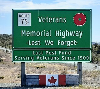
Route 75, also known as Veterans Memorial Highway, is a two-lane expressway on the Avalon Peninsula of Newfoundland. The route begins at a trumpet interchange with Route 1 and continues north, bypassing communities along the western shore of Conception Bay until it ends at a junction with Route 70 south of Carbonear. Construction of the highway was completed in 2012.
Route 201 is a provincial road in the Canadian province of Newfoundland and Labrador. It is one of only three loop roads designated with a route number that starts and ends at the Trans-Canada Highway. The road spans 28 kilometres (17 mi), and allows for a scenic journey along the southern coast of Trinity Bay. There are quite a number of summer cottages along the route, and highway is known for an abundance of ospreys during the summer months.
Route 408, also known as Cape Ray Road, is a highway on the west coast of Newfoundland in the Canadian province of Newfoundland and Labrador. The intersection at Route 1 is located roughly 17 kilometres (11 mi) northeast of Channel-Port aux Basques, a nearly 20-minute drive. Upon entering Route 408, motorists would travel only 3 kilometres (1.9 mi) before entering its only community, Cape Ray. With a total distance of 5.9 kilometres (3.7 mi) between Route 1 and its terminus, the Cape Ray Lighthouse, it may hold the distinction of being the shortest provincial route that is not a bypass nor access road. Because of its short length, plus being a rough road, the maximum speed limit is set at 50 km/h.
Route 470, also known as La Poile Highway, is a highway on the West Coast of the Canadian province of Newfoundland and Labrador. It is the last provincial highway off Route 1 before approaching the Marine Atlantic Ferry to Nova Scotia, in Channel-Port aux Basques. The route is 42.8 kilometres (26.6 mi) in length. During much of the journey, there is plenty of barren land on both sides of the road, until arriving at its final community, Rose Blanche. Route 470 also carries the designation of Granite Coast Scenic Drive.
Route 382, also known as Long Island Tickle Road, is a highway in the central portion of Newfoundland in the Canadian province of Newfoundland and Labrador, branching off Route 380 in the town of Pilley's Island. The route is the only provincial route with no communities prevalent – it is designed as an access to the Lushes Bight–Beaumont–Beaumont North ferry. The maximum speed limit for much of Route 382 is 60 km/h, but is reduced to 30 km/h when approaching the ferry.
Route 213 is a highway on the Burin Peninsula of the island of Newfoundland in the Canadian province of Newfoundland and Labrador. It is one of a small number of provincial routes that start and end on the same highway. It is a very short route, running for about 12 kilometres. Due to being a rough road, the maximum speed limit is 60 km/h, except through communities where the speed limit is reduced to 30 km/h. The western side of the route allows for a drive along the shore of Fortune Bay, until reaching the community of Frenchman's Cove. Midway along the route is Frenchman's Cove Provincial Park, one of only a small number of provincial parks in existence since 1997. After exiting Frenchman's Cove, motorists travel along the Frenchman's Cove Barasway and enjoy more of a view of Fortune Bay until approaching the Town of Garnish.
Route 390, also known as Springdale Road, is a highway in the central portion of Newfoundland in the Canadian province of Newfoundland and Labrador. It is a very short route, running for only 11.0 kilometres (6.8 mi), with its only community, Springdale, as its terminus. Its branch routes, Route 391 and Route 392, run for a much longer distance.
Route 402, also known as Gallants Road, is a minor highway in the Canadian province of Newfoundland and Labrador. The highway is located about 40 kilometres (25 mi) southwest of the city of Corner Brook, approximately 30 minutes by car. The route's eastern terminus is Route 1, and its western terminus at the community of Gallants, located 9 kilometres (5.6 mi) from Route 1. Although no directional signage on Route 1 before the intersection in either direction depict Route 402, but according to some provincial government road maps, Route 402 is the official name of the highway.
Route 335, also known as Farewell Road, is a highway in the northern portion of Newfoundland in the Canadian province of Newfoundland and Labrador. The highway's southern terminus is at the junction at Route 331 near the community of Horwood, and its northern terminus is the community of Farewell, a community where the Fogo Island and Change Islands ferries, served by the MV Veteran, depart or arrive.
Route 406, also known as Codroy Road, is a highway on the western portion of Newfoundland in the Canadian province of Newfoundland and Labrador. It is a relatively short route, with its eastern terminus at Route 1 in the community of Doyles, and its western terminus at Cape Anguille. The route travels through the scenic Codroy Valley region.
Route 405, also known as Highlands Road, is a 18.0-kilometre-long (11.2 mi) minor highway in the western region of Newfoundland in the Canadian province of Newfoundland and Labrador. The highway begins at a junction with Route 1 and continues to its west terminus, the community of Highlands.
Route 401, also known as Howley Road, is a 13-kilometre-long (8.1 mi) minor highway in the western region of Newfoundland in the Canadian province of Newfoundland and Labrador. The highway begins at a junction with the Trans-Canada Highway and continues to its southern terminus, the community of Howley. There are no other major intersections or communities along the entire length of Route 401. As with most highways in Newfoundland and Labrador, Route 401 is a two-lane highway in its entirety.
Route 91, also known as Old Placentia Highway, is a 48-kilometre-long (30 mi) east–west highway located on the Avalon Peninsula in the Canadian province of Newfoundland and Labrador. The highway starts at a junction at Route 90, traveling through the town of Colinet on a paved road, then transitions to a dirt road just west of the Route 92 junction, only to transition back to a paved road prior to approaching its western terminus, Southeast Placentia, where it intersects with Route 100. Along the stretch of dirt road is Cataracts Provincial Park, one of only a small number of active provincial parks remaining since 1997.
Route 407, also known as St. Andrew's-Searston Road, is a minor highway on the western portion of Newfoundland in the Canadian province of Newfoundland and Labrador. The route's southern terminus is the Trans-Canada Highway in the community of Tompkins, and its northern terminus is in the community of Millville, at an intersection with Route 406. Along with Route 406, Route 407 allows for an extensive view of the Codroy Valley.
Route 370, also known as the Buchans Highway, is a 73-kilometre-long (45 mi) east-west highway in the central portion of Newfoundland in the Canadian province of Newfoundland and Labrador. Its eastern terminus is the intersection at the Trans-Canada Highway in the Town of Badger, and the route ends at the Town of Buchans.
Route 310, also known as Road to the Beaches, in Newfoundland and Labrador runs from its southern terminus at Glovertown, and ends at its northern terminus at the community of Salvage, all along the Eastport Peninsula of Newfoundland. A portion of this route runs through Terra Nova National Park. The route is noteworthy for its beautiful sandy beaches, particularly in the towns of Eastport and Sandy Cove. The speed limit ranges from 60–70 km/h except when traveling through a community in which the speed is reduced to 50 km/h.
Route 205, also known as Hatchet Cove Road, is a relatively short east-west highway on the island of Newfoundland in the Canadian province of Newfoundland and Labrador. It connects the communities along the northern shore of the Southwest Arm of Trinity Bay with Route 1. It is the last provincial route heading west along the Trans-Canada Highway before approaching the Town of Clarenville.
Route 239 is a highway in the Trinity Bight portion of Newfoundland in the Canadian province of Newfoundland and Labrador. It is a short route, running from a junction at Route 230, starting at the community of Lockston and ending at the community of New Bonaventure.
Route 301, also known as Terra Nova Road, is a 10.9-mile-long (17.5 km) east–west highway on the island of Newfoundland in the province of Newfoundland and Labrador. It serves as the only road connection to the town of Terra Nova, connecting with Route 1 within Terra Nova National Park at the other end.
