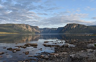
Gros Morne National Park is a Canadian national park and World Heritage Site located on the west coast of Newfoundland. At 1,805 km2 (697 sq mi), it is the second largest national park in Atlantic Canada after Torngat Mountains National Park, which has an area of 9,700 km2 (3,700 sq mi).
St. Barbe is a defunct provincial electoral district for the House of Assembly of Newfoundland and Labrador, Canada. As of 2011, there were 7,064 eligible voters living within the district. The district was abolished in 2015 and replaced by St. Barbe-L'Anse aux Meadows.

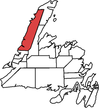
The Great Northern Peninsula is the largest and longest peninsula of Newfoundland, Canada, approximately 270 km long and 90 km wide at its widest point and encompassing an area of 17,483 km2. It is defined as that part of Newfoundland from Bonne Bay northwards around Cape Norman and Cape Bauld and thence southwards to the head of White Bay, bounded by the Gulf of St. Lawrence on the west, the Strait of Belle Isle on the north and the Labrador Sea and White Bay on the east.
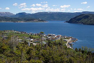
Woody Point is a town located in the heart of Gros Morne National Park, on the western coast of Newfoundland. Situated on Bonne Bay, the Town of Woody Point encompasses three areas: Curzon Village, Woody Point and Winterhouse Brook. It has a total population of 244 residents. Woody Point is a Registered Heritage District and has a waterfront with many heritage buildings and four Registered Newfoundland and Labrador Heritage Structures. The community is served by Route 431.

Trout River is a small rural fishing town located on the southern coastal edge of Gros Morne National Park in Newfoundland, near the Tablelands. Trout River was settled in 1815 by George Crocker and his family, who were its only inhabitants until 1880. The community is served by Route 431.
Bakers Brook is a former Canadian fishing settlement on Bonne Bay, on the island of Newfoundland, in the Canadian province of Newfoundland and Labrador.
The Humber Valley is a region in the western part of the island of Newfoundland. The Humber Valley is formed by the Humber River.

Route 330, also known as Road to the Shore or more commonly Gander Bay Road, is a highway that extends from Gander, Newfoundland across "the loop" passing through towns such as Gander Bay South, Carmanville, Musgrave Harbour, and Lumsden to New-Wes-Valley. Here, the highway connects with Route 320, which continues "the loop" down the west shore of Bonavista Bay exiting back to the Trans-Canada Highway in Gambo.

Route 430 is a 413-kilometre-long (257 mi) paved highway that traverses the Great Northern Peninsula of Newfoundland in the Canadian province of Newfoundland and Labrador. The route begins at the intersection of Route 1 in Deer Lake and ends in St. Anthony. Officially known as the Great Northern Peninsula Highway, it has been designated as the Viking Trail since it is the main auto route to L'Anse aux Meadows, the only proven Viking era settlement in North America. It is the primary travel route in the Great Northern Peninsula and the only improved highway between Deer Lake and St. Anthony. It is the main access route to the Labrador Ferry terminal in St. Barbe.
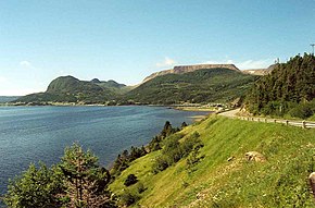
Lomond was a logging town in Newfoundland, Canada, located southeast of Woody Point near Bonne Bay. It developed out of the decline of the fishing industry in the area in the early 20th century and the rise of the logging and pulpwood industries. It was leveled for the creation of the Gros Morne National Park, all of its residents having been resettled as part of the Newfoundland government's general resettlement programme of the 1950s and 1960s. The park's Lomond campground is on the site of the town; by the end of the 20th century, the only structures there were park buildings.

Route 463, also known as Lourdes Road, is a rural highway in Newfoundland and Labrador that leads from Route 460 at Abraham's Cove to Cape St. George. It is situated entirely on the northern shore of the Port au Port Peninsula in Western Newfoundland and has an approximate length of 51.7 kilometres (32.1 mi). Along with Route 460, Route 463 also carries the designation of the French Ancestors Route.
Wiltondale is a settlement on western Newfoundland in the Canadian province of Newfoundland and Labrador. It is located at the intersection between Route 430 and Route 431.
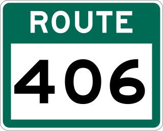
Route 406, also known as Codroy Road, is a highway on the western portion of Newfoundland in the Canadian province of Newfoundland and Labrador. It is a relatively short route, with its eastern terminus at Route 1 in the community of Doyles, and its western terminus at Cape Anguille. The route travels through the scenic Codroy Valley region.

Route 403 is a minor highway in the western region of Newfoundland in the Canadian province of Newfoundland and Labrador. The highway begins at a junction with the Trans-Canada Highway and continues to its northern terminus, the community of Journois.

Route 436, also known as L'Anse aux Meadows Road, is a 29.1-kilometre-long (18.1 mi) north-south highway on the Great Northern Peninsula of Newfoundland in the Canadian province of Newfoundland and Labrador. Its southern terminus is an intersection on Route 430, and its northern terminus is at L'Anse aux Meadows, a world-famous archaeological site.

Route 422, also known as Cormack Road, is a relatively short highway on western Newfoundland in the Canadian province of Newfoundland and Labrador. The route travels through its only community, Cormack, and to Sir Richard Squires Memorial Provincial Park.

Route 440 is a relatively short highway in the Canadian province of Newfoundland and Labrador, on the West Coast. The highway was named in honor of Admiral Hugh Palliser. The highway starts at an interchange at Route 1 in Corner Brook, and terminates at Cox's Cove. The speed limit is 80 km/h except in communities where the speed is reduced to 50 km/h.
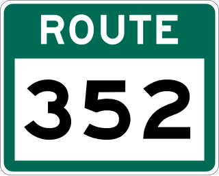
Route 352, also known as Fortune Harbour Road, is a 53.1-kilometre-long (33.0 mi) north-south highway on the northern coast of Newfoundland in the Canadian province of Newfoundland and Labrador. It connects the town of Northern Arm, at an intersection with Route 350, with the community of Fortune Bay, along with several other communities in between.
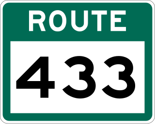
Route 433, also known as Englee Highway, is a 35.7-kilometre-long (22.2 mi) north–south highway on the Great Northern Peninsula of Newfoundland in the Canadian province of Newfoundland and Labrador. It connects the towns of Englee, Bide Arm, Roddickton, as well as Conche via Route 434, with Route 432 and Main Brook.

Route 490, also known as Stephenville Access Road and Katarina Roxon Way, is a 18.7-kilometre-long (11.6 mi) north–south highway on the western coast of Newfoundland in the Canadian province of Newfoundland and Labrador. It is one of two highways that connects the town of Stephenville with the Trans-Canada Highway, with the other being Route 460.