Route 230 is the main Bonavista Peninsula Highway, commencing from Route 1 at Thorburn Lake, about 10-15 kilometres north of Clarenville and proceeding all the way to Bonavista at the end of the Peninsula. The highway also carries the designation of Discovery Trail.

Route 340, also known as Road to the Isles, is a road in the Canadian province of Newfoundland and Labrador passing through the towns of Lewisporte, Summerford and Twillingate, all in The Isles of Notre Dame region of the province.

Route 330 Beaton Tulk Highway, also known as Road to the Shore or more commonly Gander Bay Road, is a highway that extends from Gander, Newfoundland across "the loop" passing through towns such as Gander Bay South, Carmanville, Musgrave Harbour, and Lumsden to New-Wes-Valley. Here, the highway connects with Route 320, which continues "the loop" down the west shore of Bonavista Bay exiting back to the Trans-Canada Highway in Gambo.
Route 210, also known as the Burin Peninsula Highway and Heritage Run, is a highway that extends through the Burin Peninsula from Goobies to Grand Bank, Newfoundland and Labrador. The maximum speed limit is 90 km/h except through communities and settlements where the speed limit is reduced to 50 km/h. Just after exiting Swift Current, until a few kilometres north of Marystown, much of the landscape is barren, with very few trees prevalent. After entering Marystown, motorists approach a junction where they could turn right to continue their journey on Route 210 until arriving at Grand Bank, or going straight onto Route 220 towards Burin and St. Lawrence. Marystown is the most populous community along the route.
Route 350, commonly known as Botwood Highway, is a side highway in Central Newfoundland that leads from the Trans-Canada Highway in Bishop's Falls to Botwood, Point Leamington and Leading Tickles. It is 70.7 kilometres (43.9 mi) in length and contains several side roads to communities located off the route, such as Peterview, and Route 352 that leads to Point of Bay and the Cottrell's Cove-Fortune Harbour area. Route 350-17 branches off in Point Leamington and connects the small community of Pleasantview to the main route. Route 350 continues on from Point Leamington for another 25 km north to Leading Tickles where the road officially ends. Along the way there is another short road connecting Glovers Harbour to the main route as well.

Route 342 in Newfoundland and Labrador leads from Route 341 in Lewisporte to Embree and then to Little Burnt Bay, all on the island of Newfoundland. The highway also acts as the main road in all three towns and links them together.

Route 430 is a 413-kilometre-long (257 mi) paved highway that traverses the Great Northern Peninsula of Newfoundland in the Canadian province of Newfoundland and Labrador. The route begins at the intersection of Route 1 in Deer Lake and ends in St. Anthony. Officially known as the Great Northern Peninsula Highway, it has been designated as the Viking Trail since it is the main auto route to L'Anse aux Meadows, the only proven Viking era settlement in North America. It is the primary travel route in the Great Northern Peninsula and the only improved highway between Deer Lake and St. Anthony. It is the main access route to the Labrador Ferry terminal in St. Barbe.

Route 410, also known as Dorset Trail, is an 89.9-kilometre-long (55.9 mi) north-south highway on the northern coast of Newfoundland in the Canadian province of Newfoundland and Labrador. It leads from Sheppardville, at Route 1, to a dead end in Fleur de Lys, Newfoundland and Labrador. Route 410 serves as the primary roadway access on-and-off the Baie Verte Peninsula. Baie Verte is the most populous community along the route.

Route 232 is a provincial highway in the province of Newfoundland and Labrador with the western terminus at George's Brook, where it intersects with Route 230A. The eastern terminus is at the community of Burgoyne's Cove, where the road reaches a cul-de-sac. It roughly follows the north shore of Smith Sound for the entire route.
Route 201 is a provincial road in the Canadian province of Newfoundland and Labrador. It is one of only three loop roads designated with a route number that starts and ends at the Trans-Canada Highway. The road spans 28 kilometres (17 mi), and allows for a scenic journey along the southern coast of Trinity Bay. There are quite a number of summer cottages along the route, and highway is known for an abundance of ospreys during the summer months.

Route 470, also known as La Poile Highway, is a highway on the West Coast of the Canadian province of Newfoundland and Labrador. It is the last provincial highway off Route 1 before approaching the Marine Atlantic Ferry to Nova Scotia, in Channel-Port aux Basques. The route is 42.8 kilometres (26.6 mi) in length. During much of the journey, there is plenty of barren land on both sides of the road, until arriving at its final community, Rose Blanche. Route 470 also carries the designation of Granite Coast Scenic Drive.

Route 420, also known as White Bay South Highway, is a 67.7-kilometre-long (42.1 mi) north-south highway located in the western region of Newfoundland in the Canadian province of Newfoundland and Labrador. It starts at its southern terminus at an intersection on the Trans-Canada Highway, near Sandy Lake, and ends at its northern terminus, the town of Jackson's Arm, passing through several other communities in between.
Route 413 is a highway on the Baie Verte Peninsula of Newfoundland in the Canadian province of Newfoundland and Labrador. It is a short route, running from a junction at Route 410 and ending at its eastern terminus at Middle Arm.

Route 220 is the southern portion of the Heritage Run in the Canadian province of Newfoundland and Labrador, running along the southern and western coastlines of the Burin Peninsula of Newfoundland. It is a loop road, running due south from the town of Marystown and continues until the town of Grand Bank where it transitions into Route 210 - and vice versa. The speed limit along much of Route 220 is 80 km/h, except in communities where the speed limit is reduced to 50 km/h.
Route 204, also known as Southwest Arm Road, is a 30.5-kilometre-long (19.0 mi) east–west highway on the island of Newfoundland in the province of Newfoundland and Labrador. It connects the communities along the southern shore of the Southwest Arm of Trinity Bay with the Trans-Canada Highway at North West Brook. It is a very curvy two-lane highway traversing very hilly terrain for its entire length.

Route 221, also known as Burin Road, is a 15.9-kilometre-long (9.9 mi) east–west highway on the Burin Peninsula of the island of Newfoundland in the province of Newfoundland and Labrador. It connects Fox Cove-Mortier with Port au Bras, Burin, and Route 220.
Route 352, also known as Fortune Harbour Road, is a 53.1-kilometre-long (33.0 mi) north-south highway on the northern coast of Newfoundland in the Canadian province of Newfoundland and Labrador. It connects the town of Northern Arm, at an intersection with Route 350, with the community of Fortune Bay, along with several other communities in between.

Route 411, also known as Purbeck's Cove Road, is a 27.7-kilometre-long (17.2 mi) east–west highway on the Baie Verte Peninsula of Newfoundland in the Canadian province of Newfoundland and Labrador. It connects the town of Westport, along with the community of Purbeck's Cove, with Route 410, serving as the only road access to these aforementioned settlements.
Route 433, also known as Englee Highway, is a 35.7-kilometre-long (22.2 mi) north–south highway on the Great Northern Peninsula of Newfoundland in the Canadian province of Newfoundland and Labrador. It connects the towns of Englee, Bide Arm, Roddickton, as well as Conche via Route 434, with Route 432 and Main Brook.
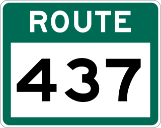
Route 437, also known as Cape Onion Road, is a 22.1-kilometre-long (13.7 mi) north-south highway on the northern edge of the Great Northern Peninsula of Newfoundland in the Canadian province of Newfoundland and Labrador. It connects the communities of Cape Onion-Ship Cove and Raleigh, along with Pistolet Bay Provincial Park, with Route 436 and St. Anthony.
