
Humber East is a former provincial electoral district for the House of Assembly of Newfoundland and Labrador, Canada.

State Route 42 (SR 42) is a 115.3-mile-long (185.6 km) state highway that runs southeast-to-northwest through portions of Peach, Crawford, Monroe, Butts, Henry, Clayton, and DeKalb counties in the central and north-central parts of the U.S. state of Georgia. The route connects Byron with the Atlanta metropolitan area, via Forsyth, McDonough, and Forest Park.
Route 1 is a highway in the Canada province of Newfoundland and Labrador, and is the easternmost stretch of the Trans-Canada Highway. Route 1 is the primary east–west road on the island of Newfoundland.

State Route 10 (SR 10) is a 172.3-mile-long (277.3 km) state highway in the U.S. state of Georgia. It travels from Downtown Atlanta to the South Carolina state line in Augusta. This highway, along with U.S. Route 78 (US 78), connect three of the biggest metro areas of the state together: Atlanta, Athens, and Augusta. It travels concurrently with US 78 in three sections: from Atlanta to Druid Hills; from near Stone Mountain to near Athens; and from Athens to its eastern terminus, for a total of 149.2 miles (240.1 km), or approximately 86.6 percent of its route.

U.S. Route 50 is a major east–west route of the U.S. Highway system, stretching just over 3,000 miles (4,800 km) from Ocean City, Maryland, on the Atlantic Ocean to West Sacramento, California. In the U.S. state of Maryland, US 50 exists in two sections. The longer of these serves as a major route connecting Washington, D.C. with Ocean City; the latter is the eastern terminus of the highway. The other section passes through the southern end of Garrett County for less than 10 miles (16 km) as part of the Northwestern Turnpike, entering West Virginia at both ends. One notable section of US 50 is the dual-span Chesapeake Bay Bridge across the Chesapeake Bay, which links the Baltimore–Washington metropolitan area with the Eastern Shore region, allowing motorists to reach Ocean City and the Delaware Beaches.
Route 2, also known as Pitts Memorial Drive and Peacekeeper's Way, is a 34.2-kilometre-long (21.3 mi) freeway on the Avalon Peninsula of Newfoundland in the Canadian province of Newfoundland and Labrador. The road provides a direct link from the Trans-Canada Highway (TCH) to downtown St. John's, Newfoundland, which was previously accessible only via city streets such as Topsail Road or Kenmount Road. Initially called the Harbour Arterial, construction began in the early 1970s and was completed in 1979. The $52-million project was funded by the federal and provincial governments. It was renamed by the city council in 1984 after local businessman James Stewart Pitt (1847-1914).
Route 50, also known as Thorburn Road and St. Thomas Line, is a 20.2-kilometre-long (12.6 mi) east-west highway on the Avalon Peninsula of Newfoundland in the Canadian province of Newfoundland and Labrador. It extends from the city of St. John's west to Paradise.
Route 210, also known as the Burin Peninsula Highway and Heritage Run, is a highway that extends through the Burin Peninsula from Goobies to Grand Bank, Newfoundland and Labrador. The maximum speed limit is 90 km/h except through communities and settlements where the speed limit is reduced to 50 km/h. Just after exiting Swift Current, until a few kilometres north of Marystown, much of the landscape is barren, with very few trees prevalent. After entering Marystown, motorists approach a junction where they could turn right to continue their journey on Route 210 until arriving at Grand Bank, or going straight onto Route 220 towards Burin and St. Lawrence. Marystown is the most populous community along the route.

Route 430 is a 413-kilometre-long (257 mi) paved highway that traverses the Great Northern Peninsula of Newfoundland in the Canadian province of Newfoundland and Labrador. The route begins at the intersection of Route 1 in Deer Lake and ends in St. Anthony. Officially known as the Great Northern Peninsula Highway, it has been designated as the Viking Trail since it is the main auto route to L'Anse aux Meadows, the only proven Viking era settlement in North America. It is the primary travel route in the Great Northern Peninsula and the only improved highway between Deer Lake and St. Anthony. It is the main access route to the Labrador Ferry terminal in St. Barbe.
Route 232 is a provincial highway in the province of Newfoundland and Labrador with the western terminus at George's Brook, where it intersects with Route 230A. The eastern terminus is at the community of Burgoyne's Cove, where the road reaches a cul-de-sac. It roughly follows the north shore of Smith Sound for the entire route.
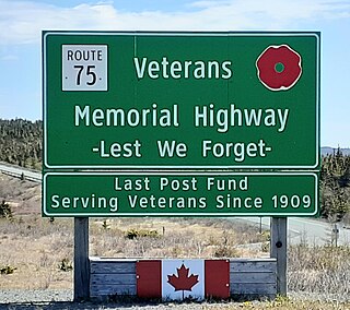
Route 75, also known as Veterans Memorial Highway, is a two-lane expressway on the Avalon Peninsula of Newfoundland. The route begins at a trumpet interchange with Route 1 and continues north, bypassing communities along the western shore of Conception Bay until it ends at a junction with Route 70 south of Carbonear. Construction of the highway was completed in 2012.
Route 10, also known as the eastern portion of the Irish Loop Drive and the Southern Shore Highway, is a 173-kilometre (107 mi) uncontrolled-access highway in Newfoundland and Labrador. Its southern terminus is at Route 90 in St. Vincent's-St. Stephen's-Peter's River, and its northern terminus is at Route 2 and The Parkway in St. John's. The route is in Division No. 1 and winds along the southern and eastern coasts of Avalon Peninsula on the island of Newfoundland.
Route 390, also known as Springdale Road, is a highway in the central portion of Newfoundland in the Canadian province of Newfoundland and Labrador. It is a very short route, running for only 11.0 kilometres (6.8 mi), with its only community, Springdale, as its terminus. Its branch routes, Route 391 and Route 392, run for a much longer distance.
Route 370, also known as the Buchans Highway, is a 73-kilometre-long (45 mi) east-west highway in the central portion of Newfoundland in the Canadian province of Newfoundland and Labrador. Its eastern terminus is the intersection at the Trans-Canada Highway in the Town of Badger, and the route ends at the Town of Buchans.
Route 100 is a major highway in Newfoundland and Labrador. The highway begins at its northern terminus at the Trans-Canada Highway in the town of Whitbourne, runs for 108 kilometres (67 mi) until it ends at its southern terminus, the town of Branch, where it transitions into Route 92. Motorists can drive along the coast of Placentia Bay and eventually the Atlantic Ocean once traveling south of Point Verde.
Route 220 is the southern portion of the Heritage Run in the Canadian province of Newfoundland and Labrador, running along the southern and western coastlines of the Burin Peninsula of Newfoundland. It is a loop road, running due south from the town of Marystown and continues until the town of Grand Bank where it transitions into Route 210 - and vice versa. The speed limit along much of Route 220 is 80 km/h, except in communities where the speed limit is reduced to 50 km/h.
Route 440 is a relatively short highway in the Canadian province of Newfoundland and Labrador, on the West Coast. The highway was named in honor of Admiral Hugh Palliser. The highway starts at an interchange at Route 1 in Corner Brook, and terminates at Cox's Cove. The speed limit is 80 km/h except in communities where the speed is reduced to 50 km/h.
Route 80, also known as Trinity Road, is a 105-kilometre-long (65 mi) north–south highway along the Avalon Peninsula of Newfoundland. It connects the communities along the eastern side of Trinity Bay with the Trans Canada Highway (TCH).
Route 230A, also known as Old Bonavista Highway, is a 16.2-kilometre-long (10.1 mi) alternate route of Route 230 at the southwestern corner of the Bonavista Peninsula on the island of Newfoundland. It represents the former route of Route 230 through Clarenville, Milton, and George's Brook.
