
Eastport is a long-popular Newfoundland vacation destination on the Eastport Peninsula. Eastport is located on the north-eastern border of Terra Nova National Park and is known for its sandy beaches, scenery and traditional Newfoundland outport heritage.

Baranof Warm Springs is a small, primarily seasonally-occupied community located in the city and borough of Sitka, Alaska, on the eastern side of Baranof Island, from which it likely derives its name, in the Alexander Archipelago. It is occasionally referred to simply as Baranof. Baranof Warm Springs is located at 57°05′22″N134°49′59″W.

Blue Knob State Park is a 6,128-acre (2,480 ha) Pennsylvania state park in Kimmel, Lincoln, and Pavia townships in Bedford County, Pennsylvania, in the United States. The average annual snowfall at the park is about 12 feet (370 cm). The park is named for Blue Knob, the second highest mountain in Pennsylvania at 3,146 feet (959 m). It is the location of Blue Knob All Seasons Resort, the ski slope in Pennsylvania with the highest elevation. Blue Knob State Park is just off Interstate 99 on Pennsylvania Route 869 west of Pavia.
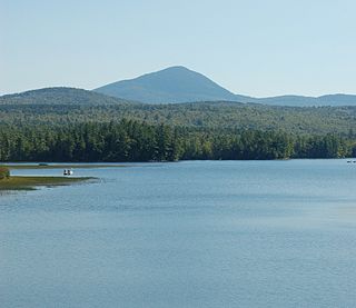
Mount Blue is a mountain in Maine, USA. It is a hiking destination with outstanding views from the observation deck of a tower at the summit. Its name is shared with Mount Blue State Park in Weld and Mount Blue High School in Farmington.
The Crystal Lake Recreation Area is located in the San Gabriel Mountains of Southern California, administered by the San Gabriel Mountains National Monument of the United States Forest Service. The Recreation Area consists of a small lake, an open-air amphitheater, a large public campground containing approximately 120 camp sites grouped into "loops," and a group campground called Deer Flats which consists of approximately 25 camp sites. The Recreation Area contains a United States Forest Service visitor center and a cafe which is open to the public from dawn to dusk except for Tuesdays when the cafe is closed. Within the Recreation Area are 16 hiking and nature trails which are well-maintained by volunteers who work under the direction of the Forest Service. The Recreation Area is located approximately 26 miles (42 km) north on Hwy. 39 heading out of Azusa, California at the headwaters of the north fork of the San Gabriel River at an elevation approximately 5,539 feet above sea level. Crystal Lake is the only naturally occurring lake in the San Gabriel Mountains.

Trout River is a small rural fishing town located on the southern coastal edge of Gros Morne National Park in Newfoundland, near the Tablelands. Trout River was settled in 1815 by George Crocker and his family, who were its only inhabitants until 1880. The community is served by Route 431.
Gooseberry Cove is a settlement in the Trinity Bay area of Newfoundland located on an area of land known as the Southwest Arm, which extends off the Trans Canada Highway on Route 204. It is neighbored by the communities of Butter Cove and Southport.

Robinsons is a village in the Bay St. George area of the Canadian province of Newfoundland and Labrador. "Robinson's Head" has been on maps since about 1798. The headland and community were named after John Robinson from Ireland who lived in a cave in Robinson's Head. "Robinson's Station" about two miles from the original village came into being after the railway was constructed in the late 1890s and people, mainly those working at railway maintenance, settled in the area where the local road intersected the railway. The name "Robinson's Station" became simply "Robinson's" on October 1, 1960. Robinson's had a population of 299 in 1956. "Modern" Robinsons consists of the original Robinson's Head settlement (Robinsons), Robinsons Station, and Robinsons Junction. For census purposes, all three are counted under the "Robinsons" name. The community is located along Route 404.

Pippy Park is a 3,400-acre (14 km2) urban park located in the city of St. John's, Newfoundland. The park is a popular camping, hiking and recreational park within the city, and incorporates numerous groomed and wilderness-style hiking/skiing trails, a miniature golf course, a 9-hole and an 18-hole golf course, a driving range, and a public access trailer park with limited tent camping facilities. Trails within the park link to the Grand Concourse walking trails.

The East Coast Trail (ECT) is a long-distance coastal footpath located in the Canadian province of Newfoundland and Labrador. It is a developed trail over 336 kilometres (209 mi) long, the creation of which began in 1994. It is made up of 25 linked wilderness paths and passes through more than 30 communities. It was named one of the best adventure destinations by National Geographic in 2012 and is extended and improved yearly.

The Brooks Woodland Preserve is a 558-acre (226 ha) open space preserve located in Petersham, Massachusetts. The property, named after industrialist and diplomat James Wilson Brooks, is managed by the land conservation non-profit organization The Trustees of Reservations and offers 13 miles (21 km) of trails and primitive woods roads available for hiking, horseback riding, and cross country skiing. Second growth forest, overgrown farm fields, granite ledges, historic stone walls, creeks, and rolling hills characterize the preserve.
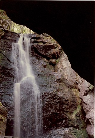
Royalston Falls is a 50 foot (15 m) waterfall and granite gorge located in Royalston, Massachusetts along Falls Brook, a tributary of the Tully River which in turn is a tributary of the Millers River. The falls are part of a 217-acre (88 ha) open space preserve acquired in 1951 by the land conservation non-profit organization The Trustees of Reservations. The 22-mile (35 km) Tully Trail and the 235-mile (378 km) New England National Scenic Trail pass through the property.
Bearpen Mountain is a mountain located in the Catskill Mountains of New York. The mountain's highest peak is in Greene County, but its northwest subpeak at 42°16.42′N74°29.05′W is the highest point in Delaware County at 3,520 ft. Bearpen Mountain is flanked to the north by Roundtop, and to the southeast by Vly Mountain.

Brace Mountain is the peak of a ridge in the southern Taconic Mountains, near the tripoint of the U.S. states of New York, Connecticut and Massachusetts. Its 2,311-foot (704 m) main summit is located in New York; it is the highest point in that state's Dutchess County.
Port au Port Bay located on the west coast of the Island of Newfoundland formed by a long narrow point of land of the Port au Port Peninsula and the area of Newfoundland known as the Lewis Hills, in the Canadian province of Newfoundland and Labrador.
The Highlands is a coastal community located south west of Stephenville, on Bay St. George, Newfoundland. The former Way Office was established in 1881, where The first Waymaster was John MacPherson in 1892 and Margaret MacPherson in 1897. Once a thriving agricultural and fishing community, Highlands is situated at the end of the Cormack Trail. Home to families of Scottish and Irish descent, the community has been home to an active Catholic congregation.
Poke-O-Moonshine Mountain, spelled Pokamoonshine on U.S. Geological Survey maps, and sometimes known as just Poke-O, is a minor peak of the Adirondack Mountains. The name is believed to be a corruption of the Algonquin words pohqui, meaning 'broken', and moosie, meaning 'smooth'. It is located in the town of Chesterfield, New York, United States, on New York state Forest Preserve land, part of the Taylor Pond Wild Forest complex within the Adirondack Park. Due to its location next to the pass through which most travelers from the north enter the range, it has been called the "gateway to the Adirondacks".
The San Gabriel Mountains Trailbuilders (SGMTBs) is a 501(c)(3) non-profit volunteer organization which performs hiking and nature trail building and maintenance within the Los Angeles Gateway District of the United States Forest Service which maintains the Angeles National Forest within the San Gabriel Mountains.

Division No. 1, Subdivision G is an unorganized subdivision on the Avalon Peninsula in Newfoundland and Labrador, Canada. It is in Division 1 and contains the unincorporated communities of Baccalieu Island, Besom Cove, Bradley's Cove, Burnt Point, Caplin Cove, Daniel's Cove, Grates Cove, Gull Island, Job's Cove, Kingston, Long Beach, Lower Island Cove, Low Point, Northern Bay, Ochre Pit Cove, Red Head Cove, Riverhead, Smooth Cove and Western Bay.
Van Loan Hill is a mountain in Greene County, New York. It is located in the Catskill Mountains southwest of Maplecrest. Round Hill is located west, Elm Ridge is located north-northeast, and East Jewett Range is located south of Van Loan Hill.

