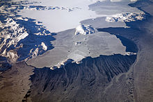
The Prince Charles Mountains are a major group of mountains in Mac. Robertson Land in Antarctica, including the Athos Range, the Porthos Range, and the Aramis Range. The highest peak is Mount Menzies, with a height of 3,228 m (10,591 ft). Other prominent peaks are Mount Izabelle and Mount Stinear. These mountains, together with other scattered peaks, form an arc about 420 km (260 mi) long, extending from the vicinity of Mount Starlight in the north to Goodspeed Nunataks in the south.
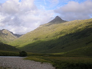
Sgùrr na Cìche is a mountain in Knoydart, in the Northwest Highlands of Scotland. It lies on the edge of Knoydart in an area known as the Rough Bounds of Knoydart.

Bear Glacier Provincial Park is a provincial park in British Columbia, Canada. The park is 542 ha in size and was established, effective 11 May 2000, by the Nisga'a Treaty, Appendix G-3.
The Stikine Ranges are a group of mountain ranges and mountainous plateaus in northwestern British Columbia, Canada. They are the northernmost subdivision of the Cassiar Mountains and among the least explored and most undeveloped parts of the province.

Fort Napoléon is a fortification, located on Terre-de-Haut Island, in the Îles des Saintes, Guadeloupe. Property of the Departmental Council of Guadeloupe, it has been classified as a historical monument since the December 15, 1997.
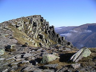
Sgòr Gaoith is a mountain peak in the far western massif of the Cairngorms in the Scottish Highlands. It is 1,118 metres (3,668 ft) high, and is the highest point on a long north-south ridge. The ridge is separated from the Braeriach massif to the east by Glen Eanaich and Loch Eanaich.
CHET-FM is a Canadian radio station that broadcasts a community/campus format at 94.5 FM in Chetwynd, British Columbia. The station is owned by the Chetwynd Communications Society. CHET-FM and its television sister share studios on North Access Road in downtown Chetwynd.
Mghart is a town in the Lori Province of Armenia. As of 2001, it has a population of 523.
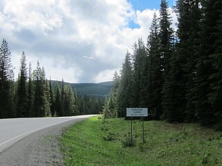
Monashee Pass, 1,189 m (3,901 ft), is a mountain pass in the Monashee Mountains of the Southern Interior of British Columbia, Canada. Located southeast of Cherryville, the pass is used by British Columbia Highway 6 connecting Vernon to Nakusp on Arrow Lake, and beyond to the cities of the West Kootenay. It is the "prominence col" for Big White Mountain, which is the highest mountain to its southwest.
Wedge Pass, also known as Billygoat Pass, 1430 m (4692 ft), is a mountain pass in the northern Garibaldi Ranges, the southwesternmost subdivisions of the Pacific Ranges of the Coast Mountains in British Columbia, Canada. Located immediately on the southern flank of Wedge Mountain and to the immediate north of the Spearhead Range, site of the Blackcomb half of the Whistler Blackcomb Ski Area, it connects the head of Wedge Creek (W), a tributary of the Green River with those of Billgoat Creek (E), a tributary of the Lillooet River. The pass is within Garibaldi Provincial Park and has no road access.
The Tottenham Range is a small mountain range in southwestern British Columbia, Canada, located between Seymour Inlet and at the head of Belize Inlet. It has an area of 46 km2 and is a subrange of the Pacific Ranges which in turn form part of the Coast Mountains.
Chavdar Peninsula is a 10 kilometres (6.2 mi) wide peninsula projecting 13 kilometres (8.1 mi) in northwest direction from Graham Land on the Antarctic Peninsula in Antarctica.
The Cayley Glacier is a glacier flowing northwest into the south side of Brialmont Cove, on the west coast of Graham Land, Antarctica.
Sjögren Glacier is a glacier 15 nautical miles long in the south part of Trinity Peninsula, Antarctica. It flows southeast from Detroit Plateau to the south side of Mount Wild, where it enters Prince Gustav Channel.
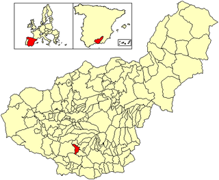
El Valle is a municipality in the province of Granada, Spain. As of 2010, it has a population of 1130 inhabitants.
Zavera Snowfield is the glacier extending 18 kilometres (11 mi) in a north-south direction and 16 kilometres (9.9 mi) in an east-west direction on southern Trinity Peninsula in Graham Land, Antarctica. It is located in the northeast foothills of Detroit Plateau, south of Diplock Glacier, north of Mount Wild and northeast of Kopito Ridge. It drains into Prince Gustav Channel in Weddell Sea. The glacier is named after the Bulgarian liberation uprising of ‘Velchova Zavera’ in 1835.

The Little Dragoon Mountains, are included in the Douglas Ranger District of Coronado National Forest, in Cochise County, Arizona.
Mount Jacobsen, 3031 m, is a mountain in the northernmost Pacific Ranges of the Coast Mountains in the Central Coast region of British Columbia, Canada, located to the south of the Bella Coola Valley and immediately south of Ape Lake, to the west of the valley of the Talchako River.
Roxanna is an unincorporated community in Greene County, in the U.S. state of Ohio.

