Route 1 is a highway in the Canada province of Newfoundland and Labrador, and is the easternmost stretch of the Trans-Canada Highway. Route 1 is the primary east–west road on the island of Newfoundland.
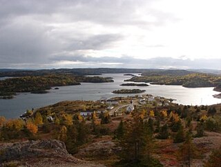
Pilley's Island is a town located on the island of the same name in the Canadian province of Newfoundland and Labrador. It is located in Division No. 8, Newfoundland and Labrador.

Route 340, also known as Road to the Isles, is a road in the Canadian province of Newfoundland and Labrador passing through the towns of Lewisporte, Summerford and Twillingate, all in The Isles of Notre Dame region of the province.
Route 210, also known as the Burin Peninsula Highway and Heritage Run, is a highway that extends through the Burin Peninsula from Goobies to Grand Bank, Newfoundland and Labrador. The maximum speed limit is 90 km/h except through communities and settlements where the speed limit is reduced to 50 km/h. Just after exiting Swift Current, until a few kilometres north of Marystown, much of the landscape is barren, with very few trees prevalent. After entering Marystown, motorists approach a junction where they could turn right to continue their journey on Route 210 until arriving at Grand Bank, or going straight onto Route 220 towards Burin and St. Lawrence. Marystown is the most populous community along the route.
Route 350, commonly known as Botwood Highway, is a side highway in Central Newfoundland that leads from the Trans-Canada Highway in Bishop's Falls to Botwood, Point Leamington and Leading Tickles. It is 70.7 kilometres (43.9 mi) in length and contains several side roads to communities located off the route, such as Peterview, and Route 352 that leads to Point of Bay and the Cottrell's Cove-Fortune Harbour area. Route 350-17 branches off in Point Leamington and connects the small community of Pleasantview to the main route. Route 350 continues on from Point Leamington for another 25 km north to Leading Tickles where the road officially ends. Along the way there is another short road connecting Glovers Harbour to the main route as well.

Route 480, also known as Burgeo Highway or The Burgeo Road, is a 150-kilometre-long (93 mi) north-south on southwestern Newfoundland in the Canadian province of Newfoundland and Labrador. It connects the town of Burgeo with the Trans-Canada Highway. The highway is a winding two-lane highway traveling through remote, hilly, and wooded terrain for its entire length. There are no other communities of any kind along the highway, with the only other intersections being abandoned logging roads. Route 480 also provides access to Sandbanks Provincial Park and ferries to the remote outports of Ramea, Grey River and Francois at its southern terminus. There are also several vacation/hunting camps along Route 480, including Peter Strides.

Route 232 is a provincial highway in the province of Newfoundland and Labrador with the western terminus at George's Brook, where it intersects with Route 230A. The eastern terminus is at the community of Burgoyne's Cove, where the road reaches a cul-de-sac. It roughly follows the north shore of Smith Sound for the entire route.

Route 470, also known as La Poile Highway, is a highway on the West Coast of the Canadian province of Newfoundland and Labrador. It is the last provincial highway off Route 1 before approaching the Marine Atlantic Ferry to Nova Scotia, in Channel-Port aux Basques. The route is 42.8 kilometres (26.6 mi) in length. During much of the journey, there is plenty of barren land on both sides of the road, until arriving at its final community, Rose Blanche. Route 470 also carries the designation of Granite Coast Scenic Drive.
Route 382, also known as Long Island Tickle Road, is a highway in the central portion of Newfoundland in the Canadian province of Newfoundland and Labrador, branching off Route 380 in the town of Pilley's Island. The route is the only provincial route with no communities prevalent – it is designed as an access to the Lushes Bight–Beaumont–Beaumont North ferry. The maximum speed limit for much of Route 382 is 60 km/h, but is reduced to 30 km/h when approaching the ferry.
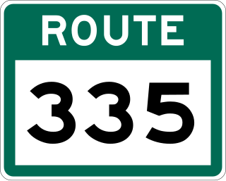
Route 335, also known as Farewell Road, is a highway in the northern portion of Newfoundland in the Canadian province of Newfoundland and Labrador. The highway's southern terminus is at the junction at Route 331 near the community of Horwood, and its northern terminus is the community of Farewell, a community where the Fogo Island and Change Islands ferries, served by the MV Veteran, depart or arrive.

Route 92, also known as North Harbour-Branch Highway, is a 51.9-kilometre-long (32.2 mi) highway on the Avalon Peninsula of the Canadian province of Newfoundland and Labrador. Its northern terminus is an intersection at Route 91, near the town of Colinet, and its southern terminus is at the town of Branch, where the route transitions into Route 100.

Route 420, also known as White Bay South Highway, is a 67.7-kilometre-long (42.1 mi) north-south highway located in the western region of Newfoundland in the Canadian province of Newfoundland and Labrador. It starts at its southern terminus at an intersection on the Trans-Canada Highway, near Sandy Lake, and ends at its northern terminus, the town of Jackson's Arm, passing through several other communities in between.
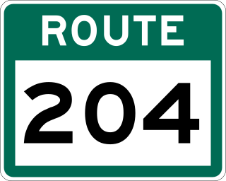
Route 204, also known as Southwest Arm Road, is a 30.5-kilometre-long (19.0 mi) east–west highway on the island of Newfoundland in the province of Newfoundland and Labrador. It connects the communities along the southern shore of the Southwest Arm of Trinity Bay with the Trans-Canada Highway at North West Brook. It is a very curvy two-lane highway traversing very hilly terrain for its entire length.

Route 212, also known as Bay L’Argent Road, is a 30.2-kilometre-long (18.8 mi) north–south highway on the Burin Peninsula of the island of Newfoundland in the Canadian province of Newfoundland and Labrador. It connects several communities along the northeastern corner of Fortune Bay with Route 210.
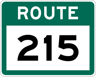
Route 215, also known as Petit Forte Road, is a 26.6-kilometre-long (16.5 mi) east–west highway on the Burin Peninsula of the island of Newfoundland in the province of Newfoundland and Labrador. It connects the towns of Boat Harbour, Brookside, and Petit Forte with Route 210.
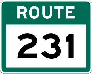
Route 231, also known as Random Island Road, is a 33.6-kilometre-long (20.9 mi) east–west highway in the Canadian province of Newfoundland and Labrador. It serves as the only road connection between Newfoundland and Random Island.

Route 363, also known as Coomb's Cove Road, is a 18.4-kilometre-long (11.4 mi) east–west highway on the Connaigre Peninsula of the island of Newfoundland. It is located entirely with the town of St. Jacques-Coomb's Cove, connecting the communities on the western half of town with Route 362.
Route 364, also known as Hermitage River Road, is a 37.4-kilometre-long (23.2 mi) north–south highway on the Connaigre Peninsula of the island of Newfoundland. It connects the towns of Seal Cove and Hermitage-Sandyville with Route 360.

Route 381, also known as Port Anson Road, is a 15.3-kilometre-long (9.5 mi) north–south highway in northern Newfoundland in the Canadian province of Newfoundland and Labrador. It serves as the only road connection to the communities on Sunday Cove Island.
Route 438, also known as Croque Road, is a 28.8-kilometre-long (17.9 mi) east–west highway on the Great Northern Peninsula of Newfoundland in the Canadian Province of Newfoundland and Labrador. It connects the communities of Croque and St. Julien's with Route 432 and the town of Main Brook. The entire length of Route 438 is a narrow, winding, gravel road.
