Newfoundland and Labrador Route 230

Last updated

NL Route 230.svg

Route 230

Bonavista Peninsula Highway
Discovery Trail
Route information
Maintained by Newfoundland and Labrador Department of Transportation and Infrastructure
Length110 km (68 mi)
Major junctions
South endNL TCH sign.svg Route 1 (TCH) near Thorburn Lake [1]
Major intersections
North endNL Route 235.svg Route 235 in Bonavista [11]
Location
Country Canada
Province Newfoundland and Labrador
Highway system
    NL Route 222.svg Route 222 NL Route 230A.svg Route 230A

    Route 230 is the main Bonavista Peninsula Highway, commencing from Route 1 (the Trans Canada Highway) at Thorburn Lake, about 10-15 kilometres north of Clarenville and proceeding all the way to Bonavista at the end of the Peninsula. The highway also carries the designation of Discovery Trail.

    Contents

    Route description

    Route 230 begins a few kilometres northwest of Clarenville at an interchange with Route 1 (Trans-Canada Highway, Exit 26), just southeast of Thorburn Lake. It heads east to bypass Clarenville along its north side, where it meets Route 230A (Old Bonavista Highway) at the Clarenville Airport. The highway now heads northeast through rural areas to pass Morley's Siding and Lethbridge, where it has intersections with Route 233 (Clode Sound Road) and Route 234 (Winter Brook Road). Route 230 heads through rural areas for several more kilometres to pass through Southern Bay, where it meets a local road leading to Charleston and Sweet Bay as well as meeting the southern end of Route 235 (Bonavista Bay Highway). The highway heads through more rural terrain before entering the Trinity Bight area and beginning to follow the southern coastline of the peninsula at Lockston, where it also has an intersection with Route 239 (New Bonaventure Road). Route 230 has an intersection with Route 236 (Stock Cove Road) before passing through Port Rexton, where it meets a local road leading to Trinity East. The highway now passes through Champney's Arm, where it meets two local roads, one leading to Champney's West, and the other leading to Champney's East and English Harbour, before heading northeast through inland, rural, and hilly for the next several kilometres. Route 230 now heads north along the coast to pass through the town of Trinity Bay North, where it passes the communities of Melrose, Port Union, and Catalina, as well as where it meets Route 237 (Blackhead Bay Road). The highway now leaves Trinity Bay North and it meets a local road leading to Little Catalina before heading north through rural areas, where it has an intersection with Route 238 (Elliston Road). Route 230 now enters the Bonavista town limits along Confederation Drive, and heads north through neighbourhoods and business district to have another intersection with Route 238 (Coster Street) as Route 230 bypasses downtown along its west side. The highway passes through more neighbourhoods before making a sharp left turn and coming to an end shortly thereafter at another intersection with Route 235 (Church Street).

    As with most highways in Newfoundland and Labrador, the entire length of Route 230 is a two-lane highway.

    Major intersections

    LocationkmmiDestinationsNotes
    Thorburn Lake 0.00.0NL TCH sign.svg Route 1 (TCH)  Clarenville, Gander, Grand Falls-Windsor Exit 26 on Route 1; southern terminus
    11.47.1NL Route 230A.svg Route 230A south (Old Bonavista Highway) Shoal Harbour, Clarenville Northern terminus of Route 230A
    12.27.6Ontario M502.svg Clarenville Airport main entranceAccess road into airport
    Lethbridge 21.513.4NL Route 233.svg Route 233 west (Clode Sound Road) Bloomfield, Musgravetown Eastern terminus of Route 233
    25.615.9NL Route 234.svg Route 234 east (Winter Brook Road) Lethbridge, Brooklyn Western terminus of Route 234
    Southern Bay 38.824.1Sweet Bay Road (Route 230-14) - Charleston, Sweet Bay
    41.826.0NL Route 235.svg Route 235 north (Bonavista Bay Highway) Summerville, Plate Cove West Southern terminus of Route 235
    Lockston 62.338.7NL Route 239.svg Route 239 south (New Bonaventure Road) Trinity, Dunfield Northern terminus of Route 239
    Port Rexton 64.440.0NL Route 236.svg Route 236 north (Stock Cove Road) Knight's Cove, King's Cove Southern terminus of Route 236; provides access to Lockston Path Provincial Park
    65.640.8Rocky Hill Road (Route 230-15) - Trinity East
    66.641.4Champney's West Road (Route 230-17) - Champney's West
    Champney's Arm 67.742.1Champney's Arm Road (Route 230-19) - Champney's Arm
    68.242.4English Harbour Road (Route 230-21) - Champney's East, English Harbour
    Catalina 92.457.4NL Route 237.svg Route 237 west (Church Street) Amherst Cove Eastern terminus of Route 237; Blackhead Bay Road
    Little Catalina 95.159.1Little Catalina Road (Route 230-26) - Little Catalina
    10263NL Route 238.svg Route 238 north (Elliston Road) Elliston, Maberly Southern terminus of Route 238
    Bonavista 10968NL Route 238.svg Route 238 south (Coster Street) Elliston, Spillars Cove Northern terminus of Route 238
    11068NL Route 235.svg Route 235 (Church Street/Cape Shore Road) Newman's Cove, Summerville, Cape Bonavista, Cape Bonavista Light Northern terminus
    1.000 mi = 1.609 km; 1.000 km = 0.621 mi

    Related Research Articles

    <span class="mw-page-title-main">Interstate 680 (California)</span> Interstate highway in California

    Interstate 680 (I-680) is a north–south auxiliary Interstate Highway in Northern California. It curves around the eastern cities of the San Francisco Bay Area from San Jose to I-80 at Fairfield, bypassing cities along the eastern shore of San Francisco Bay such as Oakland and Richmond while serving others more inland such as Pleasanton and Concord.

    <span class="mw-page-title-main">Bonavista—Gander—Grand Falls—Windsor</span> Federal electoral district in Newfoundland and Labrador, Canada

    Bonavista—Gander—Grand Falls—Windsor was a federal electoral district in Newfoundland and Labrador, Canada, that was represented in the House of Commons of Canada from 2004 until 2015.

    <span class="mw-page-title-main">Trinity North</span> Former Canadian electoral district

    Trinity North was a provincial electoral district for the House of Assembly of Newfoundland and Labrador, Canada. As of 2011, there were 8,278 eligible voters living within the district.

    Route 1 is a highway in the Canada province of Newfoundland and Labrador, and is the easternmost stretch of the Trans-Canada Highway. Route 1 is the primary east–west road on the island of Newfoundland.

    Provincial Trunk Highway 9 is a provincial primary highway located in the Canadian province of Manitoba. It runs from Winnipeg north to Gimli.

    Provincial Trunk Highway 8 is a provincial primary highway located in the Canadian province of Manitoba. It runs from the north limit of the City of Winnipeg, where it meets with Route 180, north to Hecla-Grindstone Provincial Park. The highway between Winnipeg and PR 230 is known as McPhillips Street. At PR 230, McPhillips Street becomes McPhillips Road and continues along PR 230 to PTH 9. The route is a major road connecting Winnipeg with the communities of Winnipeg Beach and Gimli. The speed limit is 100 km/h (60 mph).

    <span class="mw-page-title-main">Newfoundland and Labrador Route 238</span> Highway in Newfoundland and Labrador, Canada

    Route 238, also known as Elliston Road, is a 12.2-kilometre-long (7.6 mi) north-south highway on the northeastern corner of the Bonavista Peninsula on the island of Newfoundland. It is one of very few highways in Newfoundland and Labrador that both begin and end at the same highway, this one being Route 230.

    <span class="mw-page-title-main">Newfoundland and Labrador Route 235</span> Highway in Newfoundland and Labrador, Canada

    Route 235, commonly called the Cabot Highway branches off from Route 230 at Southern Bay. Both Route 230 and Route 235 head towards Bonavista, Route 230 crossing the Bonavista Peninsula at this point to service towns on the Trinity Bay side of the Peninsula whilst Route 235 stays on the Bonavista Bay side of the Peninsula, going all the way to Cape Bonavista.

    <span class="mw-page-title-main">Newfoundland and Labrador Route 237</span> Highway in Newfoundland and Labrador, Canada

    Route 237 is a bypass road linking Catalina, Trinity Bay with Newman's Cove, Bonavista Bay. It is refer to as Church Street despite lack of signage as St. Peter's Anglican Church is located on the highway in Catalina.

    <span class="mw-page-title-main">Newfoundland and Labrador Route 236</span> Highway in Newfoundland and Labrador, Canada

    Route 236 is a bypass road linking Port Rexton, Trinity Bay with King's Cove and nearby towns on Bonavista Bay. It runs north–south across between the two towns.

    The Bonavista Peninsula is a large peninsula on the east coast of the island of Newfoundland in the Canadian province of Newfoundland and Labrador. It consists of 50 incorporated towns/unincorporated communities which have a population of 12,176 as of the 2016 Canadian Census. Bonavista is the largest population centre on the peninsula.

    <span class="mw-page-title-main">Newfoundland and Labrador Route 330</span> Highway in Newfoundland and Labrador, Canada

    Route 330, also known as Road to the Shore or more commonly Gander Bay Road, is a highway that extends from Gander, Newfoundland across "the loop" passing through towns such as Gander Bay South, Carmanville, Musgrave Harbour, and Lumsden to New-Wes-Valley. Here, the highway connects with Route 320, which continues "the loop" down the west shore of Bonavista Bay exiting back to the Trans-Canada Highway in Gambo.

    <span class="mw-page-title-main">Newfoundland and Labrador Route 232</span> Highway in Newfoundland and Labrador, Canada

    Route 232 is a provincial highway in the province of Newfoundland and Labrador with the western terminus at George's Brook, where it intersects with Route 230A. The eastern terminus is at the community of Burgoyne's Cove, where the road reaches a cul-de-sac. It roughly follows the north shore of Smith Sound for the entire route.

    <span class="mw-page-title-main">Newfoundland and Labrador Route 205</span> Highway in Newfoundland and Labrador

    Route 205, also known as Hatchet Cove Road, is a relatively short east-west highway on the island of Newfoundland in the Canadian province of Newfoundland and Labrador. It connects the communities along the northern shore of the Southwest Arm of Trinity Bay with Route 1. It is the last provincial route heading west along the Trans-Canada Highway before approaching the Town of Clarenville.

    <span class="mw-page-title-main">Newfoundland and Labrador Route 239</span> Highway in Newfoundland and Labrador

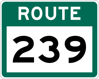
    Route 239 is a highway in the Trinity Bight portion of Newfoundland in the Canadian province of Newfoundland and Labrador. It is a short route, running from a junction at Route 230, starting at the community of Lockston and ending at the community of New Bonaventure.

    Route 230A, also known as Old Bonavista Highway, is a 16.2-kilometre-long (10.1 mi) alternate route of Route 230 at the southwestern corner of the Bonavista Peninsula on the island of Newfoundland. It represents the former route of Route 230 through Clarenville, Milton, and George's Brook.

    <span class="mw-page-title-main">Newfoundland and Labrador Route 231</span>

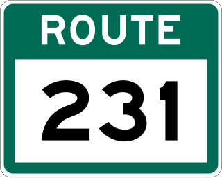
    Route 231, also known as Random Island Road, is a 33.6-kilometre-long (20.9 mi) east–west highway in the Canadian province of Newfoundland and Labrador. It serves as the only road connection between Newfoundland and Random Island.

    <span class="mw-page-title-main">Newfoundland and Labrador Route 233</span>

    Route 233, also known as Clode Sound Road, is a 32.1-kilometre-long (19.9 mi) east–west highway on the island of Newfoundland in the province of Newfoundland and Labrador. It connects the communities along the southern shores of Clode Sound and Goose Bay with Route 1 and Route 230.

    <span class="mw-page-title-main">Newfoundland and Labrador Route 234</span>

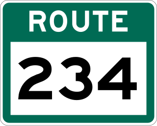
    Route 234, also known as Winter Brook Road, is a 17.5-kilometre-long (10.9 mi) east–west highway on the island of Newfoundland in the province of Newfoundland and Labrador. It is located along the Bonavista Peninsula, connecting Winter Brook with Lethbridge.

    References

    1. Google (August 5, 2017). "Route 1 intersection at Route 230 near Thorburn Lake" (Map). Google Maps . Google. Retrieved August 5, 2017.
    2. Google (August 5, 2017). "Route 230A intersection at Route 230 at Clarenville Airport" (Map). Google Maps . Google. Retrieved August 5, 2017.
    3. Google (August 5, 2017). "Route 233 intersection at Route 230 near Lethbridge" (Map). Google Maps . Google. Retrieved August 5, 2017.
    4. Google (August 5, 2017). "Route 234 intersection at Route 230 near Lethbridge" (Map). Google Maps . Google. Retrieved August 5, 2017.
    5. Google (August 5, 2017). "Route 235 intersection at Route 230 near Southern Bay" (Map). Google Maps . Google. Retrieved August 5, 2017.
    6. Google (August 5, 2017). "Route 239 intersection at Route 230 near Lockston" (Map). Google Maps . Google. Retrieved August 5, 2017.
    7. Google (August 5, 2017). "Route 236 intersection at Route 230 near Port Rexton" (Map). Google Maps . Google. Retrieved August 5, 2017.
    8. Google (August 5, 2017). "Route 237 intersection at Route 230 in Catalina" (Map). Google Maps . Google. Retrieved August 5, 2017.
    9. Google (August 5, 2017). "Route 238 intersection at Route 230 near Elliston" (Map). Google Maps . Google. Retrieved August 5, 2017.
    10. Google (February 16, 2020). "Route 238 intersection with Route 230 in Bonavista" (Map). Google Maps . Google. Retrieved February 16, 2020.
    11. Google (February 16, 2020). "Route 235 intersection at Route 230 in Bonavista" (Map). Google Maps . Google. Retrieved February 16, 2020.