Summerville, Newfoundland and Labrador

Last updated

Canada Newfoundland and Labrador location map 2.svg
Red pog.svg
Summerville

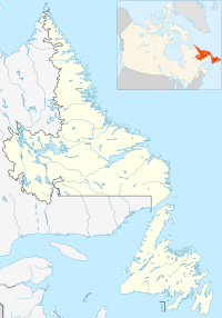
Summerville is a settlement in Newfoundland and Labrador. It is part of the local service district of Summerville-Princeton-Southern Bay.

It was previously known as Indian Arm; the first Waymaster was Edward Humby in 1891.
See also

48°27′00″N53°33′22″W / 48.450°N 53.556°W / 48.450; -53.556


Related Research Articles

Glovertown is a town in northeastern Newfoundland, Newfoundland and Labrador, Canada. It is in Division No. 7 on Alexander Bay.

Chapel Arm is a settlement in Newfoundland, Canada, located at the southeast corner of Trinity Bay, approximately 100 km (62 mi) west of St. John's and two km from the Trans-Canada Highway.

Newfoundland and Labrador Hydro, commonly known as Hydro, is a provincial Crown corporation that generates and delivers electricity for Newfoundland and Labrador, as well as portions of Quebec and the north-eastern areas of the United States. Between 2007 and 2021, NL Hydro was a subsidiary of the provincial Crown-owned energy holding company Nalcor Energy.

<span class="mw-page-title-main">Eastport Peninsula</span>

The Eastport Peninsula is a small extension of land into the central part of Bonavista Bay in the Canadian province of Newfoundland and Labrador. The peninsula is adjacent to Terra Nova National Park and contains seven small communities: Eastport, Happy Adventure, Sandy Cove, Salvage, St. Chad's, Burnside and Sandringham.

Bonavista Bay (BB) is a large bay located on the northeast coast of the island of Newfoundland in the province of Newfoundland and Labrador in Canada. It opens directly onto the Atlantic Ocean.

Hillview-Adeytown is a former local service district and former designated place on the east coast of Newfoundland in Newfoundland and Labrador, Canada that existed from 1999 until 2008. It consisted of the village of Hillview on the Southwest Arm of Trinity Bay and the village of Adeytown on the Northwest Arm of Trinity Bay, just south of Clarenville.

<span class="mw-page-title-main">Curling, Newfoundland and Labrador</span> Neighbourhood in Corner Brook, Newfoundland and Labrador, Canada

Curling is a mainly residential neighbourhood of the city of Corner Brook, Newfoundland and Labrador. It is situated just west of the main part of the city. Located in the Humber Arm of the Bay of Islands, Curling was originally a fishing community. It is the oldest section of Corner Brook.

<span class="mw-page-title-main">Sandy Cove, Newfoundland and Labrador</span> Town in Newfoundland and Labrador, Canada

Sandy Cove is a town located on the Eastport Peninsula in Newfoundland and Labrador, Canada. It is located on Newman Sound, which is part of Bonavista Bay. It had a population of 120 in the 2021 census.

Trinity Bight is a large area of the Northwestern portion of Trinity Bay, Newfoundland and Labrador, Canada. The bight contains the communities of New Bonaventure, Old Bonaventure, Trouty, Dunfield, Goose Cove, Trinity, Lockston, Trinity East, Port Rexton, Champney's Arm, Champney's West, Champney's East, and English Harbour. The area is not to be confused with the bay named Trinity Bight in the Strait of Belle Isle, Newfoundland.

Colinet is an incorporated town located on the northwest arm of St. Mary's Bay in Newfoundland and Labrador, Canada.

The Bonavista Peninsula is a large peninsula on the east coast of the island of Newfoundland in the Canadian province of Newfoundland and Labrador. It consists of 50 incorporated towns/unincorporated communities which have a population of 12,176 as of the 2016 Canadian Census. Bonavista is the largest population centre on the peninsula.

Indian Bay is located in Newfoundland, Canada.

St. Jones Within is located in Trinity Bay, Newfoundland and Labrador. It takes approximately two hours to drive there from the province's capital city, St. John's. Most of the houses in the community are built around the sheltered harbour.

Sandringham is a town on the Eastport Peninsula in Bonavista Bay North in the Canadian province of Newfoundland and Labrador, Canada. The town had a population of 205 in the Canada 2021 Census.

Trinity Bay North is a town in the Canadian province of Newfoundland and Labrador. It is located at the northern tip of Trinity Bay. The town had a population of 1,649 in the Canada 2021 Census.

Old Shop is a local service district and designated place in the Canadian province of Newfoundland and Labrador. It is on the western side of the Dildo Arm, at the southern end of Trinity Bay. It is northwest of South Dildo, across the Dildo Arm from Dildo proper.

Southern Bay is a settlement in Newfoundland and Labrador. It is part of the local service district of Summerville-Princeton-Southern Bay.

Princeton is a settlement in Newfoundland and Labrador. It is part of the local service district of Summerville-Princeton-Southern Bay.

Britannia is a designated place in the Canadian province of Newfoundland and Labrador. It is on Trinity Bay and is part of the local service district of Random Island West.

<span class="mw-page-title-main">Division No. 1, Subdivision G, Newfoundland and Labrador</span> Unorganized territory in Newfoundland and Labrador, Canada

Division No. 1, Subdivision G is an unorganized subdivision on the Avalon Peninsula in Newfoundland and Labrador, Canada. It is in Division 1 and contains the unincorporated communities of Baccalieu Island, Besom Cove, Bradley's Cove, Burnt Point, Caplin Cove, Daniel's Cove, Grates Cove, Gull Island, Job's Cove, Kingston, Long Beach, Lower Island Cove, Low Point, Northern Bay, Ochre Pit Cove, Red Head Cove, Riverhead, Smooth Cove and Western Bay.