Route 230 is the main Bonavista Peninsula Highway, commencing from Route 1 at Thorburn Lake, about 10-15 kilometres north of Clarenville and proceeding all the way to Bonavista at the end of the Peninsula. The highway also carries the designation of Discovery Trail.
Route 330, also known as Road to the Shore or more commonly Gander Bay Road, is a highway that extends from Gander, Newfoundland across "the loop" passing through towns such as Gander Bay South, Carmanville, Musgrave Harbour, and Lumsden to New-Wes-Valley. Here, the highway connects with Route 320, which continues "the loop" down the west shore of Bonavista Bay exiting back to the Trans-Canada Highway in Gambo.
Route 210, also known as the Burin Peninsula Highway and Heritage Run, is a highway that extends through the Burin Peninsula from Goobies to Grand Bank, Newfoundland and Labrador. The maximum speed limit is 90 km/h except through communities and settlements where the speed limit is reduced to 50 km/h. Just after exiting Swift Current, until a few kilometres north of Marystown, much of the landscape is barren, with very few trees prevalent. After entering Marystown, motorists approach a junction where they could turn right to continue their journey on Route 210 until arriving at Grand Bank, or going straight onto Route 220 towards Burin and St. Lawrence. Marystown is the most populous community along the route.
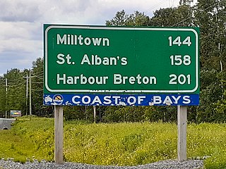
Route 360, also known as Bay d'Espoir Highway, is a provincial highway in Newfoundland and Labrador. It runs from the Bishop's Falls area to Bay d'Espoir and Harbour Breton. The road is very isolated for at least 140 kilometres (87 mi), where there are no communities or stops to refuel. Bishop's Falls and Harbour Breton are the only two settlements of any size along the entire length of Route 360, with other towns and communities being along the other highways it intersects.

Route 430 is a 413-kilometre-long (257 mi) paved highway that traverses the Great Northern Peninsula of Newfoundland in the Canadian province of Newfoundland and Labrador. The route begins at the intersection of Route 1 in Deer Lake and ends in St. Anthony. Officially known as the Great Northern Peninsula Highway, it has been designated as the Viking Trail since it is the main auto route to L'Anse aux Meadows, the only proven Viking era settlement in North America. It is the primary travel route in the Great Northern Peninsula and the only improved highway between Deer Lake and St. Anthony. It is the main access route to the Labrador Ferry terminal in St. Barbe.

Route 463, also known as Lourdes Road, is a rural highway in Newfoundland and Labrador that leads from Route 460 at Abraham's Cove to Cape St. George. It is situated entirely on the northern shore of the Port au Port Peninsula in Western Newfoundland and has an approximate length of 51.7 kilometres (32.1 mi). Along with Route 460, Route 463 also carries the designation of the French Ancestors Route.
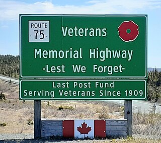
Route 75, also known as Veterans Memorial Highway, is a two-lane expressway on the Avalon Peninsula of Newfoundland. The route begins at a trumpet interchange with Route 1 and continues north, bypassing communities along the western shore of Conception Bay until it ends at a junction with Route 70 south of Carbonear. Construction of the highway was completed in 2012.
Route 201 is a provincial road in the Canadian province of Newfoundland and Labrador. It is one of only three loop roads designated with a route number that starts and ends at the Trans-Canada Highway. The road spans 28 kilometres (17 mi), and allows for a scenic journey along the southern coast of Trinity Bay. There are quite a number of summer cottages along the route, and highway is known for an abundance of ospreys during the summer months.
Route 390, also known as Springdale Road, is a highway in the central portion of Newfoundland in the Canadian province of Newfoundland and Labrador. It is a very short route, running for only 11.0 kilometres (6.8 mi), with its only community, Springdale, as its terminus. Its branch routes, Route 391 and Route 392, run for a much longer distance.
Route 406, also known as Codroy Road, is a highway on the western portion of Newfoundland in the Canadian province of Newfoundland and Labrador. It is a relatively short route, with its eastern terminus at Route 1 in the community of Doyles, and its western terminus at Cape Anguille. The route travels through the scenic Codroy Valley region.
Route 405, also known as Highlands Road, is a 18.0-kilometre-long (11.2 mi) minor highway in the western region of Newfoundland in the Canadian province of Newfoundland and Labrador. The highway begins at a junction with Route 1 and continues to its west terminus, the community of Highlands.
Route 407, also known as St. Andrew's-Searston Road, is a minor highway on the western portion of Newfoundland in the Canadian province of Newfoundland and Labrador. The route's southern terminus is the Trans-Canada Highway in the community of Tompkins, and its northern terminus is in the community of Millville, at an intersection with Route 406. Along with Route 406, Route 407 allows for an extensive view of the Codroy Valley.
Route 370, also known as the Buchans Highway, is a 73-kilometre-long (45 mi) east-west highway in the central portion of Newfoundland in the Canadian province of Newfoundland and Labrador. Its eastern terminus is the intersection at the Trans-Canada Highway in the Town of Badger, and the route ends at the Town of Buchans.
Route 205, also known as Hatchet Cove Road, is a relatively short east-west highway on the island of Newfoundland in the Canadian province of Newfoundland and Labrador. It connects the communities along the northern shore of the Southwest Arm of Trinity Bay with Route 1. It is the last provincial route heading west along the Trans-Canada Highway before approaching the Town of Clarenville.
Route 380 is a highway in Newfoundland and Labrador. There are five communities along the route, beginning with South Brook at the Trans-Canada Highway, and ending at the community of Brighton. The route travels through three islands, including Pilley's Island and Brighton Tickle Island. Triton is the most populous community along the route.
Route 100 is a major highway in Newfoundland and Labrador. The highway begins at its northern terminus at the Trans-Canada Highway in the town of Whitbourne, runs for 108 kilometres (67 mi) until it ends at its southern terminus, the town of Branch, where it transitions into Route 92. Motorists can drive along the coast of Placentia Bay and eventually the Atlantic Ocean once traveling south of Point Verde.
Route 450 is a highway in the Canadian province of Newfoundland and Labrador. The highway starts at an interchange at Route 1 in Corner Brook. When approaching O'Connell Drive, motorists can turn left to continue their journey along the route. The route terminates at a cul-de-sac in Lark Harbour.
Route 440 is a relatively short highway in the Canadian province of Newfoundland and Labrador, on the West Coast. The highway was named in honor of Admiral Hugh Palliser. The highway starts at an interchange at Route 1 in Corner Brook, and terminates at Cox's Cove. The speed limit is 80 km/h except in communities where the speed is reduced to 50 km/h.
Route 204, also known as Southwest Arm Road, is a 30.5-kilometre-long (19.0 mi) east–west highway on the island of Newfoundland in the province of Newfoundland and Labrador. It connects the communities along the southern shore of the Southwest Arm of Trinity Bay with the Trans-Canada Highway at North West Brook. It is a very curvy two-lane highway traversing very hilly terrain for its entire length.
Route 461 is a 21.0-kilometre-long (13.0 mi) north–south highway on the western side of Newfoundland in the Canadian province of Newfoundland and Labrador. It connects the towns of St. George's, Barachois Brook, Mattis Point, and Stephenville Crossing.
