Newfoundland and Labrador Route 340

Last updated

NL Route 340.svg Newfoundland and Labrador Route 340 rtti.PNG

Route 340

Road to the Isles
Newfoundland and Labrador Route 340 map.JPG
Route information
Maintained by Newfoundland and Labrador Department of Transportation and Infrastructure
Length106.3 km [1]  (66.1 mi)
Major junctions
South endNL TCH sign.svg Route 1 (TCH) near Lewisporte
Major intersections
North end Long Point Lighthouse near Crow Head
Location
Country Canada
Province Newfoundland and Labrador
Highway system
    NL Route 335.svg Route 335 NL Route 341.svg Route 341

    Route 340, also known as Road to the Isles, is a road in the Canadian province of Newfoundland and Labrador passing through the towns of Lewisporte, Summerford and Twillingate, all in The Isles of Notre Dame region of the province. [1]

    Contents

    The highway has a total length of 106.3 kilometres (66.1 mi) [1] and a speed limit in the range of 40–80 km/h depending on whether the road is passing through a settlement.

    As the route's alternate name implies, the Road to the Isles passes through several islands off the coast of the main island of Newfoundland, such as New World Island, Twillingate Islands and some uninhabited islands. Change Islands and Fogo Island are accessible by ferry via Route 331, which has a junction with Route 340. [2]

    Route 340 is the only road connection that New World Island and Twillingate Islands have with the main island. [1] [3]

    Route description

    Route 340 begins at Notre Dame Junction, which is a nickname given to the route's interchange with Route 1 (the Trans-Canada Highway). Leading northward, the route passes through the town of Lewisporte, where it then continues by turning right at an intersection with Route 341.

    The route continues northeastward and passes through the shoreline communities of Michael's Harbour [3] and Campbellton, where the route intersects Route 343. Continuing northeastward, the route also intersects Route 331. This route leads to ferries connecting Change Islands and Fogo Island with the main island. [2]

    Route 340 then passes through the community of Boyd's Cove. [1] Afterwards, the route leads northward through a series of causeways that connect the main island of Newfoundland with New World Island. While on New World Island, the route passes through the town of Summerford and intersects Route 344. Following that intersection, the route leads northward until passing through Virgin Arm, where it then intersects Route 345 and leads northeastward. It then passes by Dildo Run Provincial Park and through the communities of Fairbanks, Hillgrade and Newville. [1] [3]

    1.5 km north of Newville, the route intersects Route 346 and then veers westward towards a causeway connecting New World Island to Twillingate Islands. After the causeway, the route immediately veers northward and passes through Purcell's Harbour and Little Harbour, where the route then veers northwestward. [1] [3]

    The route then passes through the town of Twillingate, where a left turn at a local intersection is required to remain on the route. Through the town, the route is largely residential and is called Main Street. After a small loop, the route leads northwestward through Tickle Bridge and continues through Twillingate. The road then passes through Wild Cove and Crow Head, where a sharp right turn is required to remain on Route 340. The final stretch leads northward to Long Point Lighthouse, located at the edge of the Atlantic Ocean. [1]

    List of communities along route

    NL Route 340 road sign Road To The Isles roadsign.jpg
    NL Route 340 road sign
    Birchy Bay exit 00-Route 340 Newfoundland.jpg
    Birchy Bay exit
    Heading northbound towards Twillingate Road to the isles NL Route 340.jpg
    Heading northbound towards Twillingate

    Communities are arranged in order from the Trans-Canada Highway exit to the end at Twillingate, including those accessible by short highways that branch off from Route 340. Towns of 500 or more people are in bold:

    Major intersections

    LocationkmmiDestinationsNotes
    Notre Dame Junction 0.00.0NL TCH sign.svg Route 1 (TCH)  Gander, Grand Falls-Windsor Exit 23 on Route 1; southern terminus
    Lewisporte 11.47.1NL Route 341.svg Route 341 north (Main Street) – Downtown, Embree, Laurenceton Southern terminus of Route 341
    Michael's Harbour 21.413.3Main Road - Michael's Harbour
    22.313.9Main Road - Michael's Harbour
    Campbellton 28.517.7NL Route 343.svg Route 343 north (Road to Comfort Cove) Comfort Cove-Newstead Southern terminus of Route 343
    Baytona 40.825.4Main Street (Route 340-17) - Baytona
    Birchy Bay 44.027.3Main Street - Birchy Bay
    47.429.5Main Street - Birchy Bay
    Boyd's Cove 56.735.2NL Route 331.svg Route 331 east (Boyd's Cove Highway) Clarke's Head, Victoria Cove Western terminus of Route 331; provides access to Ontario M508.svg Fogo Island and Change Islands via Route 335
    Summerford 72.645.1NL Route 344.svg Route 344 west (Main Street) Summerford, Cottlesville Eastern terminus of Route 344
    Virgin Arm-Carter's Cove 75.747.0NL Route 345.svg Route 345 north Moreton's Harbour, Tizzard's Harbour Southern terminus of Route 345
    Parkview 76.747.7Parkview Road - Parkview
    77.147.9 Dildo Run Provincial Park main entranceAccess road into park
    Fairbanks-Hillgrade 81.950.9Fairbanks Road (Route 340-29) - Fairbanks
    83.351.8Country Road - Hillgrade
    Newville 85.753.3Country Road - Hillgrade
    86.053.4Newville Road - Newville
    87.454.3NL Route 346.svg Route 346 north (Toogood Arm Road) Cobb's Arm, Toogood Arm Southern terminus of Route 346
    Indian Cove 88.655.1Herring Neck Road (Route 340-37) - Herring Neck, Salt Harbour
    89.055.3Indian Cove Road (Route 340-73) - Indian Cove
    Black Duck Cove 91.656.9Black Duck Cove Road - Black Duck Cove
    Purcell's Harbour 92.657.5Bayview Street (Route 340-46) - Kettle Cove, Bayview
    93.057.8Purcell's Harbour Road - Purcell's Harbour
    93.558.1Purcell's Harbour Road - Purcell's Harbour
    Little Harbour 94.658.8Little Harbour Road (Route 340-49) - Little Harbour
    95.859.5Little Harbour Road (Route 340-49) - Little Harbour
    Twillingate 99.561.8Main Street - Durrell
    Crow Head 106.366.1Dead End at Long Point Lighthouse Northern terminus
    1.000 mi = 1.609 km; 1.000 km = 0.621 mi

    Related Research Articles

    Division No. 8 is a census division on the north coast of the island of Newfoundland in the province of Newfoundland and Labrador, Canada. It has a land area of 9,314.57 km² and had a population of 33,940 at the 2016 census. Its largest communities are the towns of Lewisporte, Springdale, and Twillingate.

    <span class="mw-page-title-main">Twillingate</span> Place in Newfoundland and Labrador, Canada

    Twillingate is a town of 2,121 people located on the Twillingate Islands ("Toulinquet") in Notre Dame Bay, off the north eastern shore of the island of Newfoundland in the province of Newfoundland and Labrador, Canada. The town is about 100 kilometres (62 mi) north of Lewisporte and Gander.

    <span class="mw-page-title-main">The Isles of Notre Dame</span> Provincial electoral district in Newfoundland and Labrador, Canada

    The Isles of Notre Dame, formerly called Twillingate and Fogo, is a defunct provincial electoral district for the House of Assembly of Newfoundland and Labrador, Canada. As of 2011 the district had 6,990 eligible voters. The district was abolished in 2015 and largely replaced by Lewisporte-Twillingate.

    Route 1 is a highway in the Canada province of Newfoundland and Labrador, and is the easternmost stretch of the Trans-Canada Highway. Route 1 is the primary east–west road on the island of Newfoundland.

    Virgin Arm–Carter's Cove is a local service district and designated place on New World Island in the Canadian province of Newfoundland and Labrador. Virgin Arm-Carter's Cove is located approximately 90 km Northwest of Gander in Subdivision H of Division No. 8.

    Nova Central School District was a school district headquartered in Gander in the Canadian province of Newfoundland and Labrador. The district had 66 schools located in 50 different communities, and served about 13,000 students, including a significant rural population. The District was formed by the merger of the Lewisporte-Gander and Baie Verte-Central-Connaigre school boards in 2004. The largest school in the district was Gander Academy. The district was replaced by the Newfoundland and Labrador English School District upon provincial amalgamation in 2013.

    New World Island is an island in Notre Dame Bay, just off the coast of Newfoundland in the Canadian province of Newfoundland and Labrador.

    <span class="mw-page-title-main">Newfoundland and Labrador Route 350</span> Highway in Newfoundland and Labrador, Canada

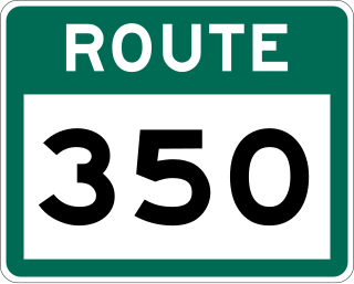
    Route 350, commonly known as Botwood Highway, is a side highway in Central Newfoundland that leads from the Trans-Canada Highway in Bishop's Falls to Botwood, Point Leamington and Leading Tickles. It is 70.7 kilometres (43.9 mi) in length and contains several side roads to communities located off the route, such as Peterview, and Route 352 that leads to Point of Bay and the Cottrell's Cove-Fortune Harbour area. Route 350-17 branches off in Point Leamington and connects the small community of Pleasantview to the main route. Route 350 continues on from Point Leamington for another 25 km north to Leading Tickles where the road officially ends. Along the way there is another short road connecting Glovers Harbour to the main route as well.

    <span class="mw-page-title-main">Newfoundland and Labrador Route 341</span>

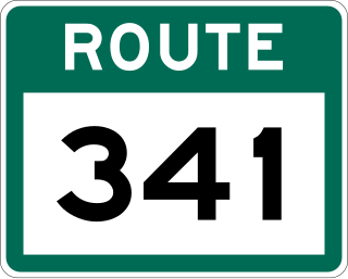
    Route 341 in Newfoundland and Labrador leads from Lewisporte to Laurenceton on the island of Newfoundland. The highway is relatively short and there aren't many communities along the way. The road is notoriously hilly and turny, ending in a large dip into Laurenceton. The highway is the only route for residents of Laurenceton to travel to Lewisporte for work.

    <span class="mw-page-title-main">Newfoundland and Labrador Route 430</span>

    Route 430 is a 413-kilometre-long (257 mi) paved highway that traverses the Great Northern Peninsula of Newfoundland in the Canadian province of Newfoundland and Labrador. The route begins at the intersection of Route 1 in Deer Lake and ends in St. Anthony. Officially known as the Great Northern Peninsula Highway, it has been designated as the Viking Trail since it is the main auto route to L'Anse aux Meadows, the only proven Viking era settlement in North America. It is the primary travel route in the Great Northern Peninsula and the only improved highway between Deer Lake and St. Anthony. It is the main access route to the Labrador Ferry terminal in St. Barbe.

    <span class="mw-page-title-main">Newfoundland and Labrador Route 346</span>

    Route 346, also known as Toogood Arm, is a highway in the province of Newfoundland and Labrador, Canada and leads from Route 340 near Newville to Toogood Arm, all on New World Island. The highway runs for 13.5 kilometres (8.4 mi) and connects the communities of Cobb's Arm, Roger's Cove, Pike's Arm, Green Cove and Toogood Arm to Route 340.

    <span class="mw-page-title-main">Tennessee State Route 156</span> State highway in Franklin and Marion counties in Tennessee, United States

    State Route 156 is a spur route of Tennessee State Route 56 (SR 56) and a state highway in Franklin and Marion counties in the southern central and southeastern portions of Tennessee, United States. It traverses the southern Cumberland Plateau before descending into the Sequatchie Valley, where follows the shores of Nickajack Lake for its final few miles.

    <span class="mw-page-title-main">Newfoundland and Labrador Route 335</span> Highway in Newfoundland and Labrador

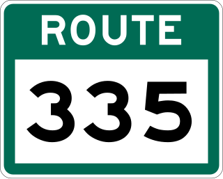
    Route 335, also known as Farewell Road, is a highway in the northern portion of Newfoundland in the Canadian province of Newfoundland and Labrador. The highway's southern terminus is at the junction at Route 331 near the community of Horwood, and its northern terminus is the community of Farewell, a community where the Fogo Island and Change Islands ferries, served by the MV Veteran, depart or arrive.

    <span class="mw-page-title-main">Newfoundland and Labrador Route 80</span> Highway in Newfoundland and Labrador

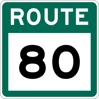
    Route 80, also known as Trinity Road, is a 105-kilometre-long (65 mi) north–south highway along the Avalon Peninsula of Newfoundland. It connects the communities along the eastern side of Trinity Bay with the Trans Canada Highway (TCH).

    <span class="mw-page-title-main">Newfoundland and Labrador Route 204</span> Highway in Newfoundland and Labrador

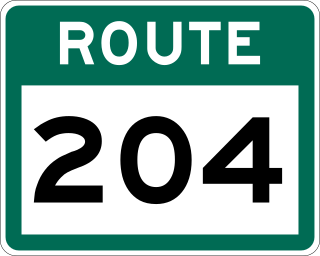
    Route 204, also known as Southwest Arm Road, is a 30.5-kilometre-long (19.0 mi) east–west highway on the island of Newfoundland in the province of Newfoundland and Labrador. It connects the communities along the southern shore of the Southwest Arm of Trinity Bay with the Trans-Canada Highway at North West Brook. It is a very curvy two-lane highway traversing very hilly terrain for its entire length.

    <span class="mw-page-title-main">Newfoundland and Labrador Route 231</span>

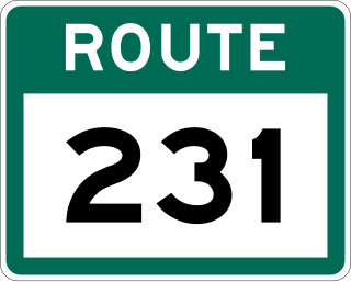
    Route 231, also known as Random Island Road, is a 33.6-kilometre-long (20.9 mi) east–west highway in the Canadian province of Newfoundland and Labrador. It serves as the only road connection between Newfoundland and Random Island.

    <span class="mw-page-title-main">Newfoundland and Labrador Route 331</span> Highway in Newfoundland and Labrador

    Route 331, also known as Boyd's Cove Highway, is a 27.4-kilometre-long (17.0 mi) east–west highway on the island of Newfoundland in the province of Newfoundland and Labrador. It connects the town of Boyd's Cove with the Gander Bay area of the island.

    <span class="mw-page-title-main">Newfoundland and Labrador Route 333</span>

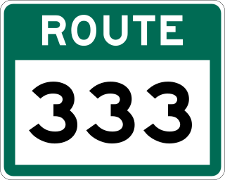
    Route 333, also known as Fogo Island Road, is a 24.4-kilometre-long (15.2 mi) north–south highway on Fogo Island in the Canadian province of Newfoundland and Labrador. It is the primary highway on the island, connecting all of the island's communities with the MV Veteran ferry, which in turn connects them to mainland Newfoundland and the rest of Canada. The highway is one of only two 3-digit highways in the province that use the same number, the other being Route 222.

    <span class="mw-page-title-main">Newfoundland and Labrador Route 345</span>

    Route 345 is a 16.1-kilometre-long (10.0 mi) north-south highway on New World Island in the Canadian province of Newfoundland and Labrador. It connects the communities of Virgin Arm–Carter's Cove with Tizzard's Harbour on the western half of the island.

    <span class="mw-page-title-main">Newfoundland and Labrador Route 381</span>

    Route 381, also known as Port Anson Road, is a 15.3-kilometre-long (9.5 mi) north–south highway in northern Newfoundland in the Canadian province of Newfoundland and Labrador. It serves as the only road connection to the communities on Sunday Cove Island.

    References

    1. 1 2 3 4 5 6 7 8 Google (2008-06-29). "Overview Map of NL 340" (Map). Google Maps . Google. Retrieved 2008-06-29.
    2. 1 2 Google (2008-07-20). "Overview Map of Road Connection from NL 340 to Change Islands and Fogo Island Ferries" (Map). Google Maps. Google. Retrieved 2008-07-20.
    3. 1 2 3 4 "Map showing Twillingate Islands, New World Island (NWI), and south of NWI" (Map). WikiMapia. Retrieved 2008-06-28.[ self-published source ]