
Dildo is an unincorporated place on the island of Newfoundland, in the province of Newfoundland and Labrador, Canada. It is located on the southeastern Dildo Arm of Trinity Bay about 60 kilometres west of St. John's. South Dildo is a neighbouring unincorporated community. The town's unusual name has brought it a certain amount of notoriety.
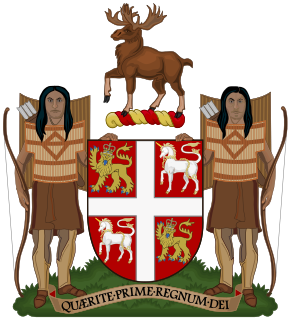
The Premier of Newfoundland and Labrador is the first minister, head of government and de facto chief executive for the Canadian province of Newfoundland and Labrador. Since 1949, the Premier's duties and office has been the successor to the First Ministerial position of the Prime Minister of the former Dominion of Newfoundland. Before 1964, the position's official title was Premier of Newfoundland. From 1964 to 2001 this title continued to be used outside the province.

Dildo Island is an island in the Canadian province of Newfoundland and Labrador. It is the largest of three islands located at the entrance to Dildo Tip in the bottom of Trinity Bay, off the coast of the neighbouring town of Dildo. As of 2016, Dildo was home to approximately 1,200 people.
Barachois Pond Provincial Park is a large and popular Provincial Park in the southwest of the island of Newfoundland. The park covers an area of 35 km2 (14 sq mi). The park is off the Trans-Canada Highway, near Stephenville.
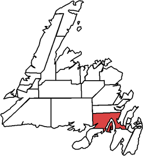
Bellevue is a former provincial electoral district for the House of Assembly of Newfoundland and Labrador, Canada. As of 2003 it had 7310 eligible voters. The district was abolished in 2015 and replaced by Placentia West-Bellevue.

Chance Cove Provincial Park is a provincial park located approximately 20 km south of Renews-Cappahayden, Newfoundland and Labrador. Chance Cove was once the site of a small settlement of approximately 50 people in the mid-19th century, and is home to many shipwrecks of the Atlantic Ocean. Until the late 1980s, pieces of the forgotten homes were still visible.

The Bay de Verde Peninsula is the largest peninsula that makes up part of the Avalon Peninsula, of the province of Newfoundland and Labrador, Canada. The peninsula separates both Trinity and Conception Bay.

Torngat Mountains National Park is a Canadian national park, located on the Labrador Peninsula at the northern tip of Newfoundland and Labrador. Set in the Torngat Mountains, the name comes from the Inuktitut word Torngait, meaning "place of spirits". It contains the highest mountains in Mainland Canada east of the Rockies.
Bakers Brook is a Canadian fishing settlement on Bonne Bay in the province of Newfoundland and Labrador.

Burgeo is a Canadian town located on the south coast of the island of Newfoundland in the province of Newfoundland and Labrador.
Articles related to the Canadian province of Newfoundland and Labrador include:
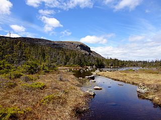
Butter Pot Provincial Park is a Provincial Park on the Avalon Peninsula of the island of Newfoundland. The park covers an area of approximately 28 km² and is located on the Trans-Canada Highway about 35 km southwest of St. John's. The park is named for a prominent rounded hill inside the park boundary. Butter Pot incorporates both day-use and overnight camping facilities, and in winter months provides groomed cross-country ski trails.
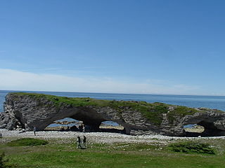
The Arches Provincial Park is a public park on the western coastline of Newfoundland and Labrador, Canada that features a photogenic rock formation.

Mealy Mountains National Park Reserve is a proposed national park reserve in the Labrador region of Newfoundland and Labrador. Its area would cover approximately 10,700 square kilometres (4,131 sq mi), and be known officially as Akami–uapishku-KakKasuak-Mealy Mountains National Park Reserve. Along with the Mealy Mountains, the park will protect a large portion of boreal forest, tundra and 50 kilometres of shoreline on the Labrador Sea. Once established, it will be the largest national park in eastern Canada. It is inhabited by a variety of wildlife, including the threatened Mealy Mountains woodland caribou herd. Other mammals that inhabit this park reserve are wolf packs, black bear, marten and two species of fox. An agreement with the native peoples of the area, including the Inuit, Innu and NunatuKavut will allow them to continue to hunt, trap and fish in the protected area.

J.T. Cheeseman Provincial Park, is a provincial park located near Channel-Port aux Basques, Newfoundland and Labrador.

Frenchman's Cove Provincial Park, is a provincial park located on the west side of the Burin Peninsula in Newfoundland and Labrador.
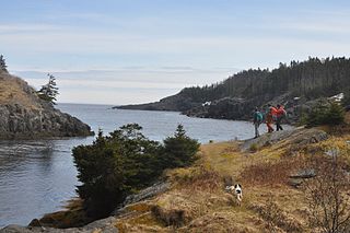
La Manche Provincial Park, is a provincial park located 53 kilometers south of St. John's, along Highway 10 Newfoundland and Labrador.

The following outline is provided as an overview of and topical guide to Newfoundland and Labrador.


