Related Research Articles

Captain James Cook was a British explorer, cartographer and naval officer famous for his three voyages between 1768 and 1779 in the Pacific Ocean and to New Zealand and Australia in particular. He made detailed maps of Newfoundland prior to making three voyages to the Pacific, during which he achieved the first recorded European contact with the eastern coastline of Australia and the Hawaiian Islands, and the first recorded circumnavigation of New Zealand.

Dildo is a local service district and designated place in the Canadian province of Newfoundland and Labrador on the island of Newfoundland. It is located on the southeastern Dildo Arm of Trinity Bay about 100 kilometres (62 mi) west of St. John's. South Dildo is a community located to the south, and in 2021 had 195 residents. It is known for its unusual name.

Corner Brook is a city located on the west coast of the island of Newfoundland in the province of Newfoundland and Labrador, Canada. Corner Brook is the fifth largest settlement in Newfoundland and Labrador.

The Humber River is a river on Newfoundland in the Canadian province of Newfoundland and Labrador. It is approximately 120 kilometres long; it flows through the Long Range Mountains, southeast then southwest, through Deer Lake, to the Bay of Islands at Corner Brook. It begins near the town of Hampden. Taylor's Brook, Aidies Stream and Dead Water Brook run into the upper Humber. The Humber is one of Newfoundland's longest rivers.

The Newfoundland Time Zone (NT) is a geographic region that keeps time by subtracting 3.5 hours from Coordinated Universal Time (UTC) during standard time, resulting in UTC−03:30; or subtracting 2.5 hours during daylight saving time. The clock time in this zone is based on the mean solar time of the meridian 52 degrees and 30 arcminutes west of the Greenwich Observatory. It is observed solely in the Canadian province of Newfoundland and Labrador. The Newfoundland Time Zone is the only active time zone with a half-hour offset from UTC in the Americas.
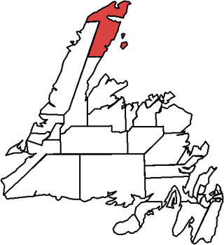
The Straits – White Bay North is a defunct provincial electoral district for the House of Assembly of Newfoundland and Labrador, Canada. The district was known as Strait of Belle Isle prior to the 1996 election. In the 2007 redistribution, it added five per cent of St. Barbe. As of 2011, there are 6,851 eligible voters living within the district.
Tilting is a community on the eastern end of Fogo Island off the northeast coast of Newfoundland. It was incorporated as a town before becoming part of the Town of Fogo Island through an amalgamation in 2011. The community has been designated as a National Historic Site of Canada, and has also been designated as a Registered Heritage District by the Heritage Foundation of Newfoundland and Labrador.

Area code 709 is the telephone area code in the North American Numbering Plan (NANP) for the entire Canadian province of Newfoundland and Labrador.

Curling is a mainly residential neighbourhood of the city of Corner Brook, Newfoundland and Labrador. It is situated just west of the main part of the city. Located in the Humber Arm of the Bay of Islands, Curling was originally a fishing community. It is the oldest section of Corner Brook.
Grand Lake is a large lake in the interior of the island of Newfoundland, in the Canadian province of Newfoundland and Labrador. It has an area of 543 km2 (210 sq mi), making it the largest lake on Newfoundland. Contained within the lake is the 18th largest lake-island in the world, Glover Island.

Birchy Bay is a small community found in Notre Dame Bay in the province of Newfoundland and Labrador, Canada.

Route 430 is a 413-kilometre-long (257 mi) paved highway that traverses the Great Northern Peninsula of Newfoundland in the Canadian province of Newfoundland and Labrador. The route begins at the intersection of Route 1 in Deer Lake and ends in St. Anthony. Officially known as the Great Northern Peninsula Highway, it has been designated as the Viking Trail since it is the main auto route to L'Anse aux Meadows, the only proven Viking era settlement in North America. It is the primary travel route in the Great Northern Peninsula and the only improved highway between Deer Lake and St. Anthony. It is the main access route to the Labrador Ferry terminal in St. Barbe.

Cook's Harbour is a town in the Canadian province of Newfoundland and Labrador. The town had a population of 123 in the Canada 2016 Census. The population as of 2021 was 118 but the population has been decreasing ever since then. Cook’s Harbour is about 45 minutes away from St. Anthony NL and 6 hours from Corner Brook NL.
Bottle Cove is located on the west coast of Newfoundland. It opens directly onto the Gulf of Saint Lawrence, although it is typically included in the regional descriptor, "Bay of Islands," which lies at the mouth of the Humber Arm. Bottle Cove is also referred to as Bottle Cove Provincial Park and as Bottle Cove Day Park in official Parks documentation.

Sop's Arm is a local service district and designated place in the Canadian province of Newfoundland and Labrador. The community was formed in the 1930s and 1940s by families moving from surrounding communities, including Jackson's Arm. In the 1950s and 1960s families from nearby Sop's Island moved to Sop's Arm, towing their houses across the channel of water.

Brig Bay is a local service district and designated place in the Canadian province of Newfoundland and Labrador. It was first mapped by Captain James Cook in September 1764. The name "Brig" was adopted by the French who occupied the bay prior to English occupation. It provided a safe and well-sheltered harbour.

Newfoundland is a large island situated off the eastern coast of the North American mainland and the most populous part of the Canadian province of Newfoundland and Labrador. The island contains 29 percent of the province's land area. The island is separated from the Labrador Peninsula by the Strait of Belle Isle and from Cape Breton Island by the Cabot Strait. It blocks the mouth of the Saint Lawrence River, creating the Gulf of Saint Lawrence, the world's largest estuary. Newfoundland's nearest neighbour is the French overseas collectivity of Saint Pierre and Miquelon.
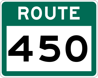
Route 450 is a highway in the Canadian province of Newfoundland and Labrador. The highway starts at an interchange at Route 1 in Corner Brook. When approaching O'Connell Drive, motorists can turn left to continue their journey along the route. The route terminates at a cul-de-sac in Lark Harbour.

Rose au Rue is an abandoned whaling town in Newfoundland and Labrador, Canada that had a small population of 11 in 1891.
References
- ↑ Sea Kayaking in Western Newfoundland- Corner Brook and the Bay of Islands
- ↑ John Robson (2000). Captain Cook's World. p. 42. ISBN 1-74051-413-0.