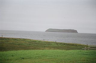
Piccadilly Slant-Abraham's Cove is a local service district and designated place in the Canadian province of Newfoundland and Labrador. It is located on the island of Newfoundland, along St. George's Bay, on the Port au Port Peninsula. The DPL consists of the fishing villages of Abraham's Cove and Piccadilly.
St. George's Bay - informally referred to as Bay St. George due to its French translation Baie St-George - is a large bay in the province of Newfoundland and Labrador, Canada. It is located on the west coast of the island of Newfoundland and comprises a sub-basin of the Gulf of St. Lawrence. The estimated population of the entire bay is 16,000, based on the demographic data of each community.

Sandy Cove is a town located on the Eastport Peninsula in Newfoundland and Labrador, Canada. It is located on Newman Sound, which is part of Bonavista Bay. It had a population of 120 in the 2021 census.

Reefs Harbour-Shoal Cove West-New Ferolle is a local service district and designated place in the Canadian province of Newfoundland and Labrador. It is southwest of Anchor Point.
Census Division No. 4 is a Statistics Canada statistical division that comprises the areas of the province of Newfoundland and Labrador called St. George's. It covers a land area of 7087.65 km² and had a population of 20,387 at the 2016 census.

Pool's Cove is a community located on the north west side of Fortune Bay, on the South Coast of Newfoundland, Canada. The town had a population of 143 in the 2021 Census.
Sheaves Cove is a local service district and designated place in the Canadian province of Newfoundland and Labrador. It is on the Port au Port Peninsula along the shore of St. George's Bay. There is a small tourist alcove just off the highway where views of the waterfalls and the ocean are visited often.
Ship Cove-Lower Cove-Jerry's Nose is a local service district and designated place in the Canadian province of Newfoundland and Labrador.

Port au Choix or Port aux Choix is a town in the Canadian province of Newfoundland and Labrador.
Bird Cove is a town in the Canadian province of Newfoundland and Labrador.

Lourdes is a town in the Canadian province of Newfoundland and Labrador. The town had a population of 465 in the Canada 2016 Census. The current mayor of Lourdes is Henry Gaudon.
Miles Cove is a town on Sunday Cove Island in the Canadian province of Newfoundland and Labrador. The town had a population of 104 in 2016, down from 140 in the Canada 2006 Census.
Parker's Cove or Parkers Cove is a town in the Canadian province of Newfoundland and Labrador. The town had a population of 233 in the Canada 2021 Census, a drop from 248 in 2016.
Port au Port East is a town in the Canadian province of Newfoundland and Labrador, situated on the shore of Isthmus Bay. The town had a population of 413 in the Canada 2021 Census. The town consists of the unincorporated communities of Port au Port and Romaines.
Seal Cove is a town in the Canadian province of Newfoundland and Labrador, located on Fortune Bay. The town had a population of 100 in the 2021 Census. The population of Seal Cove, Fortune Bay has fallen to approximately 100 largely due to outmigration for education and other work-related pursuits. The town was incorporated in 1972.

L'Anse-au-Loup is a town in the Canadian province of Newfoundland and Labrador. The town had a population of 692 in the Canada 2021 Census, up from 558 in 2016. In the Canada 2006 Census, there were 593 inhabitants. Common Surnames are Barney, Belben, Cabot, Earle, Linstead, Normore, O'Brien, Ryland.
Mainland is a local service district and designated place in the Canadian province of Newfoundland and Labrador. It is on the western shore of the Port au Port Peninsula approximately 50 kilometres (31 mi) from the Stephenville International Airport. Mainland is a coastal community, bordered by both the ocean and forest. The main industry in the community has traditionally been fishing, but currently (2016) a large portion of the inhabitants leave the community seasonally to earn income.

Black Duck Brook and Winterhouse is a local service district and designated place in the Canadian province of Newfoundland and Labrador. It consists of the unincorporated fishing settlements of Black Duck Brook and Winterhouse on the Port au Port Peninsula. The communities had a combined population of 57 in the Canada 2006 Census.
Eddies Cove West is a local service district and designated place in the Canadian province of Newfoundland and Labrador.

Birchy Cove is a local service district and designated place in the Canadian province of Newfoundland and Labrador.
This page is based on this
Wikipedia article Text is available under the
CC BY-SA 4.0 license; additional terms may apply.
Images, videos and audio are available under their respective licenses.


