Related Research Articles

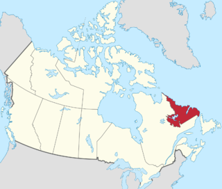
Labrador is a geographic and cultural region within the Canadian province of Newfoundland and Labrador. It is the primarily continental portion of the province and constitutes 71% of the province's area but is home to only 6% of its population. It is separated from the island of Newfoundland by the Strait of Belle Isle. It is the largest and northernmost geographical region in the four Atlantic provinces.
Division No. 7, Subd. E is an unorganized subdivision in eastern Newfoundland, Newfoundland and Labrador, Canada. It is in Division No. 7 on Bonavista Bay.

Division No. 6, Subd. E is an unorganized subdivision in northeastern Newfoundland, Newfoundland and Labrador, Canada. It is in Division No. 6.

Division No. 6, Subd. D is an unorganized subdivision in northeastern Newfoundland, Newfoundland and Labrador, Canada. It is in Division No. 6 on the Bay of Exploits.

Channel-Port aux Basques is a town at the extreme southwestern tip of Newfoundland fronting on the western end of the Cabot Strait. A Marine Atlantic ferry terminal is located in the town which is the primary entry point onto the island of Newfoundland and the western terminus of the Newfoundland and Labrador Route 1 in the province. The town was incorporated in 1945 and its population in the 2021 census was 3,547.

Sheshatshiu is an Innu federal reserve and designated place in the Canadian province of Newfoundland and Labrador. The reserve is approximately 40 kilometres (25 mi) north of Happy Valley-Goose Bay. Some references may spell the community's name as Sheshatshit, the t spelling is more traditional in the Innu-aimun language, but the u is used more commonly in English to avoid inappropriate connotations. The name means "a narrow place in the river".

Division No. 6, Subd. A is an unorganized subdivision in north-central Newfoundland, Newfoundland and Labrador, Canada. It is in Division No. 6. It surrounds the towns of Buchans and Millertown.
Tompkins is a local service district and designated place in the Canadian province of Newfoundland and Labrador. It is in the Codroy Valley north of Channel-Port aux Basques.
Upper Ferry is a local service district and designated place in the Canadian province of Newfoundland and Labrador. It is north of Port aux Basques.
Division No. 4, Subdivision A is an unorganized subdivision on the Southwest coast of the island of Newfoundland in Newfoundland and Labrador, Canada. It is in Division No. 4. According to the 2006 Statistics Canada Census:
Division No. 4, Subd. B is an unorganized subdivision on St. George's Bay on the island of Newfoundland in Newfoundland and Labrador, Canada. It is in Division No. 4. According to the 2016 Statistics Canada Census:
Division No. 4, Subd. C is an unorganized subdivision on St. George's Bay on the island of Newfoundland in Newfoundland and Labrador, Canada. It is in Division No. 4. According to the 2016 Statistics Canada Census:
Division No. 4, Subd. D is an unorganized subdivision on the island of Newfoundland in Newfoundland and Labrador, Canada. It is in Division No. 4. According to the 2016 Statistics Canada Census:
Sheaves Cove is a local service district and designated place in the Canadian province of Newfoundland and Labrador. It is on the Port au Port Peninsula along the shore of St. George's Bay. There is a small tourist alcove just off the highway where views of the waterfalls and the ocean are visited often.
Ship Cove-Lower Cove-Jerry's Nose is a local service district and designated place in the Canadian province of Newfoundland and Labrador.
Mainland is a local service district and designated place in the Canadian province of Newfoundland and Labrador. It is on the western shore of the Port au Port Peninsula approximately 50 kilometres (31 mi) from the Stephenville International Airport. Mainland is a coastal community, bordered by both the ocean and forest. The main industry in the community has traditionally been fishing, but currently (2016) a large portion of the inhabitants leave the community seasonally to earn income.

Black Duck Brook and Winterhouse is a local service district and designated place in the Canadian province of Newfoundland and Labrador. It consists of the unincorporated fishing settlements of Black Duck Brook and Winterhouse on the Port au Port Peninsula. The communities had a combined population of 57 in the Canada 2006 Census.
Port Albert is a local service district and designated place in the Canadian province of Newfoundland and Labrador.
Division No. 3, Subdivision F is an unorganized subdivision on the southwest coast of Newfoundland and Labrador, Canada. According to the 2016 Statistics Canada Census:
Main Point-Davidsville is a local service district and designated place in the Canadian province of Newfoundland and Labrador. It consists of the communities of Main Point and Davidsville.
References
- ↑ "Data Table for Division No. 4, Subd. E". 2016 Community Profiles. Statistics Canada. 2018-07-09. Retrieved 2018-07-09.
- ↑ "Division No. 4, Subd. e". Standard Geographical Classification (SGC) 2006. Statistics Canada. 2010-03-05. Archived from the original on 2012-04-05. Retrieved 2011-11-04.