Piccadilly Slant-Abraham's Cove is a local service district and designated place in the Canadian province of Newfoundland and Labrador. It is located on the island of Newfoundland, along St. George's Bay, on the Port au Port Peninsula. The DPL consists of the fishing villages of Abraham's Cove and Piccadilly.
Port Kirwan is a small incorporated fishing community located on the southern shore of the Avalon Peninsula, Newfoundland, Canada.
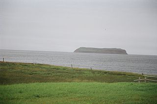
Port au Port West-Aguathuna-Felix Cove is a small town located on the Port au Port Peninsula of the Island of Newfoundland, Canada. The nearest large service area is Stephenville.
Steady Brook is a Canadian town in the province of Newfoundland and Labrador. Located on the west coast of the island of Newfoundland, the town is situated 8 kilometres east of the city of Corner Brook in the lower Humber Valley. The town is surrounded by the Long Range Mountains and sits astride the Humber River. Steady Brook has become a thriving community in recent years as a result of provincial investments in the Marble Mountain alpine ski resort, along with golf courses and other recreational amenities.
Gallants is located northeast of Stephenville, Newfoundland and Labrador, Canada. It was created as a Local Government Community on August 16, 1966.
Deep Bay is a designated place in the Canadian province of Newfoundland and Labrador.
Cape St. George is a headland and community of the same name, located at the southwestern tip of the Port au Port Peninsula on the Canadian island of Newfoundland.
Sheaves Cove is a local service district and designated place in the Canadian province of Newfoundland and Labrador. It is on the Port au Port Peninsula along the shore of St. George's Bay. There is a small tourist alcove just off the highway where views of the waterfalls and the ocean are visited often.
Ship Cove-Lower Cove-Jerry's Nose is a local service district and designated place in the Canadian province of Newfoundland and Labrador.
Lourdes is a town in the Canadian province of Newfoundland and Labrador. The town had a population of 465 in the Canada 2016 Census. The current mayor of Lourdes is Henry Gaudon.

McIvers is a town in the Canadian province of Newfoundland and Labrador. The town had a population of 575 in the Canada 2021 Census. The town celebrated its Come Home Year in 2017, following a successful Chase the Ace fundraiser the previous year which largely funded the event. The town is located on the north shore of the Bay of Islands, Newfoundland and Labrador.
Meadows is a town in the Canadian province of Newfoundland and Labrador. The town had a population of 404 in the Canada 2021 Census. The town has a senior citizen's complex, a convenience store/take-out, and the North Shore's only school, Templeton Academy, a k-12 school. It also has its own water supply, and provides water for the neighbouring town of Gilliams.
Mount Moriah is a town in the Canadian province of Newfoundland and Labrador. The town had a population of 700 in the Canada 2021 Census.
Port Rexton is a small town in the Canadian province of Newfoundland and Labrador. It is located on the East Coast of the island of Newfoundland at the north end of Robinhood Bay, about 10 minutes east of Trinity and 3 hours north of St. John's. The town had a population of 690 in 1940, 449 in 1951, 454 in 1956, 351 in the Canada 2006 Census, 338 in the Canada 2011 Census and most recently 340 in the Canada 2016 Census. The town is part of a group of communities known as the Trinity Bight. The town is home to a few small businesses, including inns and restaurants as well as the Skerwink trail which connects Port Rexton to Trinity Harbour.
Trinity Bay North is a town in the Canadian province of Newfoundland and Labrador. It is located at the northern tip of Trinity Bay. The town had a population of 1,649 in the Canada 2021 Census.
Fox Island River-Point au Mal is a local service district and designated place in the Canadian province of Newfoundland and Labrador. It is northwest of Stephenville.
Mainland is a local service district and designated place in the Canadian province of Newfoundland and Labrador. It is on the western shore of the Port au Port Peninsula approximately 50 kilometres (31 mi) from the Stephenville International Airport. Mainland is a coastal community, bordered by both the ocean and forest. The main industry in the community has traditionally been fishing, but currently (2016) a large portion of the inhabitants leave the community seasonally to earn income.

Black Duck Brook and Winterhouse is a local service district and designated place in the Canadian province of Newfoundland and Labrador. It consists of the unincorporated fishing settlements of Black Duck Brook and Winterhouse on the Port au Port Peninsula. The communities had a combined population of 57 in the Canada 2006 Census.
Black Duck is a local service district and designated place in the Canadian province of Newfoundland and Labrador that is 15 km (9 mi) east of the town of Stephenville. It is characterized by Harry's River, which runs past the community and is an Atlantic salmon fishing river.
Benton is a local service district and designated place in the Canadian province of Newfoundland and Labrador.