Newtown is a part of the Municipality of New-Wes-Valley, located at the North end of Bonavista Bay in the province of Newfoundland and Labrador, Canada. The approximate population is 400. Settlement in Newtown originated around 1850 when people relocated from nearby areas. Newtown is well known for being built on many small islands, and is the home of the Barbour Living Heritage Village.
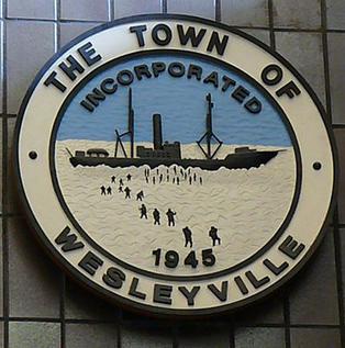
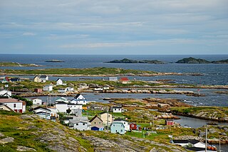
Wesleyville is a small coastal community in Newfoundland and Labrador, Canada. It is located on the Straight Shore of Bonavista Bay, on the northeast coast of Newfoundland, near the communities of Greenspond and Newtown. It was settled in the early 19th century, when residents relocated from nearby islands.
Greenspond is a community in the province of Newfoundland and Labrador, Canada.
Safe Harbour is an abandoned outport on the northeast coast of Newfoundland in the Canadian province of Newfoundland and Labrador. Settled by 1870, it was abandoned in 1955.

Open Hall-Red Cliffe is a local service district and designated place in the Canadian province of Newfoundland and Labrador.
Virgin Arm–Carter's Cove is a local service district and designated place on New World Island in the Canadian province of Newfoundland and Labrador. Virgin Arm-Carter's Cove is located approximately 90 km Northwest of Gander in Subdivision H of Division No. 8.
Carmanville is a Canadian community in the province of Newfoundland and Labrador.
Musgrave Harbour is a town in the Canadian province of Newfoundland and Labrador.
Cape Island is the name of both an island and a former community in the Canadian province of Newfoundland and Labrador.
Deadman's Bay is a local service district and designated place in the Canadian province of Newfoundland and Labrador. It is on the Straight Shore of Bonavista Bay near the community of Lumsden. The community is located near fishing grounds, contributing to its diversified and successful fishery despite its exposed, sandy coastline and harsh fall storms.
Flowers Island was one of the communities in an area on the northeast coast of the Island of Newfoundland called Bonavista North. These communities have a shared history in that they were settled by people from England, predominantly from the West Country—Dorset, Devon Somerset and Hampshire.
Cape Freels is one of the communities that comprise an area on the northeast coast of the Island of Newfoundland, called Bonavista North, in the province of Newfoundland and Labrador, Canada. These communities have a shared history in that they were settled by people from England, predominantly from the West Country - Dorset, Devon, Somerset and Hampshire.
Ladle Cove is a designated place in the Canadian province of Newfoundland and Labrador. It is along the Straight Shore on the island of Newfoundland.
Pool's Island is an incorporated community of Badger's Quay-Valleyfield-Pool's Island in the province of Newfoundland and Labrador, Canada. It is now part of the town of New-Wes-Valley.
Fair Island, also called Vere Island, is a former community on the northeast coast of the island of Newfoundland. Together with other nearby communities it comprises an area called Bonavista North. These communities have a shared history in that they were settled by people from England, predominantly from the West Country - Dorset, Devon Somerset and Hampshire.
Swain's Island, Newfoundland, is actually a group of eight islands on the north side of Bonavista Bay, southeast of Wesleyville. All of these islands once had inhabitants but eventually all of them were resettled, mostly to Wesleyville.
Located on the northwest side of Bonavista Bay, Newfoundland at the mouth of the Indian Bay inlet is a small island named Silver Fox Island that was once inhabited. It is about 3 km in length and about 3 km from Fair Island. The first settling began at Warren's Harbour on the southern side of the island.
Pinchard's Island was one of the communities that comprise an area on the northeast coast of the Island of Newfoundland, called Bonavista North. These communities have a shared history in that they were settled by people from England, predominantly from the West Country - Dorset, Devon Somerset and Hampshire.
Jackson's Arm is a town in the Canadian province of Newfoundland and Labrador, located on White Bay. It was settled by John Wicks of Christchurch, England, around 1870. The Post Office was established in 1892 and the first Postmistress was Belinda Peddle. The town had a population of 435 in 1956 and 277 as of the 2021 Canadian census. The primary industry of the town is fishing. In 2012, the local fish plant closed.

Division No. 7, Newfoundland and Labrador is a census division in the Canadian province of Newfoundland and Labrador, primarily comprising the Bonavista Bay region. Like all census divisions in Newfoundland and Labrador, but unlike the census divisions of some other provinces, the division exists only as a statistical division for census data, and is not a political entity.