
Conception Harbour is a town on the Avalon Peninsula in Newfoundland and Labrador, Canada. It is in Division 1 on Conception Bay.
Division No. 7, Subdivision M is an unorganised subdivision in eastern Newfoundland, Newfoundland and Labrador, Canada. It is in Division No. 7 on Trinity Bay.
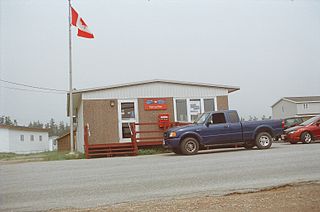
Division No. 7, Subd. K is an unorganized subdivision on the Bonavista Peninsula in Newfoundland and Labrador, Canada. It is in Division No. 7 on Trinity Bay.
Glovertown is a town in northeastern Newfoundland, Newfoundland and Labrador, Canada. It is in Division No. 7 on Alexander Bay.
Appleton is a town in the northeastern part of Newfoundland in the province of Newfoundland and Labrador, Canada.

Aldergrove is a townland sub-division in County Antrim, Northern Ireland. It is within the townland of Seacash and parish of Killead – 6 miles (9.7 km) south of Antrim and 18 miles (29 km) west of Belfast. It is part of the Borough of Antrim and Newtownabbey.

Duchess is a village in southern Alberta, Canada, located north of Brooks, across the Trans-Canada Highway, in the County of Newell.

The Great Northern Peninsula is the largest and longest peninsula of Newfoundland, Canada, approximately 270 km long and 90 km wide at its widest point and encompassing an area of 17,483 km2. It is defined as that part of Newfoundland from Bonne Bay northwards around Cape Norman and Cape Bauld and thence southwards to the head of White Bay, bounded by the Gulf of St. Lawrence on the west, the Strait of Belle Isle on the north and the Labrador Sea and White Bay on the east.

Random Island is located off Canada's Atlantic coast. Part of the Province of Newfoundland and Labrador, it is located on the east coast of Newfoundland and partially surrounded by the Bonavista Peninsula on the north and within the confines of Trinity Bay. The island is approximately 35 km (22 mi) long, its width varies from 15 km (9.3 mi) on the eastern end, to 6 km (3.7 mi) in the middle, to 17 km (11 mi) on the western end, with a total area of around 310 km2 (120 sq mi). According to the 2016 census, the population of the island is 1,232.
Port au Port is a small Canadian rural community located in the western part of the island of Newfoundland. Port au Port is situated on the isthmus connecting the main part of the island of Newfoundland to the Port au Port Peninsula to the west. Port au Port is located on Route 460, several kilometres west of the town of Stephenville and the village of Kippens, at its intersection with Route 462. It was originally named Gravels. It had a population of 505 in 1940 and 214 by 1956. Port au Port is located with the town limits of Port au Port East.

Semans is a village in the Canadian province of Saskatchewan within the Rural Municipality of Mount Hope No. 279 and Census Division No. 10. The village is located approximately 125 km north of the City of Regina and 195 km southeast of the City of Saskatoon.
The Bonavista Peninsula is a large peninsula on the east coast of the island of Newfoundland in the Canadian province of Newfoundland and Labrador. It consists of 50 incorporated towns/unincorporated communities which have a population of 12,176 as of the 2016 Canadian Census.
Wanham is a hamlet in northern Alberta, Canada within Birch Hills County. It is located 29 km (18 mi) east of Rycroft along Highway 49 and approximately 106 km (66 mi) north of Grande Prairie, in the farmlands of Peace River Country. Saddle River, a tributary of Peace River, flows immediately north of the settlement.
Bay du Nord Wilderness Reserve is located in central part of the Island of Newfoundland in the province of Newfoundland and Labrador, Canada. The area encompasses an area of 2,895 km2 and is considered one of the last remaining unspoiled areas of the province devoid of human habitat. It was officially created as a wilderness reserve in 1990.
Glover Island is a large (178 km2) lake island in the interior of the Island of Newfoundland in the province of Newfoundland and Labrador, Canada. It is the 18th largest lake island in the world by area. The island is located in Grand Lake, a natural lake whose waters were raised for the Deer Lake Power Development. Historic maps show that Glover Island pre-dates this.
Lourdes is a town in the Canadian province of Newfoundland and Labrador. The town had a population of 465 in the Canada 2016 Census. The current mayor of Lourdes is Anne Bullen.
Point Lance is a town in the Canadian province of Newfoundland and Labrador. The town had a population of 102 in the Canada 2016 Census.

Cartwright Air Station is a closed General Surveillance Radar station. It is located 233.7 km (145.2 mi) east-northeast of CFB Goose Bay, Newfoundland and Labrador. It was closed in 1968.
German submarine U-733 was a Type VIIC U-boat of Nazi Germany's Kriegsmarine during World War II. The submarine was laid down on 15 October 1941 at the Schichau-Werke yard at Danzig, launched on 5 September 1942, and commissioned on 14 November 1942 under the command of Oberleutnant zur See Wilhelm von Trotha.

The 2018 Atlantic hurricane season was an event in the annual hurricane season in the north Atlantic Ocean. It as an above-average season for tropical cyclones for the third consecutive year. Though the season officially began on June 1, 2018 and ended November 30, 2018, dates adopted by convention and historically describe the period during each year when most tropical cyclones form, it effectively started with the formation of Tropical Storm Alberto on May 25. The season's final storm, Hurricane Oscar, dissipated on October 31.