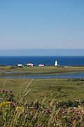
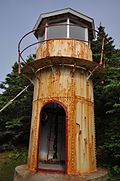
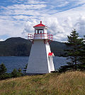
This is a list of lighthouses in Canada . These may naturally be divided into lighthouses on the Pacific coast, on the Arctic Ocean, in the Hudson Bay watershed, on the Labrador Sea and Gulf of St. Lawrence, in the St. Lawrence River watershed (including the Great Lakes), and on the Atlantic seaboard.
This is a list of lighthouses in Labrador . [4] [5]
Name | Image | Year built [4] | Location & coordinates | Class of Light [5] | Focal height [5] | NGA number [5] | Admiralty number [5] | Range nml [5] |
---|---|---|---|---|---|---|---|---|
Belle Isle Northeast Light | 1905 | Belle Isle 52°00′50″N55°16′50″W / 52.013944°N 55.280611°W | Fl W 10s. | 137 metres (449 ft) | 984 | H0096 | 17 | |
Belle Isle South End Lower Light | Image | 1908 | Belle Isle 51°52′42″N55°23′01″W / 51.878346°N 55.383561°W | Fl W 20s. | 50 metres (160 ft) | 992 | H0104 | 18 |
Belle Isle South End Upper Light | Image | 1858 | Belle Isle 51°52′49″N55°22′55″W / 51.880293°N 55.382059°W | Fl W 20s. | 137 metres (449 ft) | 988 | H0102 | 18 |
Camp Island Light | n/a | Division No. 10 52°10′11″N55°38′56″W / 52.169796°N 55.648834°W | Fl W 5s. | 42 metres (138 ft) | 976 | H0094 | 15 | |
Castle Island Light | n/a | Division No. 10 51°58′20″N55°51′11″W / 51.972214°N 55.853042°W | Fl W 6s. | 20 metres (66 ft) | 980 | H0108 | 15 | |
Double Island Light | Image | 1905 | Battle Harbour 52°15′20″N55°33′14″W / 52.255532°N 55.553845°W | Fl W 6s. | 38 metres (125 ft) | 968 | H0092 | 7 |
Kenamu River Range Front Light | n/a | Hamilton Inlet 53°28′48″N59°53′51″W / 53.480079°N 59.897464°W | Oc G 6s. | 7 metres (23 ft) | 904 | H0077 | 13 | |
Kenamu River Range Rear Light | n/a | Hamilton Inlet 53°28′29″N59°55′02″W / 53.474703°N 59.917180°W | Oc G 6s. | 7 metres (23 ft) | 900 | H0076.5 | 13 | |
Point Amour Lighthouse | 1858 | Division No. 10 51°27′38″N56°51′30″W / 51.460616°N 56.858281°W | Oc W 20s. | 46 metres (151 ft) | 1012 | H0114 | 24 | |
Red Bay Light | Image | 1906 est. | Saddle Island 51°43′29″N56°26′10″W / 51.724709°N 56.436001°W | Fl W 5s. | 36 metres (118 ft) | 1000 | H0110 | 15 |
St Modeste Island Light | Image | 1956 | West St. Modeste 51°35′42″N56°42′03″W / 51.595083°N 56.700899°W | inactive since 2010 | 5.5 metres (18 ft) tower height | 1004 | H0111 | |
Terrington Narrows Light | n/a | Happy Valley-Goose Bay 53°20′38″N60°24′06″W / 53.343961°N 60.401736°W | Dir WRG | 10 metres (33 ft) | 910 | H0076.3 | 19 | |
This is a list of lighthouses on Newfoundland's Atlantic Coast. [6] [7] [5]
This is a list of lighthouses in Newfoundland South Coast. [8] [9] [5]
This is a list of lighthouses in Newfoundland West Coast. [10] [11] [5]
Sources: [15]
Cape Beale Lightstation is an active manned lighthouse on Vancouver Island in British Columbia., Canada.
Belle Isle Northeast Light is a 27-metre (89 ft) tall, 12-sided flying buttress lighthouse located on Belle Isle, Newfoundland, which was built in 1905. It is one of three lighthouses on the island and was maintained by the Canadian Government despite the fact that Newfoundland did not join Confederation until 1949. It was designed by William P. Anderson as one in a series of nine buttressed lighthouses built in Canada around 1910.
The Langara Point Lighthouse is a staffed lighthouse located atop a scenic bluff on the northwest corner of Langara Island. It is one of only two lighthouses in Haida Gwaii – the other being at Cape St. James, at the southern tip of the islands. Both were built in 1913.
The Scotch Cap Light is a series of lighthouses located on the southwest corner of Unimak Island in Alaska. It was the first station established on the outside coast of Alaska.
Cape Anguille is a headland and the westernmost point in Newfoundland, reaching into the Gulf of Saint Lawrence. It is the southern edge of St. George's Bay. Its name is derived from the French word anguille, which means eel. Close to the cape is the community of Cape Anguille.
Long Point Lighthouse is an active Canadian lighthouse located outside Crow Head on North Twillingate Island off the northeast coast of Newfoundland. The lighthouse, completed in 1876, attracts thousands of tourists each year and is historic to the town of Twillingate.
The Gros Cap Reefs Light is a lighthouse located at the entrance to St. Mary's River from Whitefish Bay of Lake Superior. The light was completed in 1953 and replaced a lightship stationed there since 1923. The lighthouse, owned by the Canadian Coast Guard, is located on the southwest edge of the Gros Cap Reef.
The Malpeque Harbour Approach Range Lights are a set of range lights on Prince Edward Island, Canada. The current rear tower was built in 1961.
The Murray Harbour Range Lights are a set of range lights near Murray Harbour, Prince Edward Island, Canada. They were built in 1879, and are still active.
The history of lighthouses in Canada dates to 1734.
Cape Bonavista Light is a lighthouse located on Cape Bonavista, Newfoundland. The lighthouse, which operated from 1843 until 1962, is now a provincial museum, containing an exhibition about life in a lighthouse during the 1870s.
Cape Bowling Green Light is an active lighthouse on Cape Bowling Green, a long headland ending in a long low sandspit, about 30 kilometres (19 mi) from Ayr, Queensland, Australia. The lighthouse is at the end of the headland, near the base of the sandspit. The first lighthouse at the location, established in 1874, was moved multiple times. It was prefabricated in Brisbane, shipped to the location, moved twice due to coastal erosion and finally transferred for display at the Australian National Maritime Museum at Darling Harbour in Sydney.
Entrance Island is a small rocky island in the Strait of Georgia, 841 metres (2,759 ft) due north of Gabriola Island. Marine mammals such as harbour seals and Steller's sea lions use it as a haul-out.
Cape Otway Lighthouse is a lighthouse on Cape Otway in southern Victoria, Australia. It is Victoria's oldest working lighthouse. During winter to spring, the lighthouse is a vantage point for land-based whale watching as migrating whales swim very close to shores.
The major Trial Island is home to the Trial Islands Lighthouse which is operated by the Canadian Coast Guard, and continues to be staffed by two full-time lightkeepers. The current lighthouse was erected in 1970 to replace the original lighthouse that was constructed in 1906. The fourth order Fresnel lens from 1906 was used until it was replaced in 1970. That original lens is now on display courtesy of the Maritime Museum of British Columbia in Bastion Square in Downtown Victoria.
Point Riche Lighthouse, located in Port au Choix, Newfoundland in Canada's Newfoundland and Labrador province, is a "pepperpot" lighthouse that was built in 1892 and is still active. The white wooden tower is octagonal pyramidal in shape, the lantern room is painted red. The structure is 19 metres (62 ft) tall. Its light characteristic is a flash every 5 seconds, emitted at a focal plane height of 29 metres (95 ft). It is maintained by the Port au Choix National Historic Site.
Cape Mudge Lighthouse is located on Quadra Island which is off Campbell River, on the east coast of Vancouver Island, British Columbia, Canada.
Farol de Dona Maria Pia is a lighthouse at the southernmost point of the island of Santiago, Cape Verde. It stands on the headland Ponta Temerosa, at the entrance of Praia Harbour, 2 km south of the city centre of Praia. The lighthouse was built in 1881 and was named after Maria Pia of Savoy, queen of Portugal at the time. The octagonal tower is 21 m high and its focal plane is 25 m above mean sea level. It is painted white. The lighthouse is used for navigational purposes.