White Head Island

Last updated

White Head Island
Canada New Brunswick location map 2.svg
Red pog.svg
White Head Island
Location in the Bay of Fundy
Geography
LocationBay of Fundy
Coordinates 44°37′52.6″N66°42′28.63″W / 44.631278°N 66.7079528°W / 44.631278; -66.7079528
ArchipelagoGrand Manan Archipelago
Area6.17 km2 (2.38 sq mi)
Administration
Canada
Province New Brunswick
County Charlotte
Parish Grand Manan Parish
Demographics
Population162 (2011) [1]
Pop. density26.3/km2 (68.1/sq mi)
Long Point Lighthouse OOjs UI icon edit-ltr-progressive.svg
WhiteHeadIslandNB.jpg
Long Point Lighthouse at the southern tip of White Head Island
Constructed1966  OOjs UI icon edit-ltr-progressive.svg
Foundationconcrete base
Constructionconcrete tower
Height11 m (36 ft)  OOjs UI icon edit-ltr-progressive.svg
Shapequadrangular tower with balcony and lantern rising from the fog signal building [2]
Markingswhite tower, red lantern
Power sourcesolar power  OOjs UI icon edit-ltr-progressive.svg
OperatorCanadian Coast Guard [3] [4]
Fog signal 2s. blast every 20s.
Focal height15.5 m (51 ft)  OOjs UI icon edit-ltr-progressive.svg
Range12 nmi (22 km; 14 mi)  OOjs UI icon edit-ltr-progressive.svg
Characteristic Iso W 12s  OOjs UI icon edit-ltr-progressive.svg

White Head Island is located east of Grand Manan in the Bay of Fundy, New Brunswick. In 2011 the island had a population of 162. White Head Island was governed as a local service district [1] prior to the 2023 New Brunswick local governance reform.

For approximately four hours surrounding low tide, the island can be reached on-foot from Grand Manan walking across sandbars and ledges through shallow water. [5]

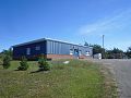
Its economy is based largely around aquaculture and fishing. [6]

The island has a two-classroom elementary school, and from Grade 7 onward students take a ferry to Grand Manan Community School.

Coastal Transport Limited operates the free year-round William Frankland car ferry between White Head and Grand Manan. [7]

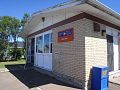
Until 2022 the community had a small general store.

There is a Baptist church on the island that was completed in 1981. However, there are records of a religious house in use until 1928, when the second of three churches was dedicated. [8]

There are 5km of paved roads circling the northern half of the island, while the southern portion has only gravel roads that are less accessible. [9]

Related Research Articles

<span class="mw-page-title-main">Bay of Fundy</span> Bay on the east coast of North America

The Bay of Fundy is a bay between the Canadian provinces of New Brunswick and Nova Scotia, with a small portion touching the U.S. state of Maine. It is an arm of the Gulf of Maine. Its tidal range is the highest in the world. The name is probably a corruption of the French word fendu, meaning 'split'.

<span class="mw-page-title-main">Grand Manan</span> Village in New Brunswick, Canada

Grand Manan is a Canadian island in the Bay of Fundy, part of the province of New Brunswick. Grand Manan is also the name of an incorporated village, which includes the main island and numerous nearby islands; White Head Island, small islands near it, and Machias Seal Island are not part of the village.

<span class="mw-page-title-main">Campobello Island</span> Island in Campobello, New Brunswick, Canada

Campobello Island is the largest and only inhabited island in Campobello, a geographic parish in southwestern New Brunswick, Canada, near the border with Maine, United States. It is the site of the Roosevelt Campobello International Park, Head Harbour Lighthouse, and of Herring Cove Provincial Park.

<span class="mw-page-title-main">Machias Seal Island</span> Disputed island in the Gulf of Maine

Machias Seal Island is an island in disputed water between the Gulf of Maine and the Bay of Fundy, about 8.6 nmi (16 km) southeast from Cutler, Maine, and 10 nmi (19 km) southwest of Grand Manan Island, New Brunswick. Sovereignty of the island is disputed by the United States and Canada. The Canadian Coast Guard continues to staff a lighthouse on the island; the first lighthouse was constructed there in 1832.

Deer Island is one of the Fundy Islands at the entrance to Passamaquoddy Bay in the Bay of Fundy, Canada. The Old Sow tidal whirlpool is the largest in the western hemisphere can be viewed from the southern tip of the island.

<span class="mw-page-title-main">Coastal Transport Limited</span> Canadian ferry company

Coastal Transport Limited is a ferry company operating in eastern Canada on the Bay of Fundy with headquarters in Saint John, New Brunswick. The company began as a wholly owned subsidiary of Marine Atlantic Incorporated (MAI), and in April 1997 was sold to Murray O. Ryder, the former MAI Vice President of Operations.

<span class="mw-page-title-main">Cape Tormentine, New Brunswick</span> Village in New Brunswick, Canada

Cape Tormentine is a rural community and former local service district in southeastern New Brunswick, Canada. It is located on the Northumberland Strait at the Abegweit Passage, the shortest crossing between Prince Edward Island and the mainland. It once flourished as a transportation hub between New Brunswick and Prince Edward Island but has been in decline since 1997 when the ferry service was closed due to the opening of the Confederation Bridge. At the Canada 2011 Census the population was 108, three quarters what it was at the 2006 census.

Blacks Harbour is a community in the rural community of Eastern Charlotte, New Brunswick, Canada. It held village status prior to 2023. It is on a harbour of the same name opening onto the Bay of Fundy. It is 15 kilometres southeast of the town of St. George, 3 kilometres west of Beaver Harbour and 56 kilometres east from the town of St. Stephen on Route 176.

<span class="mw-page-title-main">St. Martins, New Brunswick</span> Place in New Brunswick, Canada

St. Martins is a community on the Bay of Fundy now part of the village of Fundy-St. Martins, Canada.

<span class="mw-page-title-main">New Brunswick Route 776</span> Highway in New Brunswick

Route 776 is a provincial highway in New Brunswick, Canada. It serves as the main road on Charlotte County's Grand Manan Island, following the entire eastern coast of the island.

<span class="mw-page-title-main">The Anchorage Provincial Park</span> Provincial park of New Brunswick, Canada

The Anchorage Provincial Park is a public park located on the south-east coast of Grand Manan Island, New Brunswick, Canada. The island, the largest in the Bay of Fundy, is also the primary island in the Grand Manan Archipelago, sitting at the boundary between the Bay of Fundy and the Gulf of Maine.

<span class="mw-page-title-main">Department of Transportation and Infrastructure (New Brunswick)</span> Government agency in New Brunswick, Canada

The Department of Transportation and Infrastructure is a part of the Government of New Brunswick. It is charged with maintenance of government facilities and the province's highway network. From 1855 to 1912, it was known as the Board of Public Works. From 1912 to 1967, it was known as Department of Public Works and Highways. In 1967, its functions were divided between the Department of Public Works and the Department of Transportation. In 2012, the Department of Transportation and the infrastructure management components of the Department of Supply and Services were merged back together.

The Fundy Islands, also known as the Fundy Isles, is a term given to a group of Canadian islands in the Bay of Fundy along the southwestern coast of New Brunswick, Canada, in the provincial county of Charlotte.

<span class="mw-page-title-main">West Isles Parish, New Brunswick</span> Parish in Canada

West Isles is a geographic parish in Charlotte County, New Brunswick, Canada.

<span class="mw-page-title-main">Grand Manan Parish, New Brunswick</span> Parish in Canada

Grand Manan is a geographic parish in Charlotte County, New Brunswick, Canada, comprising one village and part of a rural district; the rural district portion was formerly a local service district (LSD); both of which are members of the Southwest New Brunswick Service Commission (SNBSC). The parish includes Grand Manan Island and numerous lesser islands, only one of which has permanent year-round inhabitants.

<span class="mw-page-title-main">Gannet Rock Lighthouse</span> Lighthouse

The Gannet Rock Lighthouse is a Canadian lighthouse located on a rocky islet 8 miles (13 km) south of Grand Manan in the Bay of Fundy. It was first lit in 1831 and was staffed until 1996. It was solarized in 2002 and remains operational in 2023. It was declared "surplus to requirements" by the Canadian Coast Guard in 2010 and is no longer being maintained.

<i>Lord Ashburton</i> (ship)

The Lord Ashburton was a merchant ship built in 1843 at St. Andrews, New Brunswick. She was wrecked in a nor'easter on Grand Manan Island in January 1857 en route from Toulon to Saint John, New Brunswick.

<span class="mw-page-title-main">Swallowtail Lighthouse</span> Lighthouse

The Swallowtail Lighthouse is a Canadian lighthouse located on Grand Manan Island in the Bay of Fundy. It was the first lighthouse to be built on the island. It was first lit on 7 July 1860 and was automated and de-staffed in 1986.

<span class="mw-page-title-main">Long Eddy Point Lighthouse</span> Lighthouse

The Long Eddy Point Lighthouse is a Canadian lighthouse on Grand Manan Island in the Bay of Fundy. The navigation station was first established in 1874 as a fog alarm only and operated as such until 1966, when the present structure was built incorporating a lighthouse. The building has been designated a heritage lighthouse under Canada's Heritage Lighthouse Protection Act.

<span class="mw-page-title-main">Grand Harbour Lighthouse</span> Lighthouse

The Grand Harbour Lighthouse was a Canadian lighthouse marking the entrance to Grand Harbour, Grand Manan, New Brunswick. It was built and first lit in 1879 and was decommissioned in 1963. It was severely damaged in the Groundhog Day gale of 1976 and destroyed by a gale in November 2013.

References

  1. 1 2 "White Head, New Brunswick. Census Profile". 2011 Census. Statistics Canada. 2012.
  2. List of Lights, Pub. 110: Greenland, The East Coasts of North and South America (Excluding Continental U.S.A. Except the East Coast of Florida) and the West Indies (PDF). List of Lights . United States National Geospatial-Intelligence Agency. 2015.
  3. Rowlett, Russ. "Lighthouses of Canada: Southern New Brunswick". The Lighthouse Directory. University of North Carolina at Chapel Hill . Retrieved 2017-03-23.
  4. Long Point, NB Lighthouse Friends. Retrieved 23 March 2017
  5. Lorimer, John G. "History of Islands and Islets in the Bay of Fundy, Charlotte County, New Brunswick", Archive.org copy, 1876
  6. "...things to do while on Grand Manan". ambleinncottages.com/. September 2018. Archived from the original on 2018-10-17. Retrieved 2018-10-17.
  7. "White Head Schedule". Coastal Transport. Retrieved 3 July 2017.
  8. "White Head Baptist Church". Ancestry.com. Retrieved 2017-05-01.
  9. https://www.hikingnb.ca/Trails/FundyWest/GrandManan/WhiteHead.html