Saint Andrews Parish, New Brunswick

Last updated

Saint Andrews
St. Andrews
Charlotte County NB - Saint Andrews Parish.png
Location within Charlotte County.
Country Flag of Canada (Pantone).svg  Canada
Province Flag of New Brunswick.svg  New Brunswick
County Charlotte County
Erected1786
Area
[1]
  Land24.27 km2 (9.37 sq mi)
Population
 (2021) [1]
  Total550
  Density22.7/km2 (59/sq mi)
  Change 2016-2021
Decrease2.svg 0.5%
  Dwellings
296
Time zone UTC-4 (AST)
  Summer (DST) UTC-3 (ADT)
Figures do not include portion within the town of Saint Andrews

Saint Andrews Parish is a geographic parish in Charlotte County, New Brunswick, Canada, [4] located east of St. Stephen.

Contents

For governance purposes, the entire parish is part of the town of Saint Andrews, [5] which is a member of the Southwest New Brunswick Service Commission. [6]

Prior to the 2023 governance reform, it comprised the town of Saint Andrews, which included Navy Island, and the Chamcook local service district, [7] which included Ministers Island and the mainland north of the town. The LSD assessed for fire, police, zoning, emergency measures and animal control services. [8] The taxing authority was 513.00 Chamcook. Both the town and the LSD are members of the Southwest New Brunswick Service Commission (SNBSC). [9]

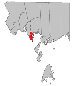
For census purposes, Statistics Canada divides the area into Saint Andrews, Parish, and Saint Andrews, Town. [1]

Origin of name

Historian William F. Ganong notes the use of St. Andrews Point in the Owen Journal of 1770 but considered the name to date back to French times. [10]

Five of the original six mainland parishes of Charlotte County used names of major saints recognised by the Church of England: Andrew (Scotland), David (Wales), George (England), Patrick (Ireland), and Stephen.

History

Saint Andrews Parish was erected in 1786 as one of the county's original parishes, [11] including most of Saint Croix Parish and parts of Saint David and Saint Patrick Parishes.

The local service district of the parish of Saint Andrews comprised all of the parish outside Saint Andrews. It was established in 1970 to assess for fire protection. [12] First aid and ambulance services were added in 1975. [13] It was replaced by Chamcook in 1997. [14]

Boundaries

Saint Andrews Parish is bounded: [2] [15] [16]

Evolution of boundaries

Saint Andrews' original eastern boundary ran straight from the original southeastern corner of the Cape Association grant that makes up the northern part of Saint David Parish to join its modern northeastern boundary near the head of Mitchell Brook, cutting through the southwestern corner of Saint Patrick Parish and leaving the northeastern part of Saint Croix Parish as part of Saint Patrick. Five grants north of the junction of Board Road and Route 760 that are now part of Saint David Parish were also part of Saint Andrews.

In 1874 the northern part of Saint Andrews was erected as Saint Croix, taking all parts of the parish now in Saint Croix, Saint David, and Saint Patrick as well as a bit of territory north of Wileys Corner and land between the railway and the Chamcook Lakes. [17]

In 1958 the modern boundary with Saint Croix was established, transferring everything between the railway and the Chamcook Lakes to Saint Andrews, as well as territory north of Wileys Corner. [18]

Communities

Communities at least partly within the parish. [15] [16] [19] bold indicates an incorporated municipality; italics indicates a name no longer in official use

Bodies of water

Bodies of water [lower-alpha 1] at least partly within the parish. [15] [16] [19]

Islands

Islands at least partly within the parish. [15] [16] [19] italics indicates a name no longer in official use

Other notable places

Parks, historic sites, and other noteworthy places at least partly within the parish. [15] [16] [19] [20] [21]

Demographics

Population total does not include the town of Saint Andrews

Population

Canada census – Saint Andrews community profile
2021 2016 2011
Population550 (-0.5% from 2016)553 (-6.7% from 2011)593 (+0.2% from 2006)
Land area24.27 km2 (9.37 sq mi)24.27 km2 (9.37 sq mi)24.38 km2 (9.41 sq mi)
Population density22.7/km2 (59/sq mi)22.8/km2 (59/sq mi)24.3/km2 (63/sq mi)
Median age54.8 (M: 55.6, F: 54.8)52.2 (M: 51.8, F: 52.4)47.6 (M: 47.2, F: 47.9)
Private dwellings250 (total) 312 (total) 311 (total) 
Median household income$68,864$.N/A
Notes: 2011 income data for this area has been suppressed for data quality or confidentiality reasons.
References: 2021 [23] 2016 [24] 2011 [25] earlier [26] [27]
Historical Census Data - Saint Andrews Parish, New Brunswick
YearPop.±%
1991 457    
1996 452−1.1%
2001 547+21.0%
YearPop.±%
2001A 552+0.9%
2006 592+7.2%
2011 593+0.2%
YearPop.±%
2016 553−6.7%
(A) adjustment due to boundary change.
[28] [29]

Language

Canada Census Mother Tongue - Saint Andrews Parish, New Brunswick [28]
CensusTotal
English
French
English & French
Other
YearResponsesCountTrendPop %CountTrendPop %CountTrendPop %CountTrendPop %
2011
590
555Increase2.svg 1.8%94.07%25Increase2.svg 20.0%4.24%0Steady2.svg 0.0%0.00%10Decrease2.svg 50.0%1.69%
2006
0
545Increase2.svg 3.7%0.00%20Steady2.svg 0.0%0.00%0Steady2.svg 0.0%0.00%20Increase2.svg n/a%0.00%
2001
545
525Increase2.svg 12.4%96.33%20Increase2.svg n/a%3.67%0Steady2.svg 0.0%0.00%0Decrease2.svg 100.0%0.00%
1996
460
450n/a97.83%0n/a0.00%0n/a0.00%10n/a2.17%

Access Routes

Highways and numbered routes that run through the parish, including external routes that start or finish at the parish limits: [30]

See also

Notes

  1. Not including brooks, ponds or coves.

Related Research Articles

<span class="mw-page-title-main">Campobello Island</span> Island in Campobello, New Brunswick, Canada

Campobello Island is the largest and only inhabited island in Campobello, a geographic parish in southwestern New Brunswick, Canada, near the border with Maine, United States. The island's permanent population in 2021 was 949. It is the site of the Roosevelt Campobello International Park, Head Harbour Lighthouse, and of Herring Cove Provincial Park.

<span class="mw-page-title-main">Saint Andrews, New Brunswick</span> Town in New Brunswick, Canada

Saint Andrews is a town in Charlotte County, New Brunswick, Canada. The historic town is a national historic site of Canada, bearing many characteristics of a typical 18th century British colonial settlement, including the original grid layout with its market square, and the classical architecture.

<span class="mw-page-title-main">Addington Parish, New Brunswick</span> Parish in New Brunswick, Canada

Addington is a geographic parish in Restigouche County, New Brunswick, Canada.

<span class="mw-page-title-main">Eldon Parish, New Brunswick</span> Parish in New Brunswick, Canada

Eldon is a geographic parish in Restigouche County, New Brunswick, Canada.

<span class="mw-page-title-main">Shippegan Parish, New Brunswick</span> Parish in New Brunswick, Canada

Shippegan is a geographic parish in Gloucester County, New Brunswick, Canada. Located in the northeastern corner of the province at the end of the Acadian Peninsula, the parish consists of the three main islands of Taylor, Lamèque, and Miscou, along with several smaller islands and tidal wetlands; Taylor Island is now joined to the mainland by an isthmus, which is crossed by a causeway.

<span class="mw-page-title-main">Saint-François Parish, New Brunswick</span> Parish in New Brunswick, Canada

Saint-François is a geographic parish in Madawaska County, New Brunswick, Canada.

<span class="mw-page-title-main">Lac Baker Parish, New Brunswick</span> Parish in New Brunswick, Canada

Lac Baker is a geographic parish in Madawaska County, New Brunswick, Canada.

<span class="mw-page-title-main">Wakefield Parish, New Brunswick</span> Parish in New Brunswick, Canada

Wakefield is a geographic parish in Carleton County, New Brunswick, Canada, located north on the west bank of the Saint John River north of Woodstock.

<span class="mw-page-title-main">Brighton Parish, New Brunswick</span> Parish in New Brunswick, Canada

Brighton is a geographic parish in Carleton County, New Brunswick, Canada, northeast of Woodstock, extending from the eastern bank of the Saint John River to the York County line.

<span class="mw-page-title-main">Clarendon Parish, New Brunswick</span> Parish in Canada

Clarendon is a geographic parish in Charlotte County, New Brunswick, Canada, located in the interior to the north of Point Lepreau and southwest of CFB Gagetown.

<span class="mw-page-title-main">Pennfield Parish, New Brunswick</span> Parish in Canada

Pennfield is a geographic parish in Charlotte County, New Brunswick, Canada, located west of Saint John located east of St. George and west of Saint John.

<span class="mw-page-title-main">West Isles Parish, New Brunswick</span> Parish in Canada

West Isles is a geographic parish in Charlotte County, New Brunswick, Canada.

<span class="mw-page-title-main">Saint George Parish, New Brunswick</span> Parish in Canada

Saint George is a geographic parish in Charlotte County, New Brunswick, Canada, located between St. Stephen and Saint John.

<span class="mw-page-title-main">Dumbarton Parish, New Brunswick</span> Parish in Canada

Dumbarton is a geographic parish in Charlotte County, New Brunswick, Canada, located inland north of St. George and south of Harvey.

<span class="mw-page-title-main">Saint Patrick Parish, New Brunswick</span> Parish in Canada

Saint Patrick is a geographic parish in Charlotte County, New Brunswick, Canada, located west of St. George and Saint Andrews.

<span class="mw-page-title-main">Saint Croix Parish, New Brunswick</span> Parish in Canada

Saint Croix is a geographic parish in Charlotte County, New Brunswick, Canada, straddling Route 1 to the north of the original town of Saint Andrews.

<span class="mw-page-title-main">Dufferin Parish, New Brunswick</span> Parish in Canada

Dufferin is a geographic parish in Charlotte County, New Brunswick, Canada, located east of St. Stephen.

<span class="mw-page-title-main">Saint Stephen Parish, New Brunswick</span> Parish in Canada

Saint Stephen is a geographic parish in Charlotte County, New Brunswick, Canada, located in the southwestern corner of the province.

<span class="mw-page-title-main">Saint James Parish, New Brunswick</span> Parish in Canada

Saint James is a geographic parish in Charlotte County, New Brunswick, Canada, located north of St. Stephen.

<span class="mw-page-title-main">Saint David Parish, New Brunswick</span> Parish in Canada

Saint David is a geographic parish in Charlotte County, New Brunswick, Canada, located northeast of St. Stephen and northwest of Saint Andrews.

References

  1. 1 2 3 "Census Profile". Statistics Canada. 26 October 2022. Retrieved 30 October 2022.
  2. 1 2 "Chapter T-3 Territorial Division Act". Government of New Brunswick. Retrieved 5 June 2023.
  3. "Chapter I-13 Interpretation Act". Government of New Brunswick. Retrieved 5 June 2023.
  4. The Territorial Division Act [2] divides the province into 152 parishes, the cities of Saint John and Fredericton, and one town of Grand Falls. The Interpretation Act [3] clarifies that parishes include any local government within their borders.
  5. "Southwest Regional Service Commission: RSC 10". Government of New Brunswick. Retrieved 5 June 2023.
  6. "Regions Regulation – Regional Service Delivery Act". Government of New Brunswick. 21 July 2022. Retrieved 5 June 2023.
  7. "New Brunswick Regulation 84-168 under the Municipalities Act (O.C. 84-582)". Government of New Brunswick. Retrieved 6 February 2021.
  8. "2020 Local Government Statistics for New Brunswick" (PDF). Department of Environment and Local Government. p. 55. Retrieved 6 February 2021.
  9. "Communities in each of the 12 Regional Service Commissions (RSC) / Les communautés dans chacune des 12 Commissions de services régionaux (CSR)" (PDF), Government of New Brunswick, July 2017, retrieved 1 February 2021
  10. Ganong, William F. (1896). A Monograph of the Place-Nomenclature of the Province of New Brunswick. Royal Society of Canada. pp. 266–267. Retrieved 17 March 2021.
  11. "26 Geo. III Chapter I. An Act for the better ascertaining and confirming the Boundaries of the several Counties within this Province, and for subdividing them into Towns or Parishes.". Acts of the General Assembly of His Majesty's Province of New-Brunswick, passed in the year 1786. Saint John, New Brunswick: Government of New Brunswick. 1786. pp. 3–12. Retrieved 20 March 2021.
  12. "Regulation 70–63 under the Municipalities Act (O. C. 70–385)". The Royal Gazette. 128. Fredericton: 343–344. 17 June 1970.
  13. "Regulation 75–4 under the Municipalities Act (O. C. 75–33)". The Royal Gazette. 133. Fredericton: 80. 29 January 1975.
  14. New Brunswick Regulation 97-94.
  15. 1 2 3 4 5 "No. 161". Provincial Archives of New Brunswick. Department of Natural Resources and Energy Development. Retrieved 3 July 2021. Remainder of parish on map 166 at same site.
  16. 1 2 3 4 5 "489" (PDF). Transportation and Infrastructure. Government of New Brunswick. Retrieved 3 July 2021. Remainder of parish on mapbook 496 at same site.
  17. "37 Vic. c. 37 An Act to establish a new Parish in the County of Charlotte.". Acts of the General Assembly of Her Majesty's Province of New Brunswick. Passed in the Months of March & April 1874. Fredericton: Government of New Brunswick. 1874. pp. 109–111. Available as a free ebook from Google Books.
  18. "7 Elizabeth II, 1958, c. 56 An Act to Amend the Territorial Division Act". Acts of the Legislature of New Brunswick Passed During the Session of 1958. Fredericton: Government of New Brunswick. 1958. pp. 117–119.
  19. 1 2 3 4 "Search the Canadian Geographical Names Database (CGNDB)". Government of Canada. Retrieved 4 July 2021.
  20. "New Brunswick Regulation 2017-46 under the Parks Act (O.C. 2017-293)" (PDF). The Royal Gazette. 175. Fredericton: Queen's Printer: 1496–1497. 13 December 2017. ISSN   1714-9428 . Retrieved 5 July 2021.
  21. "Explore New Brunswick's Protected Natural Areas". GeoNB. Retrieved 4 July 2021.
  22. "New Brunswick Regulation 94-43 under the Fish and Wildlife Act (O.C. 94-231)". Government of New Brunswick. 5 June 2006. Retrieved 8 July 2021.
  23. "2021 Community Profiles". 2021 Canadian Census . Statistics Canada. 4 February 2022. Retrieved 27 April 2022.
  24. "2016 Community Profiles". 2016 Canadian Census . Statistics Canada. 12 August 2021. Retrieved 30 August 2019.
  25. "2011 Community Profiles". 2011 Canadian Census . Statistics Canada. 21 March 2019. Retrieved 15 March 2014.
  26. "2006 Community Profiles". 2006 Canadian Census . Statistics Canada. 20 August 2019.
  27. "2001 Community Profiles". 2001 Canadian Census . Statistics Canada. 18 July 2021.
  28. 1 2 Statistics Canada: 1996, 2001, 2006, 2011 census
  29. "Census Profile, 2016 Census Saint Andrews, Parish [Census subdivision], New Brunswick". Statistics Canada. Retrieved 30 August 2019.
  30. Atlantic Canada Back Road Atlas ISBN   978-1-55368-618-7 Pages 4, 12


45°07′55″N67°04′09″W / 45.132043°N 67.069302°W / 45.132043; -67.069302 (Saint Andrews Parish, New Brunswick)