
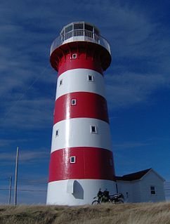
Cape Spear is a headland located on the Avalon Peninsula of Newfoundland near St. John's in the Canadian province of Newfoundland and Labrador. At a longitude of 52°37' W, it is the easternmost point in Canada and North America, excluding Greenland.
Baccalieu Island or Bacalhoo Island is a 5 km2 uninhabited island at the northern extremities of Conception Bay in Subdivision 1G, near the community of Red Head Cove, Newfoundland and Labrador, Canada. It is separated from the island of Newfoundland by Baccalieu Tickle, a small strait and an abundant fishing ground. The island has some trees but is mostly rocky.
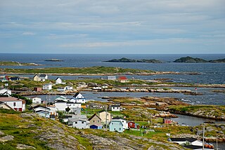
Greenspond is a community in the province of Newfoundland and Labrador, Canada.
Conche is a community on the Northern Peninsula of Newfoundland and Labrador, Canada. Its population in 2016 was 170.
Port de Grave is a peninsula on Conception Bay (CB) in Newfoundland and Labrador, Canada. The peninsula contains the communities of Bareneed, Black Duck Pond, Otterbury, Ship Cove, Blow Me Down, Hibb's Cove, Pick Eyes, and Hussey's Cove with a population of approximately 975 (2006). This community is located in the provincial electoral district of Port de Grave. An unincorporated area, for statistics purposes it is called Division No. 1, Subdivision L. The Peninsula is accessible by road via Route 72.
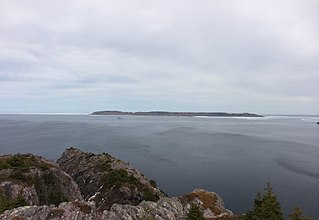
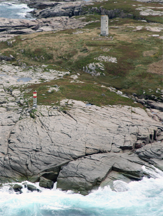
Bacalieu Island is an island off Twillingate in Newfoundland. It has a lighthouse. In 1911, it was inhabited by the lighthouse keepers and their families.

The history of Newfoundland and Labrador covers the period of time from the arrival of the Archaic peoples, Prior to European colonization, the lands encompassing present-day Newfoundland and Labrador were inhabited for millennia by different groups of indigenous peoples.
Noggin Cove is a local service district and designated place in the Canadian province of Newfoundland and Labrador. It is west of Carmanville on the south side of Hamilton Sound. It is said to be named after Noggin Island, about 5 km off its eastern point.
Ladle Cove is a designated place in the Canadian province of Newfoundland and Labrador. It is along the Straight Shore on the island of Newfoundland.
Pool's Island is an incorporated community of Badger's Quay-Valleyfield-Pool's Island in the province of Newfoundland and Labrador, Canada. It is now part of the town of New-Wes-Valley.
Swain's Island, Newfoundland, is actually a group of eight islands on the north side of Bonavista Bay, southeast of Wesleyville. All of these islands once had inhabitants but eventually all of them were resettled, mostly to Wesleyville.
The Wadham Islands are a group of islands at the eastern opening to Hamilton Sound, southeast of Fogo Island off Newfoundland in the province of Newfoundland and Labrador, Canada. The islands are: Offer Wadham Islands, Copper Island, Duck Island, White Island, Peckford Island, Coleman Island, Small Island.

Whaleback Light is a historic lighthouse marking the mouth of the Piscataqua River in Kittery, Maine. It is located on a rocky outcrop offshore southwest of Fort Foster and south of Wood Island in Kittery. The present tower was built in 1872. It was listed on the National Register of Historic Places in 1988.
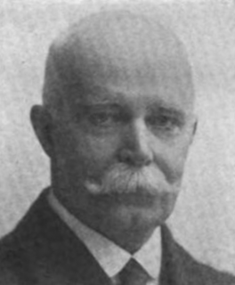
William Gilbert Gosling was a Canadian politician, businessman and author. From 1916 to 1920, he served as the mayor of St. John's, Newfoundland.

Newfoundland is a large island off the east coast of the North American mainland and the most populous part of the Canadian province of Newfoundland and Labrador. It has 29 percent of the province's land area. The island is separated from the Labrador Peninsula by the Strait of Belle Isle and from Cape Breton Island by the Cabot Strait. It blocks the mouth of the Saint Lawrence River, creating the Gulf of Saint Lawrence, the world's largest estuary. Newfoundland's nearest neighbour is the French overseas collectivity of Saint Pierre and Miquelon.
Cape Pine Light was built on Cape Pine, Newfoundland by the British architect and engineer Alexander Gordon in 1851.
William Austin Oke was a newspaper publisher, politician, and District Court judge in Newfoundland. He represented Harbour Grace in the Newfoundland House of Assembly for three terms, from 1898 to 1908, as a Liberal.
Division No. 1, Subdivision B is an unorganized subdivision on the Avalon Peninsula in Newfoundland and Labrador, Canada. It is in Division 1 and contains the unorganized communities of Iona, Little Barasway, Placentia Junction, Point Verde and Ship Harbour.
Robert Oke, H.M. was the first chief inspector for the Newfoundland Lighthouse Service and served from at least 1848 to 1870. Oke installed the first light mechanism at the Cape Bonavista Light in 1842, and installed the famous Isle of May light mechanism at the Cape Pine Light in 1850, which was later moved to Harbour Grace Island and finally to Cape Bonavista, where it can be viewed today.
Robert Carl Sheppard, MBE was a veteran of the Battle of the Somme in World War I who worked as a lighthouse keeper at Fort Amherst and was master mariner of two ships, the SS Eagle (1944–1945) and the SS Trepassey (1945–1946), chartered for the secret British Antarctic expedition, Operation Tabarin.
