
Whitefish Bay is a large bay on the eastern end of Lake Superior between Michigan, United States, and Ontario, Canada. It is located between Whitefish Point in Michigan and Whiskey Point along the more rugged, largely wilderness Canadian Shield of Ontario. The international border runs through the bay, which is heavily used by shipping traffic northbound from and southbound to the Soo Locks.

Point Iroquois Light is a lighthouse on a Chippewa County bluff in the U.S. state of Michigan. Point Iroquois and its light mark the division line between Whitefish Bay and the western end of the St. Marys River, the connection between Lake Superior and other Great Lakes.
George Island Light is a lighthouse located on George Island that lies in the middle of the North Basin of Lake Winnipeg in the Canadian province of Manitoba. It is located approximately 400 km (250 mi) north from Winnipeg, and approximately halfway between the shore communities of Grand Rapids and Poplar River.

The Muskegon Breakwater Light or South Breakwater Light is a light located on the end of the south arm of the Muskegon breakwater surrounding the mouth of the Muskegon channel in Muskegon, Michigan.

Belyea's Point Lighthouse is an 11-metre (36 ft)-tall landfall lighthouse located along the Saint John River, near the community of Morrisdale. It was built in 1881, commenced operation on June 1, 1882, with Spafford Barker Belyea serving as its first keeper and later rebuilt at a slightly different location after having been damaged due to severe flooding in the 1930s. The Canadian Coast Guard owns the lighthouse, the land it is on, and maintains it.

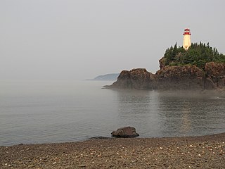
Long Point Lighthouse is an active Canadian lighthouse located outside Crow Head on North Twillingate Island off the northeast coast of Newfoundland. The lighthouse, completed in 1876, attracts thousands of tourists each year and is historic to the town of Twillingate.
The Miminegash Range Lights were a set of range lights on Prince Edward Island, Canada. They were built in 1886, and deactivated in 1972; only the rear tower has survived.
The Malpeque Harbour Approach Range Lights are a set of range lights on Prince Edward Island, Canada. The current rear tower was built in 1961.

The Malpeque Outer Range Lights are a set of range lights on Prince Edward Island, Canada. They were built in 1922, and are still active.

The Summerside Outer Range Lights are a set of range lights near Summerside, Prince Edward Island, Canada. They were built in 1991, and are still active.

The Colchester Reef Light is an active lighthouse situated on Colchester Reef in the Western Basin of Lake Erie south of the town of Colchester, Ontario.
Battle Island Light is a lighthouse on the Canadian shore of Lake Superior. It is located on the westerly point of Battle Island, 28.5 miles (45.9 km) east-northeast from Lamb Island Light.

Point Riche Lighthouse, located in Port au Choix, Newfoundland in Canada's Newfoundland and Labrador province, is a "pepperpot" lighthouse that was built in 1892 and is still active. The white wooden tower is octagonal pyramidal in shape, the lantern room is painted red. The structure is 19 metres (62 ft) tall. Its light characteristic is a flash every 5 seconds, emitted at a focal plane height of 29 metres (95 ft). It is maintained by the Port au Choix National Historic Site.

Caribou Island Lighthouse sits on the uninhabited Caribou Island in the eastern end of Lake Superior, 22 miles (35 km) south of Michipicoten Island. It lies entirely within the territorial waters of Canada although only about three miles from the international border between Canada and the United States. It is approximately 3 miles (4.8 km) long and approximately 1 mile (1.6 km) wide.

Brockton Point Lighthouse is located in Stanley Park, Vancouver, British Columbia. The light was first established at the location in 1890. A square tower, painted white with a red horizontal stripe, was built in 1914. The lighthouse was designed by William P. Anderson and has a red lantern and an arched base with a walkway underneath. The light has been officially inactive since 2008 but may still be displayed occasionally for decorative purposes.

