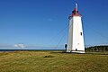
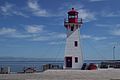
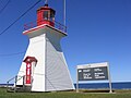
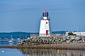
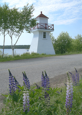
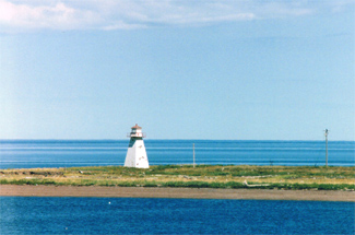
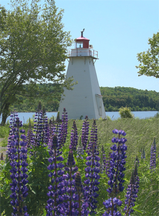
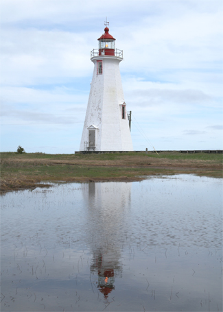
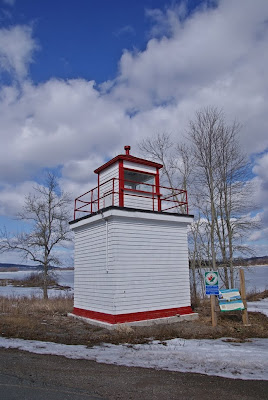
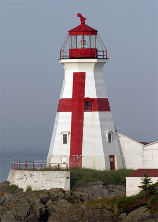
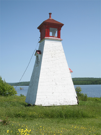
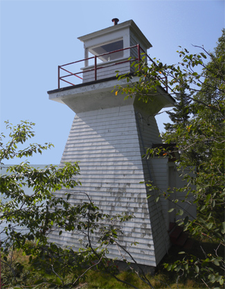
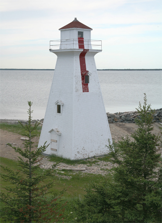
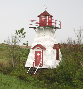
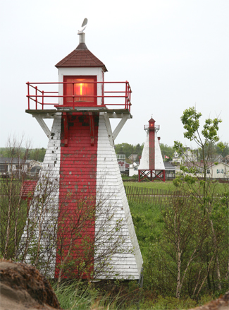
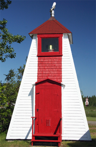
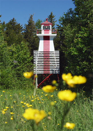
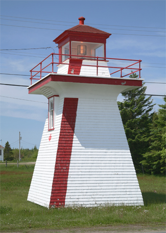
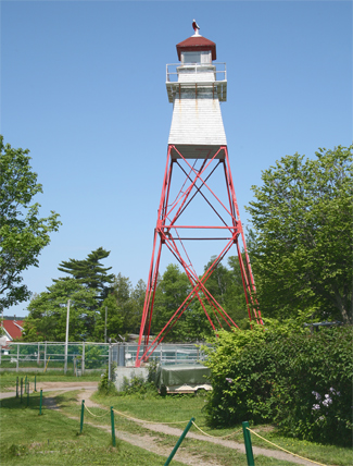
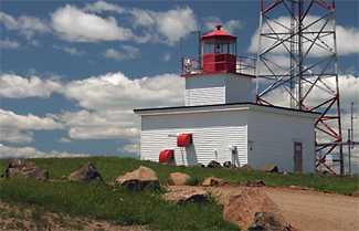
Name Image Year [ 1] [ 2] Location & Class of Light [ 3] Focal [ 3] NGA [ 3] ARLHS Admiralty [ 3] CCG Rangenml [ 3] Bathurst Range Front Light [ 1] 1871 est. Bathurst 47°39′07″N 65°37′23″W / 47.651834°N 65.623158°W / 47.651834; -65.623158 Q R 8 metres (26 ft) 7204 H1600 8 Bathurst Range Rear Light [ 1] 1871 est. Bathurst 47°38′51″N 65°37′35″W / 47.647599°N 65.626447°W / 47.647599; -65.626447 Iso R 4s. 18 metres (59 ft) 7208 H1600.1 16 Bayswater Light [ 4] Image 1914 Grand Bay–Westfield 45°21′02″N 66°08′01″W / 45.350480°N 66.133685°W / 45.350480; -66.133685 inactive 8 metres (26 ft) ARLHS --- --- Belledune Point Light [ 5] Image 1972 Sea Side (relocated) 47°57′31″N 66°08′31″W / 47.9585565°N 66.1419871°W / 47.9585565; -66.1419871 inactive 8 metres (26 ft) ARLHS --- --- Belyea's Point Light [ 6] Image 1930s Grand Bay–Westfield 45°22′41″N 66°12′58″W / 45.378183°N 66.216080°W / 45.378183; -66.216080 Fl G 5s. 13.6 metres (45 ft) ARLHS CCG 122 5 Big Shippegan Light [ 7] Image 1872 Lamèque Island 47°43′20″N 64°39′38″W / 47.722174°N 64.660607°W / 47.722174; -64.660607 Fl Y 5s. 16 metres (52 ft) 7392 H1530 15 Black Point Light [ 8] Image 1967 Black Point 47°53′07″N 64°37′24″W / 47.885341°N 64.623401°W / 47.885341; -64.623401 Oc (2) Y 10s. 18 metres (59 ft) 7360 H1556 12 Bliss Island Light [ 9] Image 1964 Bliss Island 45°01′07″N 66°51′01″W / 45.018485°N 66.850306°W / 45.018485; -66.850306 Fl R 4s. 15 metres (49 ft) 11200 H4118 5 Bouctouche Bar Light [ 10] Image 1902 est. Bouctouche 46°27′40″N 64°36′46″W / 46.461153°N 64.612875°W / 46.461153; -64.612875 Fl W 4s. 11 metres (36 ft) 7680 H1362 7 Campbellton Range Rear Light [ 11] Image 1985 Campbellton 48°00′36″N 66°40′19″W / 48.009994°N 66.671962°W / 48.009994; -66.671962 inactive 17 metres (56 ft) ex-7132 ex-H 1632.1 --- Cape Enrage Light 1838 Cape Enrage 45°35′38″N 64°46′48″W / 45.593969°N 64.779956°W / 45.593969; -64.779956 Fl G 6s. 41 metres (135 ft) 11064 H4060 10 Cape Jourimain Light [ 12] 1870 Bayfield 46°09′27″N 63°48′24″W / 46.157542°N 63.806580°W / 46.157542; -63.806580 inactive 16 metres (52 ft) ARLHS ex- H1318 --- Cape Spencer Light [ 13] Image 1983 Saint John 45°11′43″N 65°54′35″W / 45.195159°N 65.909803°W / 45.195159; -65.909803 Fl W 11s. 62 metres (203 ft) 11088 H4078 14 Cape Tormentine Outer Wharf Light [ 14] 1940s Cape Tormentine 46°08′06″N 63°46′20″W / 46.134874°N 63.772202°W / 46.134874; -63.772202 Iso R 2s. 12 metres (39 ft) 7824 H1308 5 Caraquet Island Light [ 15] 1950s Caraquet Island 47°49′22″N 64°54′16″W / 47.822731°N 64.904429°W / 47.822731; -64.904429 Fl W 4s. 22 metres (72 ft) 7272 H1588 9 Caraquet Range Front Light [ 16] Image 1903 Caraquet 47°48′30″N 64°50′28″W / 47.808370°N 64.841094°W / 47.808370; -64.841094 F Y 8 metres (26 ft) 7276 H1580 13 Caraquet Range Rear Light [ 17] Image 1903 Bas-Caraquet (relocated) 47°48′16″N 64°49′29″W / 47.804447°N 64.8248°W / 47.804447; -64.8248 inactive 12.5 metres (41 ft) ARLHS ex-H1580.1 --- Cassie Point Light [ 18] Image 1872 Grande-Digue 46°19′11″N 64°30′45″W / 46.319855°N 64.512632°W / 46.319855; -64.512632 L Fl (2) Y 12s. 14 metres (46 ft) 7724 H1350 11 Chance Harbour Light [ 19] Image 1969 Chance Harbour 45°07′07″N 66°20′51″W / 45.118574°N 66.347586°W / 45.118574; -66.347586 L Fl W 12s. 12 metres (39 ft) 11152 H4100 7 Chiasson Office [ 20] - Chiasson Office Fl Y 5s. 54 ft _ _ _ Cocagne Range Front Light [ 21] Image 1907 Cocagne 46°20′07″N 64°36′54″W / 46.335276°N 64.614931°W / 46.335276; -64.614931 F Y 8 metres (26 ft) 7708 H1354 13 Courtenay Bay Breakwater Light [ 22] Image 1927 Saint John 45°15′26″N 66°02′42″W / 45.257337°N 66.045017°W / 45.257337; -66.045017 Fl R 4s. 13 metres (43 ft) 11112 H4083 5 Dalhousie Island Light [ 1] 1886 est. Dalhousie 48°04′20″N 66°21′51″W / 48.072321°N 66.364280°W / 48.072321; -66.364280 Fl W 5s, 21 metres (69 ft) 7152 H1620 15 Dalhousie Wharf Light [ 23] Image 1909 Charlo (relocated) 48°00′13″N 66°20′21″W / 48.003655°N 66.339268°W / 48.003655; -66.339268 inactive 6 metres (20 ft) ARLHS --- --- Dixon Point Range Front Light [ 24] 1919 Saint-Louis-de-Kent 46°27′24″N 64°39′03″W / 46.456547°N 64.650758°W / 46.456547; -64.650758 FL W 5s. 10 metres (33 ft) 7686 H1382 12 Dixon Point Range Rear Light [ 25] 1919 Saint-Louis-de-Kent 46°27′24″N 64°39′03″W / 46.456547°N 64.650758°W / 46.456547; -64.650758 inactive 9 metres (30 ft) 7686 H1369.1 --- Fort Monckton Light [ 1] 1971 Strait Shores 46°02′36″N 64°04′15″W / 46.043233°N 64.070761°W / 46.043233; -64.070761 Fl W 3s. 7 metres (23 ft) 7844 H-1304 7 Gagetown Light [ 26] Image 1934 Arcadia 45°46′07″N 66°08′25″W / 45.768592°N 66.140353°W / 45.768592; -66.140353 F G 11.9 metres (39 ft) ARLHS CCG 135 8 Gannet Rock Lighthouse 1831 Bay of Fundy 44°30′37″N 66°46′54″W / 44.510366°N 66.781631°W / 44.510366; -66.781631 Fl W 5s. 28 metres (92 ft) 11416 H4188 19 Grand Dune Flats Range Front Light [ 27] Image 1916 Burnt Church 47°11′41″N 65°08′07″W / 47.194786°N 65.135320°W / 47.194786; -65.135320 inactive 12 metres (39 ft) ARLHS --- --- Grand Dune Flats Range Rear Light [ 1] 1916 est. Alniwick Parish 47°08′34″N 65°14′35″W / 47.142705°N 65.242930°W / 47.142705; -65.242930 F W 26 metres (85 ft) 7504 H1472.1 11 Grand Dune Outer Range Rear Light [ 1] n/a Black River-Hardwicke 47°06′24″N 64°59′53″W / 47.106764°N 64.998135°W / 47.106764; -64.998135 Iso W 4s. 32 metres (105 ft) 7499 H1452.1 17 Grand Harbour Lighthouse [ 28] 1879 Grand Manan Island 44°40′02″N 66°44′59″W / 44.667244°N 66.749821°W / 44.667244; -66.749821 inactive 12 metres (39 ft) ARLHS --- --- Grande-Digue Light [ 29] Image 1912 Grande-Digue 46°17′41″N 64°33′38″W / 46.294592°N 64.560556°W / 46.294592; -64.560556 inactive 6 metres (20 ft) --- --- --- Grant Beach Range Front Light [ 30] Image 1903 Lower Newcastle-Russellville 47°04′56″N 65°23′08″W / 47.082214°N 65.385643°W / 47.082214; -65.385643 inactive 12 metres (39 ft) ARLHS --- --- Grant Beach Range Rear Light [ 1] n/a Lower Newcastle-Russellville 47°05′07″N 65°23′11″W / 47.085347°N 65.386281°W / 47.085347; -65.386281 Iso R 4s. 41 metres (135 ft) 7536 H1491.1 16 Grant Beach Range Rear Light [ 31] Image 1903 The Willows 47°06′43″N 65°17′31″W / 47.112064°N 65.292046°W / 47.112064; -65.292046 inactive 12 metres (39 ft) ARLHS --- --- Great Duck Island Light [ 32] Image 1966 Grand Manan Island 44°41′04″N 66°41′36″W / 44.684533°N 66.693440°W / 44.684533; -66.693440 Fl W 10s. 15 metres (49 ft) 11384 H4174 18 Green's Point Lighthouse [ 33] Image 1903 L'Etete 45°02′20″N 66°53′31″W / 45.038898°N 66.891828°W / 45.038898; -66.891828 inactive 12 metres (39 ft) 11208 H4120 --- Grindstone Island Light [ 34] Image 1911 Harvey, Albert County 45°43′19″N 64°37′15″W / 45.721903°N 64.620737°W / 45.721903; -64.620737 inactive 20.5 metres (67 ft) ARLHS ex-H4046 --- Hampstead Wharf Light [ 35] Image 1900 Hampstead 45°37′30″N 66°05′05″W / 45.625102°N 66.084689°W / 45.625102; -66.084689 inactive 5.5 metres (18 ft) ARLHS --- ---- Head Harbour Lighthouse [ 36] Image 1829 Bay of Fundy 44°57′28″N 66°54′00″W / 44.957886°N 66.899963°W / 44.957886; -66.899963 F R 18 metres (59 ft) 11332 H4154 13 Hendry Farm Light [ 37] Image 1893 Arcadia 45°43′59″N 66°02′54″W / 45.733091°N 66.048261°W / 45.733091; -66.048261 inactive 8 metres (26 ft) ARLHS --- --- Inch Arran Point Range Front Light [ 38] 1870 Dalhousie 48°03′40″N 66°21′03″W / 48.060987°N 66.350930°W / 48.060987; -66.350930 Iso W 6s. 14 metres (46 ft) 7164 H1616 11 Leonardville Light [ 39] Image 1914 Deer Island 44°58′06″N 66°57′18″W / 44.968230°N 66.955103°W / 44.968230; -66.955103 F W 20 metres (66 ft) 11264 H4146 10 Lighthouse Point Lighthouse [ 40] Image Archived 2016-10-14 at the Wayback Machine 1984 Beaver Harbour 45°03′47″N 66°43′59″W / 45.062978°N 66.733099°W / 45.062978; -66.733099 Iso W 6s. 14 metres (46 ft) 11184 H4112 12 Long Eddy Point Light Image 1966 Grand Manan Island 44°47′59″N 66°47′08″W / 44.799596°N 66.785564°W / 44.799596; -66.785564 Fl R 8s. 38 metres (125 ft) 11360 H4166 14 Long Point Light [ 41] 1966 White Head Island 44°36′50″N 66°42′35″W / 44.613848°N 66.709857°W / 44.613848; -66.709857 Iso W 12s. 28 metres (92 ft) 11416 H4188 12 Lower Jemseg Light [ 42] 1884 est. Lower Jemseg 45°46′47″N 66°06′24″W / 45.7796438°N 66.1067512°W / 45.7796438; -66.1067512 F R 4s. 9 metres (30 ft) ARLHS CCG 136 --- Lower Musquash Island Light [ 43] Image 1893 Wickham 45°42′29″N 66°03′58″W / 45.708129°N 66.066221°W / 45.708129; -66.066221 inactive 12 metres (39 ft) ARLHS --- --- Lower Neguac Wharf Range Rear Light [ 44] Image 1892 Neguac 47°15′41″N 65°03′13″W / 47.261274°N 65.053521°W / 47.261274; -65.053521 inactive 8 metres (26 ft) ARLHS ex-H1518.1 --- Machias Seal Island Light [ 45] Image 1915 Machias Seal Island 44°30′07″N 67°06′07″W / 44.501884°N 67.101885°W / 44.501884; -67.101885 Fl W 3s. 25 metres (82 ft) 11444 H4192 17 Maisonnette Point Light [ 1] 1915 Maisonnette 47°50′15″N 65°00′13″W / 47.837613°N 65.003534°W / 47.837613; -65.003534 Fl W 2.4s. 18 metres (59 ft) 7264 H1590 15 McColgan Point Light [ 46] Image 1914 Grand Bay–Westfield 45°19′56″N 66°06′34″W / 45.332245°N 66.109541°W / 45.332245; -66.109541 Fl W 10s. 11.3 metres (37 ft) ARLHS CCG 119 6 Miscou Island Lighthouse 1930s Miscou Island 48°00′34″N 64°29′35″W / 48.009333°N 64.492972°W / 48.009333; -64.492972 Fl G 5s. 14 metres (46 ft) 7368 H1552 12 Mulholland Point Light [ 47] 1885 Welshpol 44°51′47″N 66°58′47″W / 44.863090°N 66.979618°W / 44.863090; -66.979618 inactive 13.5 metres (44 ft) ARLHS --- --- Musquash Head Light [ 48] Image 1959 Musquash 45°08′37″N 66°14′14″W / 45.143628°N 66.237232°W / 45.143628; -66.237232 Fl W 3s. 35 metres (115 ft) 11148 H4096 20 Oak Point Light [ 49] Image 1902 Oak Point 45°30′27″N 66°04′48″W / 45.507442°N 66.080087°W / 45.507442; -66.080087 Fl G 10s. 15.7 metres (52 ft) ARLHS CCG 125 8 Oak Point Range Front Light [ 50] 1904 Miramichi 47°03′03″N 65°28′06″W / 47.050737°N 65.468378°W / 47.050737; -65.468378 inactive 10 metres (33 ft) ARLHS --- --- Partridge Island Light [ 51] Image Archived 2016-10-13 at the Wayback Machine 1961 Saint John 45°14′21″N 66°03′14″W / 45.239232°N 66.053874°W / 45.239232; -66.053874 FL W 7.5s. 35 metres (115 ft) 11100 H4082 19 Pea Point Light [ 52] Image Archived 2016-10-13 at the Wayback Machine 1965 Blacks Harbour 45°02′21″N 66°48′28″W / 45.039087°N 66.807834°W / 45.039087; -66.807834 F W 17 metres (56 ft) 11192 H4114 Petit Rocher Light [ 1] 1879 est. Petit-Rocher 47°46′55″N 65°42′27″W / 47.781892°N 65.707553°W / 47.781892; -65.707553 Fl Y 10s. 8 metres (26 ft) 7196 H1606 15 Point Escuminac Light [ 53] 1966 Point Escuminac 47°04′23″N 64°47′53″W / 47.073017°N 64.797920°W / 47.073017; -64.797920 Fl W 3s. 22 metres (72 ft) 7580 H1424 13 Point Lepreau Light [ 54] Image 1959 Point Lepreau 45°03′32″N 66°27′31″W / 45.058856°N 66.458688°W / 45.058856; -66.458688 Fl W 5s. 26 metres (85 ft) 11160 H4108 14 Pointe à Brideau Range Front Light [ 1] n/a Caraquet 47°47′47″N 64°56′13″W / 47.796422°N 64.936860°W / 47.796422; -64.936860 F W 8 metres (26 ft) 7305 H1585 19 Pointe à Brideau Range Rear Light [ 55] Image 1978 Caraquet 47°47′42″N 64°56′30″W / 47.795117°N 64.941562°W / 47.795117; -64.941562 F W 14 metres (46 ft) 7306 H1586.1 19 Pointe du Chêne Range Front Light [ 56] Image 1898 Shediac 46°14′27″N 64°30′42″W / 46.240735°N 64.511677°W / 46.240735; -64.511677 F R 8 metres (26 ft) 7736 H1328 11 Pointe du Chêne Range Rear Light [ 57] Image 1898 Shediac 46°14′22″N 64°30′43″W / 46.239424°N 64.512014°W / 46.239424; -64.512014 F R 14 metres (46 ft) 7740 H1328.1 11 Pointe à Jérôme Range Front Light [ 58] Image 1916 Bouctouche 46°29′12″N 64°40′46″W / 46.486610°N 64.679336°W / 46.486610; -64.679336 F W 6 metres (20 ft) 7692 H1368 13 Pointe à Jérôme Range Rear Light [ 59] Image 1916 Bouctouche 46°29′21″N 64°40′58″W / 46.489149°N 64.682735°W / 46.489149; -64.682735 F W 18 metres (59 ft) 7696 H1368.1 13 Pointe Sapin Range Rear Light [ 60] Image 1910 Pointe-Sapin 46°57′50″N 64°49′50″W / 46.963768°N 64.830479°W / 46.963768; -64.830479 inactive 7.5 metres (25 ft) ex-7596 ex-H1418.1 --- Pokesudie Island Light [ 1] 1881 est. Pokesudie Island 47°49′10″N 64°45′16″W / 47.819547°N 64.754443°W / 47.819547; -64.754443 Iso W 4s. 13 metres (43 ft) 7308 H1566 10 Portage Channel Range Rear Light [ 1] 1986 Black River-Hardwicke 47°07′43″N 65°02′31″W / 47.128530°N 65.041977°W / 47.128530; -65.041977 F W 19 metres (62 ft) 7484 H1446.1 18 Portage Island Range Rear Light [ 61] 1908 Shippagan (relocated) 47°44′53″N 64°42′33″W / 47.748128°N 64.709112°W / 47.748128; -64.709112 inactive 13 metres (43 ft) ARLHS ex-H1444.1 --- Quaco Head Light [ 62] Image 1976 Fundy-St. Martins 45°19′26″N 65°32′07″W / 45.323969°N 65.535333°W / 45.323969; -65.535333 L Fl R 6s. 26 metres (85 ft) 11080 H4076 21 Richibucto Head Light [ 63] 1865 est. Richibucto 46°40′11″N 64°42′42″W / 46.669792°N 64.711622°W / 46.669792; -64.711622 Fl W 5s. 18 metres (59 ft) 7660 H1376 14 Richibucto Town Range Rear Light [ 1] n/a Richibucto 46°40′42″N 64°51′55″W / 46.678400°N 64.865352°W / 46.678400; -64.865352 F Y 23 metres (75 ft) 7652 H1402.1 11 Saint John Harbour Range Front Light [ 2] Image Archived 2016-10-15 at the Wayback Machine n/a Saint John 45°16′22″N 66°04′07″W / 45.2728775°N 66.0687468°W / 45.2728775; -66.0687468 F G 21 metres (69 ft) 11104 H4089 20 Sand Point Light [ 64] Image 1898 Grand Bay–Westfield 45°20′33″N 66°11′56″W / 45.342630°N 66.198826°W / 45.342630; -66.198826 F R 22.7 metres (74 ft) ARLHS CCG 121 7 Shediac Harbour Range Rear Light [ 1] 1914 est. Shediac 46°14′26″N 64°31′50″W / 46.240590°N 64.530570°W / 46.240590; -64.530570 Iso Y 4s. 12 metres (39 ft) 7748 H1332.1 22 Southwest Head Light Image 1959 Grand Manan Island 44°36′04″N 66°54′20″W / 44.601130°N 66.905563°W / 44.601130; -66.905563 Fl W 10s. 48 metres (157 ft) 11436 H4186 16 Southwest Wolf Island Light [ 65] Image 1982 Pennfield Parish 44°56′12″N 66°44′00″W / 44.936773°N 66.733419°W / 44.936773; -66.733419 Fl W 10s. 38 metres (125 ft) 11172 H4110 7 St. Andrews North Point Light, also called Pendlebury Lighthouse [ 66] 1833 St. Andrews 45°04′03″N 67°02′50″W / 45.067407°N 67.047253°W / 45.067407; -67.047253 Fl R 4s. 7 metres (23 ft) 11230 H4127 4 Stonehaven Light [ 1] 1885 est. Stonehaven 47°45′12″N 65°21′42″W / 47.753430°N 65.361676°W / 47.753430; -65.361676 Fl W 4s. 21.5 metres (71 ft) 7240 H1596 10 Swallowtail Lighthouse [ 2] 1860 Grand Manan Island 44°45′52″N 66°43′57″W / 44.764338°N 66.732557°W / 44.764338; -66.732557 Oc W 6s. 37 metres (121 ft) 11364 H4168 12 Swift Point Lighthouse [ 67] 1869 Saint John 45°16′57″N 66°07′17″W / 45.282418°N 66.121334°W / 45.282418; -66.121334 Fl G 12s. 28 metres (92 ft) --- --- --- The Cedars Light [ 68] Image 1904 Kingston Peninsula 45°28′42″N 66°04′57″W / 45.478370°N 66.082619°W / 45.478370; -66.082619 inactive 10 metres (33 ft) ARLHS --- --- Tongue Shoal Light [ 2] 1875 est. Passamaquoddy Bay 45°03′45″N 67°00′46″W / 45.062517°N 67.012708°W / 45.062517; -67.012708 Fl W 4s. 7 metres (23 ft) 11232 H4126 7 Wimot Bluff Light [ 69] Image 1869 Oromocto 45°52′09″N 66°30′38″W / 45.869209°N 66.510482°W / 45.869209; -66.510482 inactive 13 metres (43 ft) ARLHS --- --- 


